

Hurricane Iota reaches Category 5 strength as it moves toward Central America

MANAGUA, Nicaragua (AP) - Hurricane Iota rapidly strengthened Monday into a Category 5 storm that is likely to bring catastrophic damage to the same part of Central America already battered by a powerful Hurricane Eta less than two weeks ago.
Iota has intensified over the western Caribbean on approach to Nicaragua and Honduras. The U.S. National Hurricane Center said the storm had maximum sustained winds of 160 mph (260 kph). It was centered about 80 miles (130 kilometers) east-southeast of Puerto Cabezas, also known as Bilwi, Nicaragua and moving westward at 9 mph (15 kph).
Authorities warned that Iota would probably come ashore over areas where Eta’s torrential rains saturated the soil, leaving it prone to new landslides and floods, and that the storm surge could reach a shocking 15 to 20 feet (4.5 to 6 meters) above normal tides.
RELATED: Hurricane Iota heads for already battered Nicaragua, Honduras
That storm surge was on the mind of Yasmina Wriedt on Monday in Bilwi's El Muelle neighborhood, sitting tight against the sea.
“The situation doesn’t look good at all,” Wriedt said. “We woke up without electricity, with rain and the surf is getting really high.”
Wriedt, who works for a small-scale fishing organization called Piquinera, said that the roof of her house was blown off in Eta less than two weeks ago. “We repaired it as best we could, now I think the wind will take it again because they say (Iota) is even stronger,” Wriedt said, the sound of hammering echoing around her as neighbors boarded windows and reinforced roofs.
During Eta the surf came up to just behind her house, where she lives with eight other members of her family. “Today I’m afraid again about losing my house and I’m frightened for all of us who live in this neighborhood.”
Wriedt said some neighbors went to stay with relatives elsewhere, but most have stayed. “We’re almost all here,” she said. “Neither the army nor the government came to move us.”
Cairo Jarquin, Nicaragua emergency response project manager for Catholic Relief Services, had just visited Bilwi and smaller coastal communities Friday.
In Wawa Bar, Jarquin said he found “total destruction.” People had been working furiously to put roofs back over their families' heads, but now Iota threatened to take what was left.
Workers of banana fields evacuate the area in El Progreso, Yoro department, Honduras, on November 14, 2020, before the arrival of tropical storm Iota. (Photo by ORLANDO SIERRA/AFP via Getty Images)
“The little that remained standing could be razed,” Jarquin said. There were other communities farther inland that he was not even able to reach due to the condition of roads. He said he heard that Wawa bar was evacuated again Saturday.
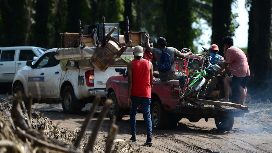
Evacuations were being conducted from low-lying areas in Nicaragua and Honduras near their shared border through the weekend.
Limborth Bucardo, of the Miskito Indigenous ethnic group, said many people had moved to churches in Bilwi. He rode out Eta with his wife and two children at home, but this time decided to move in with relatives in a safer neighborhood.
“We hadn't finished repairing our houses and settling in when another hurricane comes,” Bucardo said. “The shelters in Bilwi are already full, packed with people from (surrounding) communities.”
Iota is the record 30th named storm of this year’s extraordinarily busy Atlantic hurricane season. It’s also the ninth storm to rapidly intensify this season, a dangerous phenomenon that is happening increasingly more often. Such activity has focused attention on climate change, which scientists say is causing wetter, stronger and more destructive storms.
RELATED: Iota strengthens into hurricane; 13th of the Atlantic season
Eta had hit Nicaragua as a Category 4 hurricane, killing at least 120 people as torrential rains caused flash floods and mudslides in parts of Central America and Mexico. Then it meandered across Cuba, the Florida Keys and around the Gulf of Mexico before slogging ashore again near Cedar Key, Florida, and dashing across Florida and the Carolinas.
Iota was forecast to drop 8 to 16 inches (200-400 millimeters) of rain in northern Nicaragua, Honduras, Guatemala and southern Belize, with as much as 30 inches (750 millimeters) in isolated spots. Costa Rica and Panama could also experience heavy rain and possible flooding, the hurricane center said.
Eta was this year's 28th named storm, tying the 2005 record. Remnants of Theta, the 29th, dissipated Sunday in the eastern Atlantic Ocean.
Over the past couple of decades, meteorologists have been more worried about storms like Iota that power up much faster than normal. They created an official threshold for this rapid intensification -- a storm gaining 35 mph (56 kph) in wind speed in just 24 hours. Iota doubled it.
Earlier this year, Hannah, Laura, Sally, Teddy, Gamma, Delta, Zeta and Iota all rapidly intensified. Laura and Delta tied or set records for rapid intensification.
National Oceanic and Atmospheric Administration climate and hurricane scientists studied the effect and found “a lot of that has to do with human-caused climate change.”
This is the first time on record that the Atlantic had two major hurricanes, with winds exceeding 110 mph (177 kph), in November, with Iota and Eta, according to Colorado State University hurricane researcher Phil Klotzbach. When Iota's top winds reached 155 mph (250 kph), they tied with 1999’s Lenny for the strongest Atlantic hurricane this late in the calendar year.
The official end of the hurricane season is Nov. 30.
___
Associated Press writer Marlon González in Tegucigalpa, Honduras, contributed to this report.