

Severe thunderstorm watch in place for DMV amid humid, hot Tuesday

FOX 5 Weather forecast for Tuesday, July 12
Claire Anderson has the FOX 5 Weather forecast for Tuesday, July 12
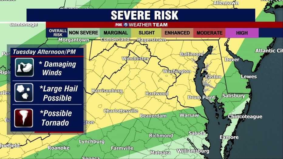
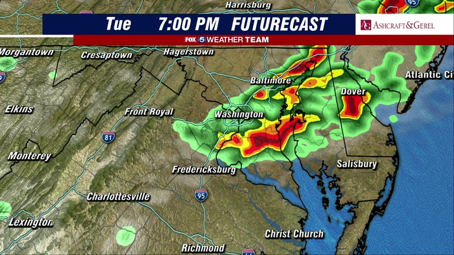
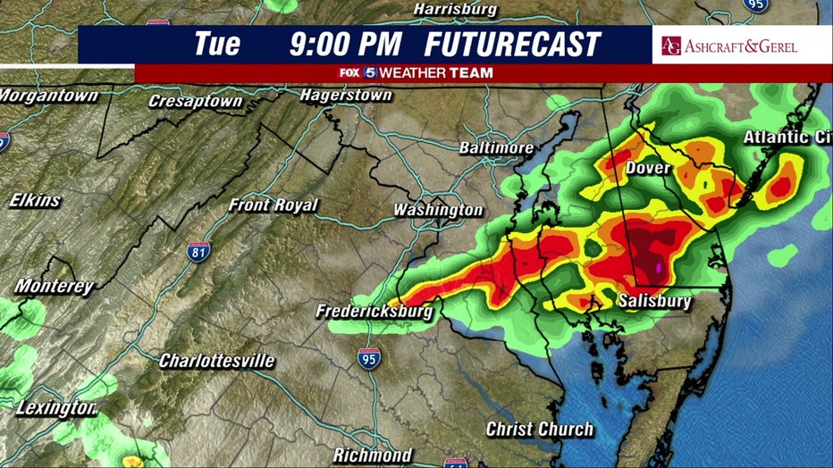
WASHINGTON - Severe weather is expected to bring storms into the region throughout the evening on Tuesday as a severe thunderstorm watch has gone into place.
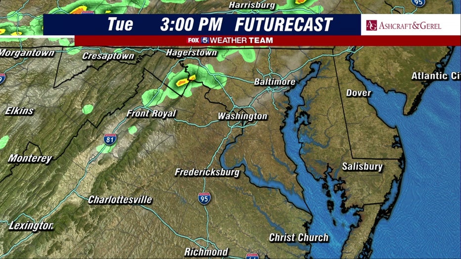
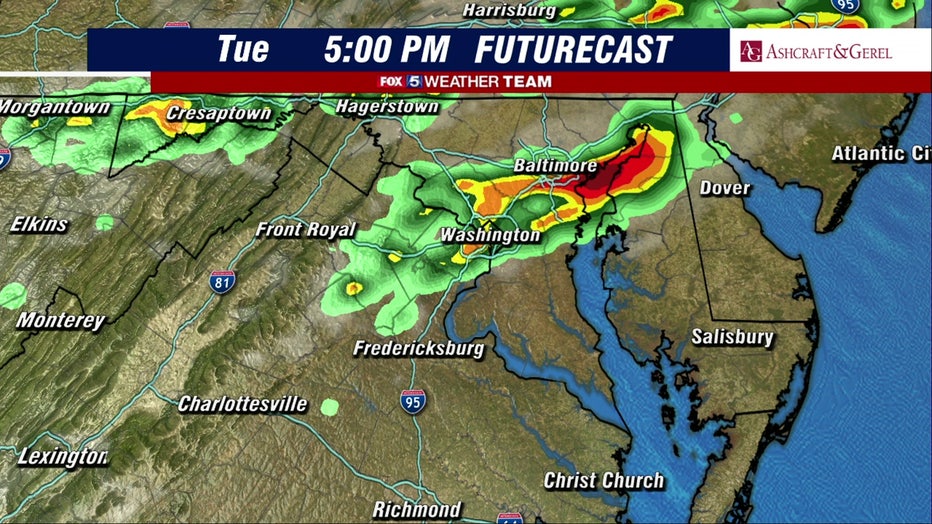
A line of severe thunderstorms will drop in from the northwest, bringing damaging winds, some hail and flooding rain through the evening, according to the FOX 5 weather team.
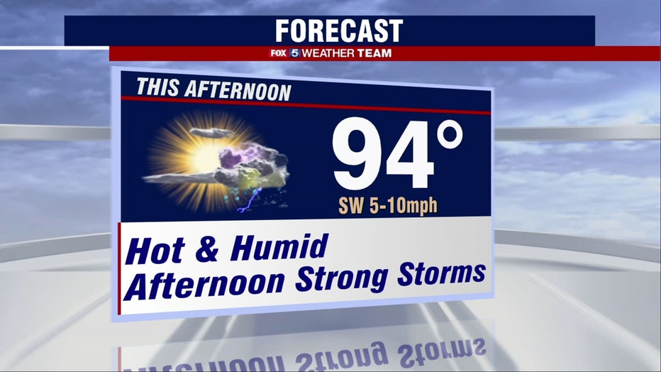
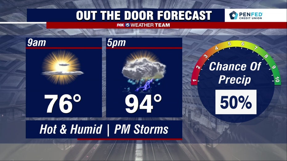
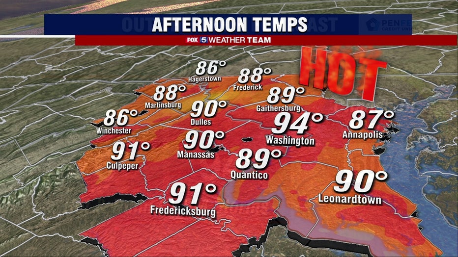
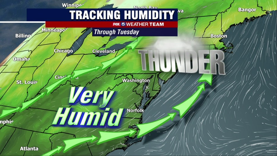
Tuesday has seen temperatures in the low-70s with calm conditions so far. The heat and humidity have built up as temperatures climbed into the mid-90s this afternoon.
FOX 5's Mike Thomas says as a cold front approaches from the northwest, scattered thunderstorms are likely to fire, anytime between 2 p.m. and 10 p.m.
"The D.C. region is at the tail end of a low-level jet, and forecast soundings do suggest some mild directional shear that will need to be monitored for isolated tornado risks, especially areas north of D.C. towards the Mason-Dixon Line where forcing is stronger," Thomas says.
Thomas says that storm risks should be patchy, but could turn severe quickly with damaging winds being the primary concern.
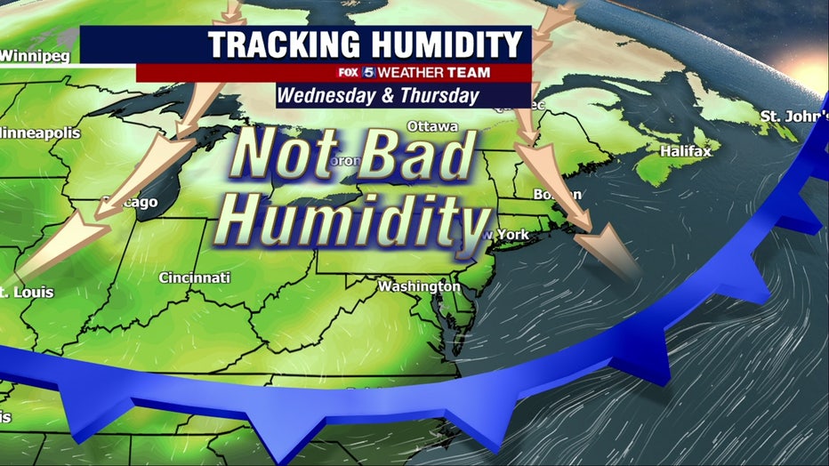
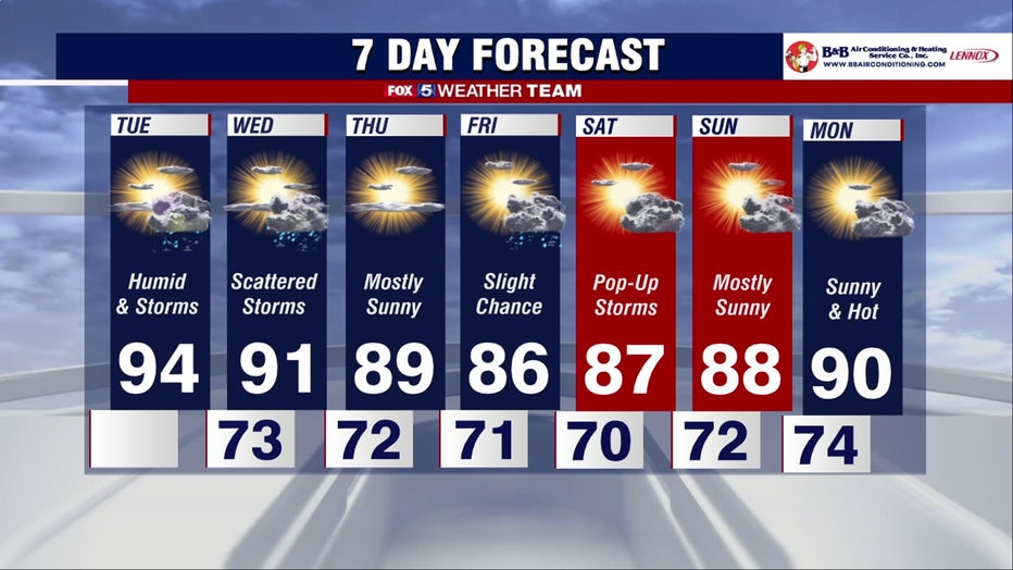
Thomas says Tuesday seems to be the most active weather day of the week.
Get the latest FOX 5 Forecast, and see local radars here.
Download the FOX 5 DC News App for Local Breaking News and Weather