

WorldPride weekend weather forecast: Scattered storms expected over events

Rain showers with warm temperatures in DC region
FOX 5's Gwen Tolbart has your weekend weather forecast ahead of DC Pride activities.
WASHINGTON - It's a big weekend across our region with celebrations for WorldPride events taking over DC. This includes the big parade downtown at 1 p.m. on Saturday, which you can stream live right on your FOX Local app if you are not able to attend in person!
Will Mother Nature cooperate with those outdoor weekend events though?
The forecast:
Starting off Saturday morning, some showers leftover from a system in the Midwest look like they'll want to cross over our region. These look likely during the early morning hours of Saturday, with drier conditions then moving into the region heading into the afternoon.
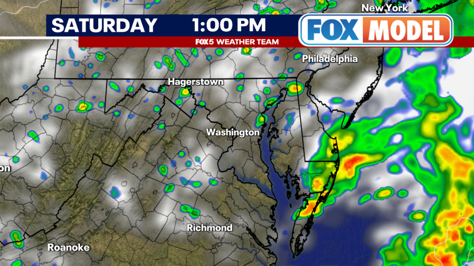
This is good news for the D.C. WorldPride Parade, which is set to start at 14th and T Streets, NW, at 1 p.m. on Saturday afternoon.
While we cannot guarantee a completely dry parade, shower and thunderstorm activity through the afternoon and evening should be much more hit-or-miss.
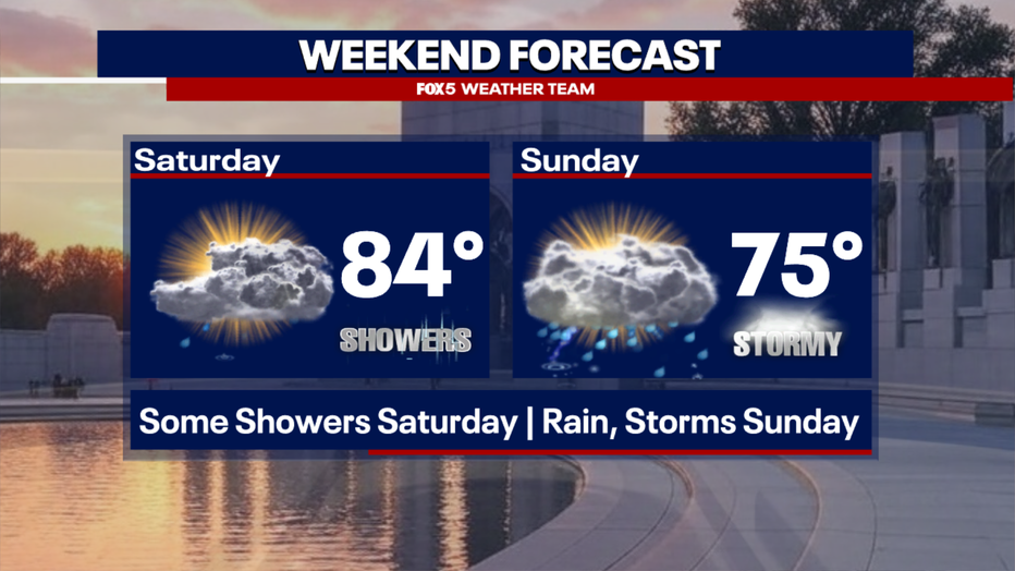
Temperatures will warm nicely into the afternoon as well, with high temperatures expected to rise into the lower 80s, though humidity levels will be high. Due to this, one or two of those pop-up thunderstorms could be on the stronger side. The Storm Prediction Center has officially placed our region under a marginal risk of severe weather – their lowest designation.
What's next:
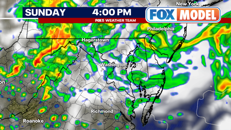
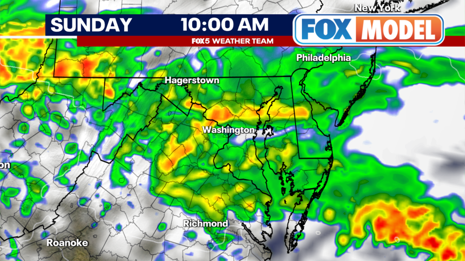
By Sunday, a stronger wave of low pressure will work its way towards the D.C. region out of the Midwest.
With ample atmospheric moisture to work with, rain is expected to overspread the region during the morning hours. It could be heavy at times, with the potential for some isolated flash flooding not out of the question.
Some thunderstorms could mix in as well, and though officially under a marginal risk from the Storm Prediction Center for severe weather, this looks to be most favored to the south of the DC area where warmer air will be present.
By the afternoon, the rain should taper to more clouds and scattered rain showers, with high temperatures only reaching the 70s.
Recent trends have struggled to work drier air into the D.C. region enough to the point that it seems like we are teetering in washout territory. Scattered showers and pockets of drizzle have the potential to continue well into the evening hours as low pressure passes to our south.
Big picture view:
So of the two days, Saturday continues to show the most promise for outdoor activity. It is the early morning hours when activity looks most widespread.
Sunday has been trending in a direction that may make outdoor activities difficult. There are still a few weather models that suggest that late in the day Sunday we could dry out enough to welcome in some late-day sunshine, but these models are outliers as of the writing of this story.
Expect a wetter day Sunday, with unsettled conditions lingering into the early workweek as well. Later next week does look drier and sunnier, but hotter, as we look to make a run for something that has alluded us so far this year, our first 90°F day in DC.