

Intense heat, storm risks return to DC this weekend
WASHINGTON - July is not exactly known for cool weather in the DC region, as it is the hottest month of the calendar year.
For much of it, D.C.’s high temperature averaged 90°F—a number we have already eclipsed eleven times this month.
It might surprise you to learn that our hottest temperature this July so far was only 95°F, which we hit back on July 8. In fact, the hottest temperatures of the year so far were June 23 and 24, when we hit 98° and 99°, respectively.
We could give those numbers a run for their money by the end of the week though, as another strong heat wave is building across the eastern half of the country.
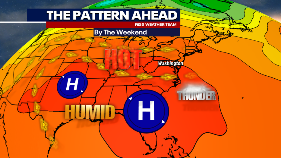
Heat ridges are something not at all uncommon this time of year. With the jet stream pulled back well into Canada this time of year, you occasionally get these broad zones of sinking air centered over the United States and western Atlantic—the formation zones for areas of high pressure, sunshine and building heat.
Such is the case heading into the end of the week, as a ridge of high pressure over the Atlantic will extend eastward across the American Southeast and Southern Plains. The prevailing southwesterly winds returning stronger heat and humidity to the DC region.
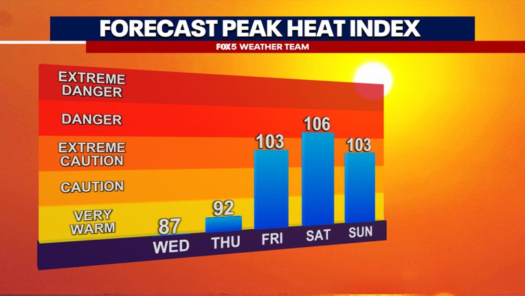
For a bit of good news with this upcoming hot forecast, the extreme heat should not be as long-lived as the one that we had back in June, which featured four days in a row of temperatures exceeding 95°F.
The bad news is that the hottest two days, Friday and Saturday, could rival how the worst of that June heat wave felt in the D.C. region. Friday is likely to be the hottest day in terms of air temperature, with some models suggesting we could make a run for that illusive 100°F mark, something that will be highly dependent on just how humid we get in the afternoon.
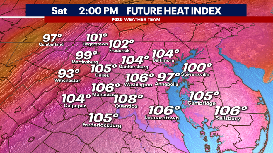
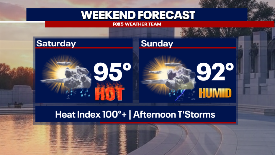
By Saturday, air temperatures are likely a few degrees cooler though it may feel even hotter. More humidity in the region should make it the hottest feeling day with heat index values above 105°F for much of the region. Expect that heat advisories will likely be issued for both days in our region.
It is hard to believe we are just six weekends away from Labor Day, and the unofficial end of summer. While much of this week has been dry, unfortunately the weekend will bring back the threats that we have gotten used to a lot this July.
Hit-or-miss storms are expected in our region as early as Friday afternoon, especially in the mountain areas to the west where the hilly geography can aid storm formation on hot and humid afternoons.
For those with outdoor plans on Saturday and Sunday, I would never say to cancel any outdoor activities on a summer afternoon. Both days do have a good chance of scattered thunderstorms firing with the heat of the day in the middle to late afternoon and early evening hours.
You can follow the latest forecast and track the latest radar on the FOX Local app and have a backup plan or plan to take shelter if storms do start to fire. Due to the heat and high humidity, isolated severe weather and flash flooding would be risks on any afternoon where storms do fire.
Stay tuned to FOX 5 as we continue to monitor these risks heading into the weekend!