

Dusting of snow possible Wednesday in DC region

Dusting of snow possible Wednesday in DC region
The first chance of measurable snow this season is looming in the D.C. area as we approach the midweek! Here's the forecast!
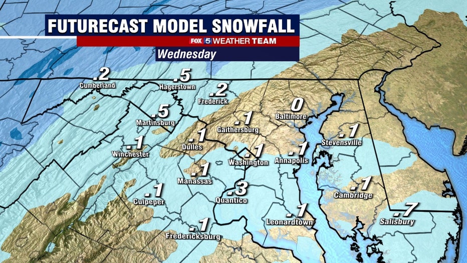
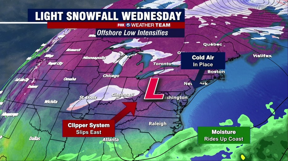
WASHINGTON - The first chance of measurable snow this season is looming in the D.C. area as we approach the midweek. While totals will not be plowable or significant, light snowfall could disrupt the Wednesday morning commute, though the forecast remains highly uncertain.
Download the FOX 5 Weather App
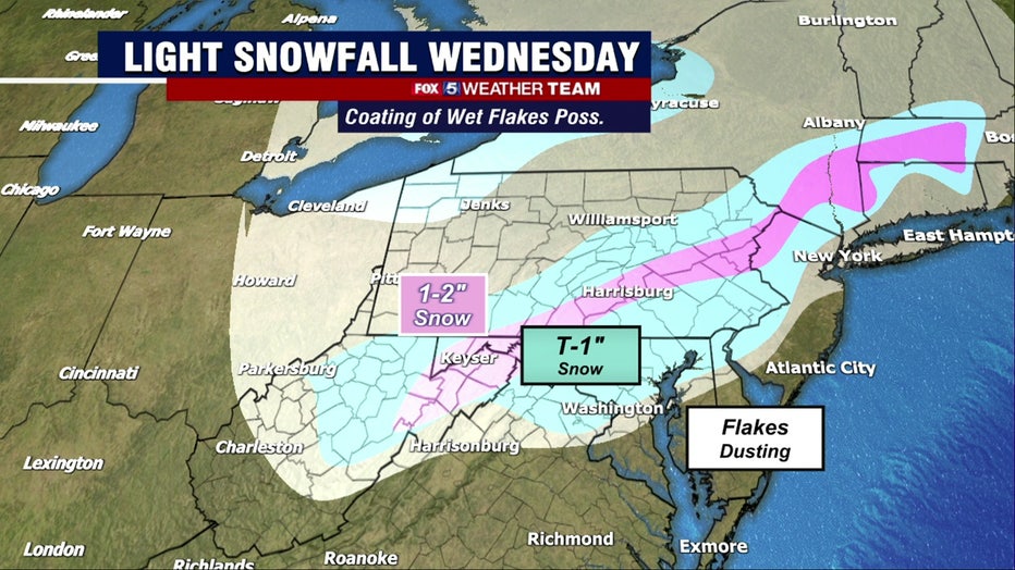
A clipper system will sweep through the Midwest on Tuesday, interacting with moisture riding up the Southeast Coast as it transfers its energy to a new low offshore on Tuesday night. By Wednesday morning, wraparound precipitation will be impacting our area, including the chance of some light to briefly moderate snow.
Totals look light — mainly a coating in D.C. with up to an inch in the higher terrain of northwest Maryland and the Panhandle, as well as on the western rim of the Blue Ridge.
Check the latest Closings and Delays
A number of factors have yet to be ironed out, including just how stubbornly cold air remains entrenched east of the Appalachians. If more "cold air damming" occurs, the odds of snow increase.
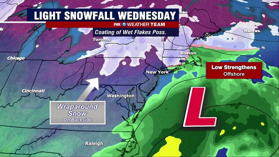
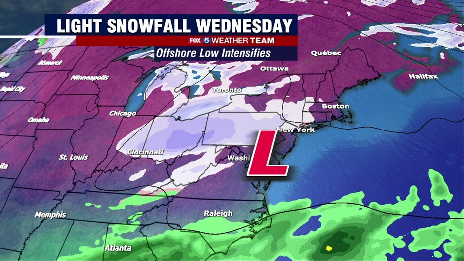
Storm track and intensity is also a wildcard. Our temperature fields, and therefore precipitation type, depend on the exact track of the storm, and subtle shifts could make a big difference. A stronger offshore storm, meanwhile, would draw in cooler air from the northwest, bolstering the odds of snowfall. We’ll be ironing out the details in the days ahead.
All told, it’s not a high-end event by any means, but some festive flakes and perhaps a coating are possible by Wednesday afternoon. Precipitation will exit during the evening with a cold night on tap.
Thursday looks cool too before a warmup as we head into the weekend.
Stay with FOX 5 on the app and online for weather updates:
Get the latest FOX 5 forecast here.
Check the latest Closings and Delays
Download the FOX 5 DC News App for Local Breaking News and Weather
Download the FOX 5 Weather App
Check the latest weather radars
Stay up to date with the FOX 5 Weather Team on Twitter: