Widespread showers move into DC region Sunday afternoon; More storms expected Monday

FOX 5 Weather forecast for Sunday, August 21
Matthew Cappucci has the FOX 5 Weather forecast for Sunday, August 21
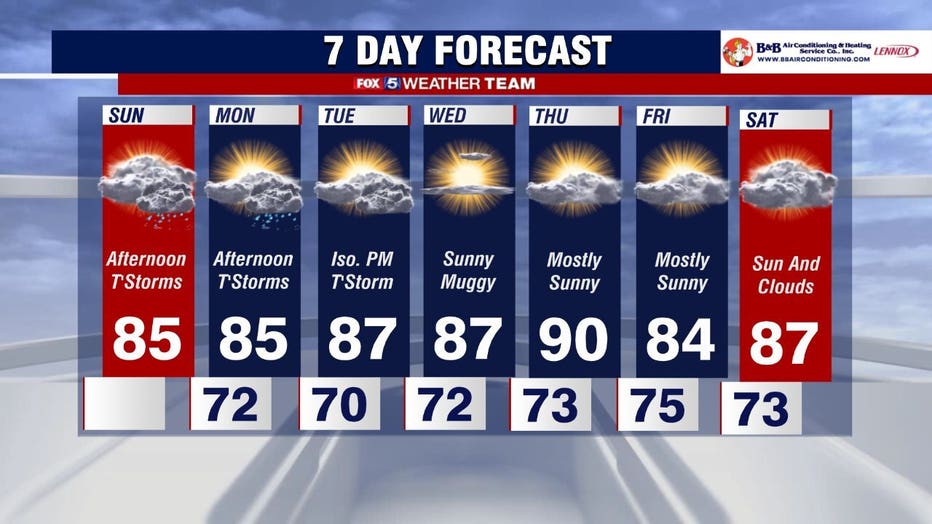
Sunday is getting off the cool and cloudy start before high temperatures and possible strong storms move into the area this afternoon.
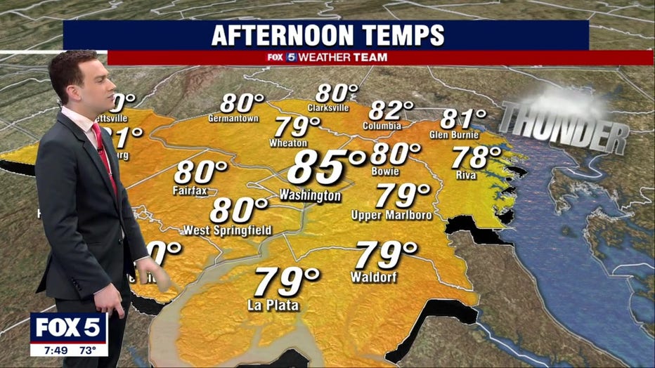
Temperatures will be in the 70s Sunday before highs top out in the low to mid 80s later in the day. It will also be a humid day across the region thanks to rising dew points.
The morning will get off to a dry start until about 1 p.m., when storms are expected to make their way across the greater D.C. region.
The storms will start west of D.C. before making their way closer to the District around 5 p.m., so make sure you grab an umbrella if you are heading out for any Sunday night plans!
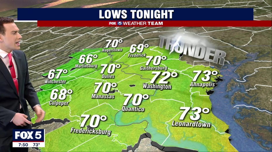
The storms are expected to be widespread, and could bring heavy downpours to parts of the area throughout the evening. The storms are expected to clear out by the nighttime hours, setting up a drier overnight period. Temperatures overnight will be in the 70s.
We will be rinsing and repeating Monday, as temperatures will be back in the 80s and more storms are expected to move into the D.C. region during the afternoon.
The storms will hang around Tuesday as well before clearing out for the rest of the week. Temperatures throughout the week will stay in the mid to upper 80s, with a chance for 90 on Thursday.