Heat, humidity linger across D.C. region to end the weekend; Cooldown expected this week

FOX 5 Weather forecast for Sunday, August 7
Claire Anderson has your FOX 5 Weather forecast for Sunday, August 7
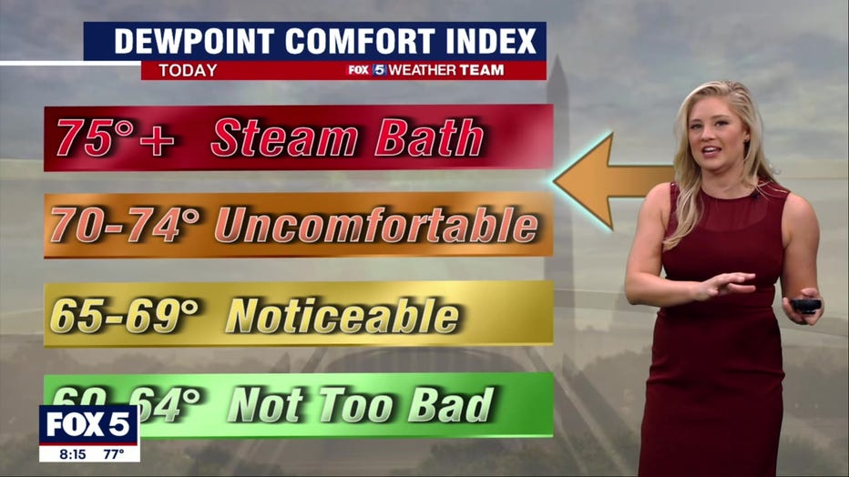
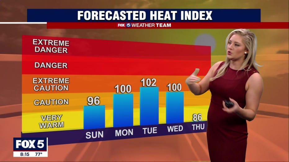
WASHINGTON - The hot and muggy streak continues day across the D.C. region Sunday thanks to high humidity and temperatures in the 90s.
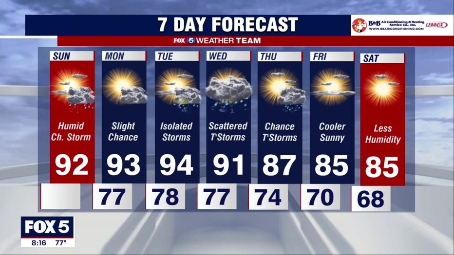
We'll see some mid-level cloud cover thin throughout the morning Sunday, giving way to predominantly sunny conditions by afternoon. Highs should peak in the lower 90s.
There will be some storms, but pinpointing exactly where is a challenge. One focus for an isolated downpour might be along Interstate 81 thanks to differential heating over the Alleghenies, which could nudge a few pockets of air upwards. Elsewhere, a lee trough, or a broad, diffuse strip of low pressure just west of I-95, could make a rogue downpour pop during the afternoon or evening.
Otherwise, most folks will stay dry. Lows tonight dip only into the mid 70s, with lower 70s north and west.
Monday we kick off the work week with a carbon copy of Sunday, but only a degree or two warmer. Same thing Tuesday, with maybe a bit better storm coverage on Wednesday. Right now it's not looking like we'll have any strong to severe storms, although any thunderstorm could produce brief, localized gusty winds.
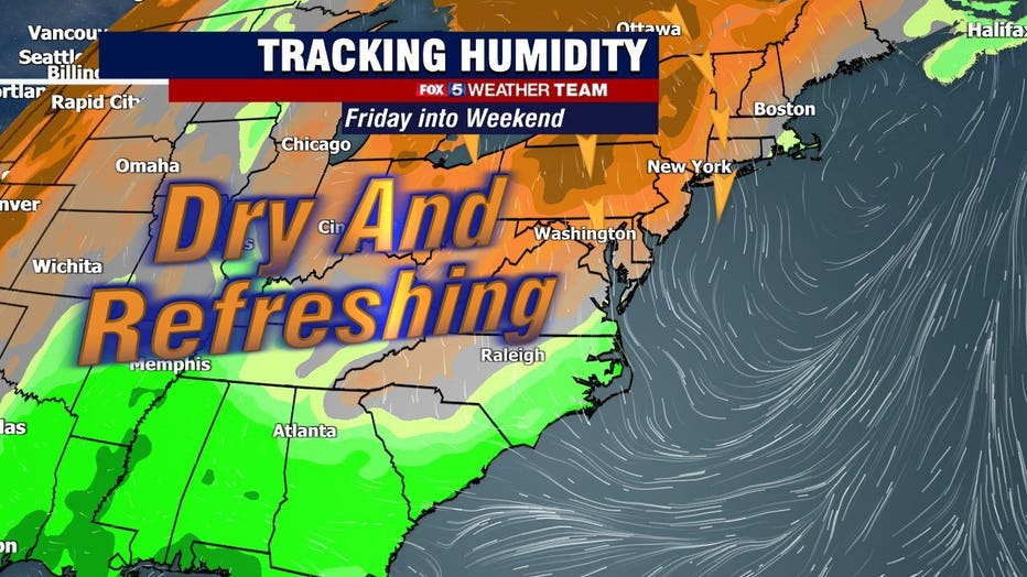
A front approaches Thursday, knocking us back into the upper 80s, and then Canadian high pressure builds overhead on Friday and Saturday. That'll bring absolutely stunning weather with highs in the mid 80s and much lower humidity. Eyes on the prize!