

Winter Storm Warning: DC area snow brings messy commutes, power outages and school cancellations
WASHINGTON - If you think it has been a while since D.C. has gotten a decent snowfall, you're correct!
In fact you have to go back about 3 years, to January 13th, 2019, when DC last received over 3 inches of snowfall during a single event. That changed Monday!

FOX 5 Winter Weather forecast for Monday, January 3
Mike Thomas has the FOX 5 Winter Weather forecast for Monday, January 3

FOX 5 Weather snow forecast for Monday, January 3
Mike Thomas has the FOX 5 Weather snow forecast for Monday, January 3
Snow lovers around our region who had been rather starved the last couple of winters got what they were waiting for. In fact, there is a shot that snowfall Monday could eclipse the total snow for the past two winters combined…though that total is only 6 inches of snow.

Winter snow conditions hit Virginia
FOX 5’s Melanie Alnwick checks in as winter snow conditions hit Virginia.

Virginia drivers deal with snowstorm aftermath
Drivers in Virginia are dealing with hazardous conditions on the roads after a snowstorm dumped inches of snow on the region Monday. VDOT spokesperson Ellen Kamilakis gives an update.
If this storm seemingly came out of nowhere, you would not be incorrect either!
Forecasters have been watching this storm for most of the week, however it was only within the last day or so that weather models really zeroed in on the Mid-Atlantic as the focal point for winter impacts.

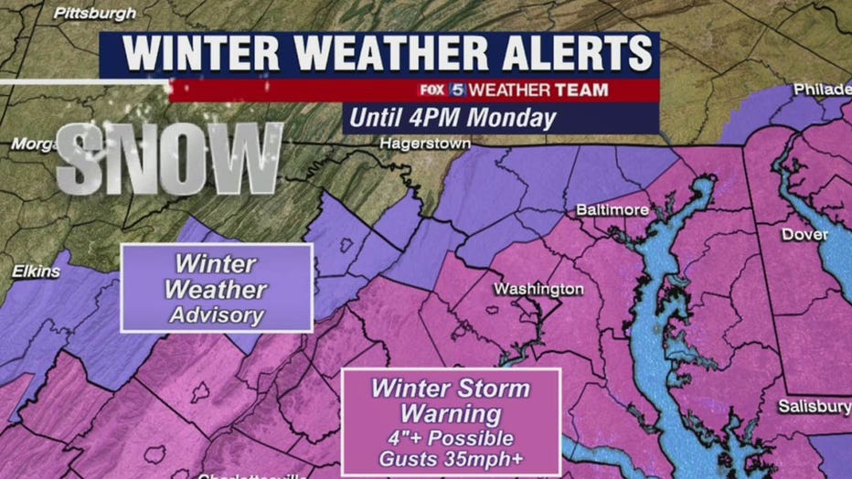
Winter Storm Warnings were put in place Sunday and adjusted to remain in effect until 4 p.m. Monday afternoon.
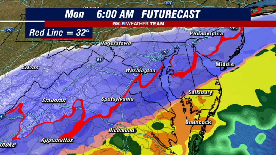
As for how much everyone will see, this has been a very tricky forecast given how rapidly the storm has seemingly come into play.

Winter weather conditions hit Maryland
FOX 5’s Maureen Umeh covers the conditions as the winter snow hits Maryland.

Snow causes hazardous road conditions in Maryland
Road conditions have been rough due to the winter weather the DMV experienced on Monday, especially in parts of Maryland. Charlie Gischlar with the Maryland State Highway Administration gives an update on how the state is working to clear the roadways.
There are a number of factors to consider as well. The city has not been below freezing at all, not even at night, since December 23rd. Sunday hit a high of 66° in fact.
However, you do not need a string of cold days to get snow to lay on the ground. You simply need snow to fall as a rapid enough rate, so that the ground is unable to melt it fast enough. A favorite example of forecasters is November of 1987…
Monday's snow was of the heavy and wet variety. Power outages climbed throughout the morning and schools districts around the region canceled class.
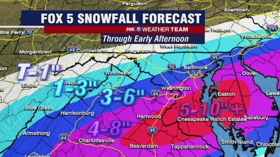
In what you might call a typical snow storm in the D.C. region, areas northwest get the most snow.
This event was the opposite. While northwest zones are colder, southern zones saw the higher snowfall rates, and with warm ground temps that's going to be key to getting some higher totals across the region.
SUBSCRIBE TO FOX 5 DC ON YOUTUBE
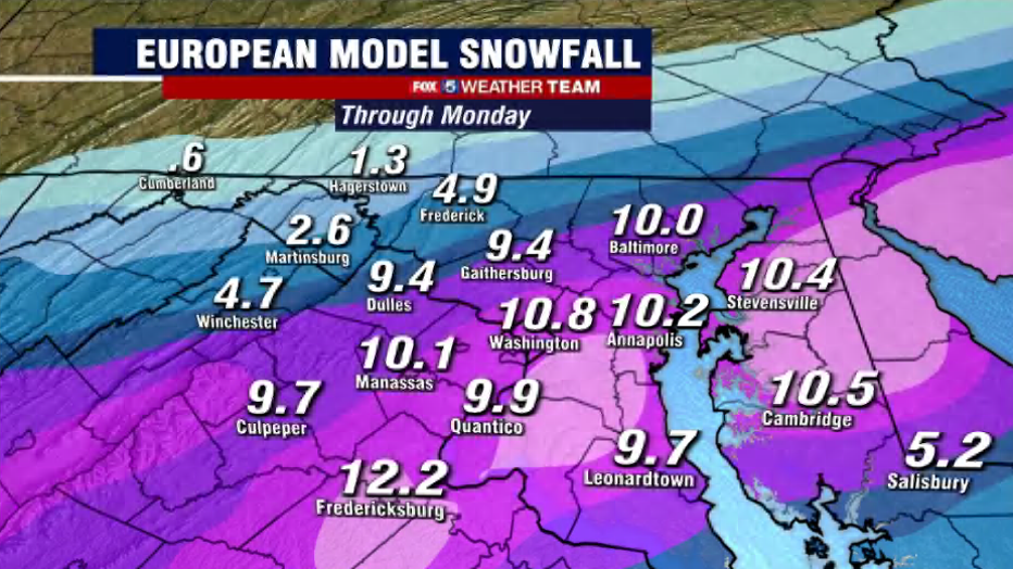
We expect the "jackpot zone" in the region will likely be somewhere in the Northern Neck or Southern Maryland, though a last minute shift could bring it farther north. For the city itself, we favor t3 to 6 inches of snow total.
Regardless of how much snow actually falls, the commute into the afternoon will likely continue to be quite a mess across the region.
But if you need to head out, please leave yourself ample extra time to reach your destination.
The entire event should wrap up by the early afternoon, and we may even see sun before the day is over.
The evening commute should be much easier, but expect temperatures to plummet overnight. School delays and cancellations will be possible again on Tuesday due to a likely refreeze during the overnight hour.
Stay with the FOX 5 Weather Team for the latest forecast updates!