

Snow in DC next week? While possible, it’s highly unlikely

DC WINTER FORECAST: More snow, brutal waves of cold predicted for DC region
We’re expecting more snow this winter and waves of brutal cold thanks to periodic polar vortex visits. Mike Thomas and Tucker Barnes are breaking down what you can expect this winter.
WASHINGTON - There’s been a lot of chatter on social media about the possibility of the DC region seeing its first snowflakes fall from the sky next week, but the FOX 5 Weather Team is cautioning to limit your expectations.
Weather models are struggling to get a good read on the current system heading to the East Coast. The FOX 5 Weather Tam has already seen several shifts in the models and they expect this to continue in the days ahead.
DOWNLOAD: The FOX 5 DC Weather app for local weather alerts
Both models, the American and the European, currently favor a rain-to-snow scenario, which means we have to wait on the cold air to arrive to change our rain over to snow.
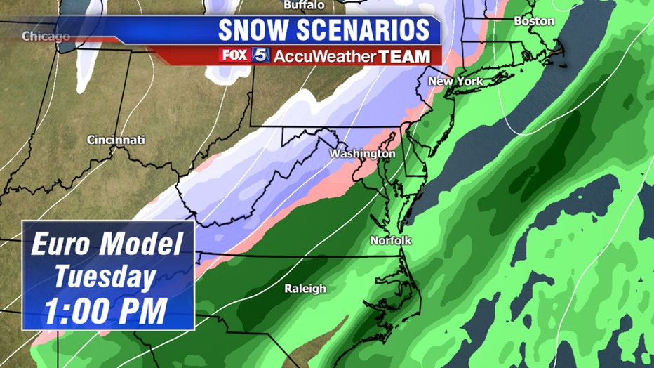
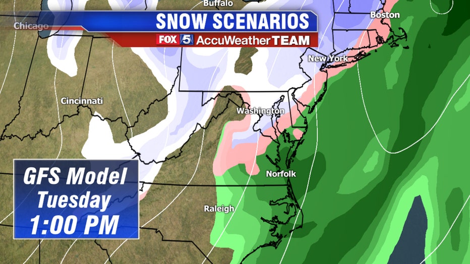
DC does not have a good history of pre-forming well with these events, because the mountains to the northwest lock up more cold air than the weather models see initially - so it takes longer to arrive.
The worst-case scenario is that DC gets an energy wave to ride up the cold front as it passes and that throws moisture back into the incoming cold air, leading to some snowfall. If this happens, models say 1 to 3 inches of snow could be possible in some spots, but this is not the favored solution at this time.
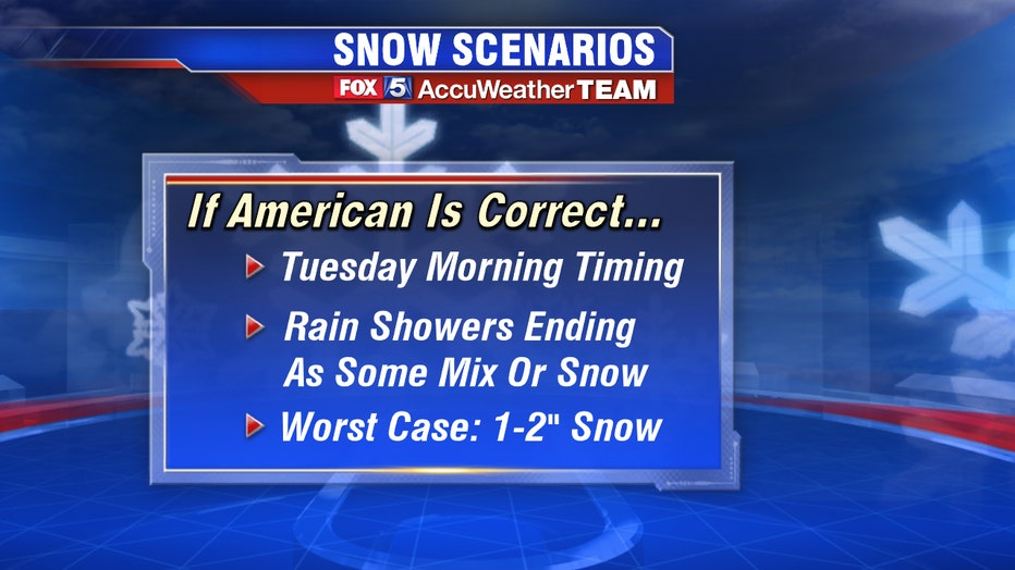
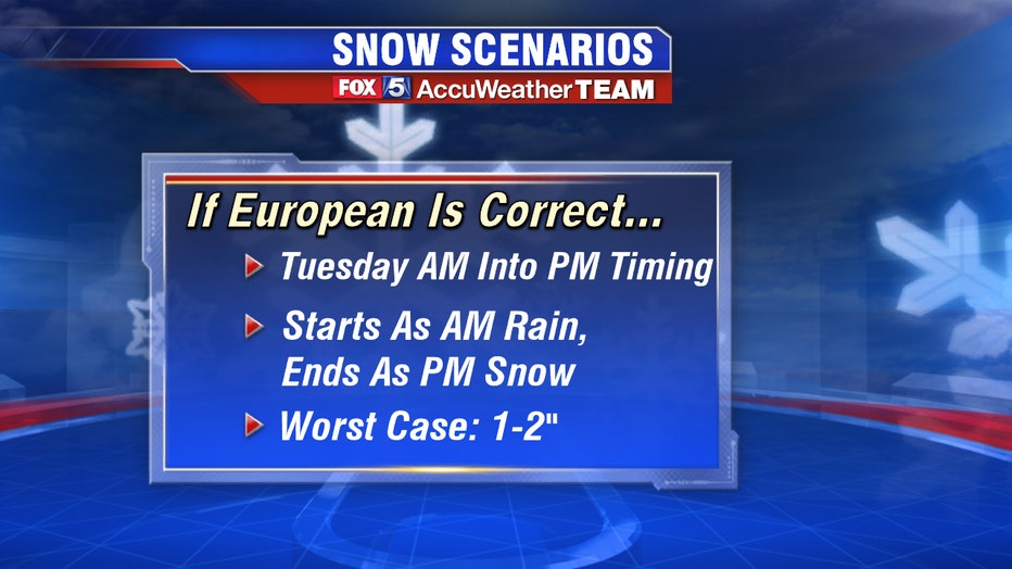
The FOX 5 Weather Team is closely monitoring that window of opportunity on Tuesday and will be sure to keep you up-to-date with the latest details as they become available.
While all eyes are currently on the potential for snow on Tuesday, we really should be concentrating was almost guaranteed to come on Wednesday: frigid cold.
Whether snow comes or not, a cold blast of air will drop temperatures into the 30s on Wednesday.