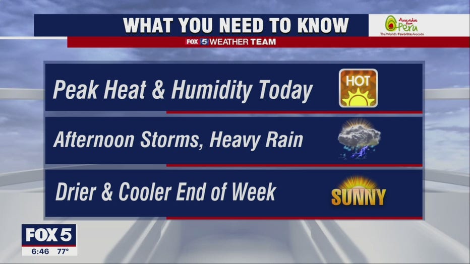
Heat streak continues Tuesday with scattered evening showers

D.C. has reached its third heat wave of the season as Tuesday marks three days in a row of 90° weather.
Six of the last seven days have been above 90°, however, we just snuck an 88° day in this past Saturday that broke the heat streak up.
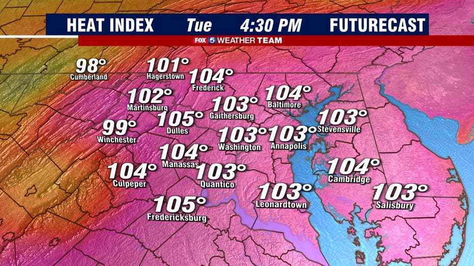
Sky-high humidity combined with temperatures in the mid-90s yielded heat indices pushing into the triple digits on Tuesday.
Anyone working outdoors or planning outdoor recreational activities should take it easy, take frequent rest breaks indoors and remember to stay hydrated.
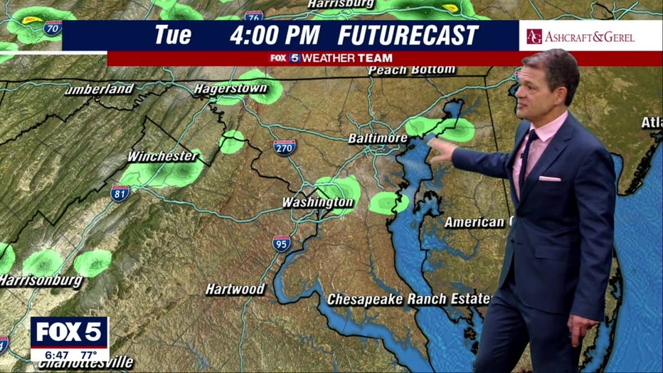
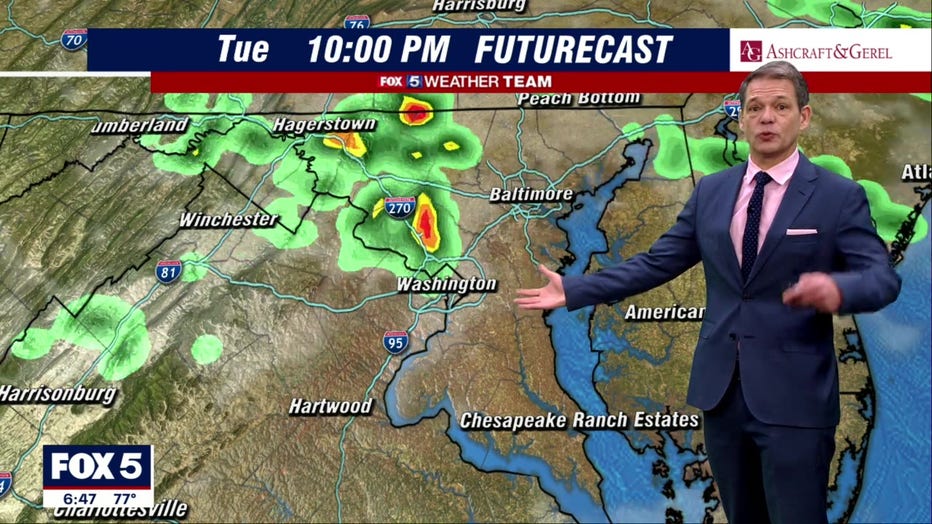
There will likely be more scattered afternoon showers about the area. However, it's tough to predict exactly where they'll crop up. Futurecast suggests the best shot at anything close to a storm in the District arrives between 8 p.m. -10 p.m.
Any thunderstorms that do form could produce brief gusty winds, but the bigger threat is heavy rainfall. Water rescues were conducted in Prince George's County with some flash flooding on Monday after 2.7 inches of rain fell.
Tuesday night will be very warm and extremely humid.
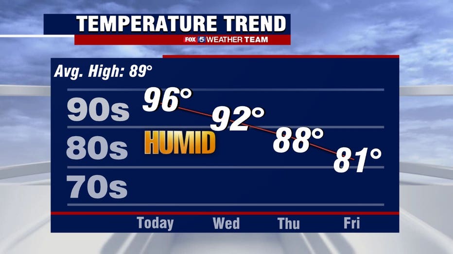
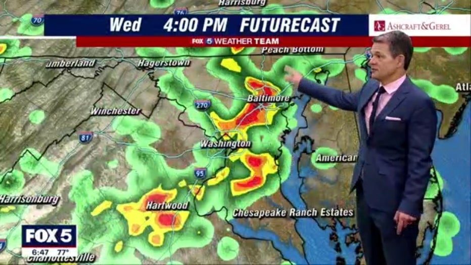
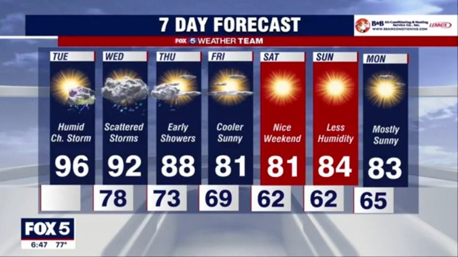
Wednesday will feature highs in the lower 90s and a renewed threat of heavy rains. Storms may be a bit more widespread, including along the Interstate 95 corridor. Some heavy thunderstorms could pop up in the afternoon with torrential rainfall, localized flash flooding and strong winds.
Storms could linger into Thursday morning, but Thursday's a transition day with highs in the upper 80s to around 90.
By Friday, a more refreshing air mass arrives with highs only in the mid-80s. Nights may dip into the mid-60s, falling below 70 for the first time in D.C. since July 11.