

Freezing rain threat early Tuesday across the DC region
Freezing rain threat early Tuesday across DC region
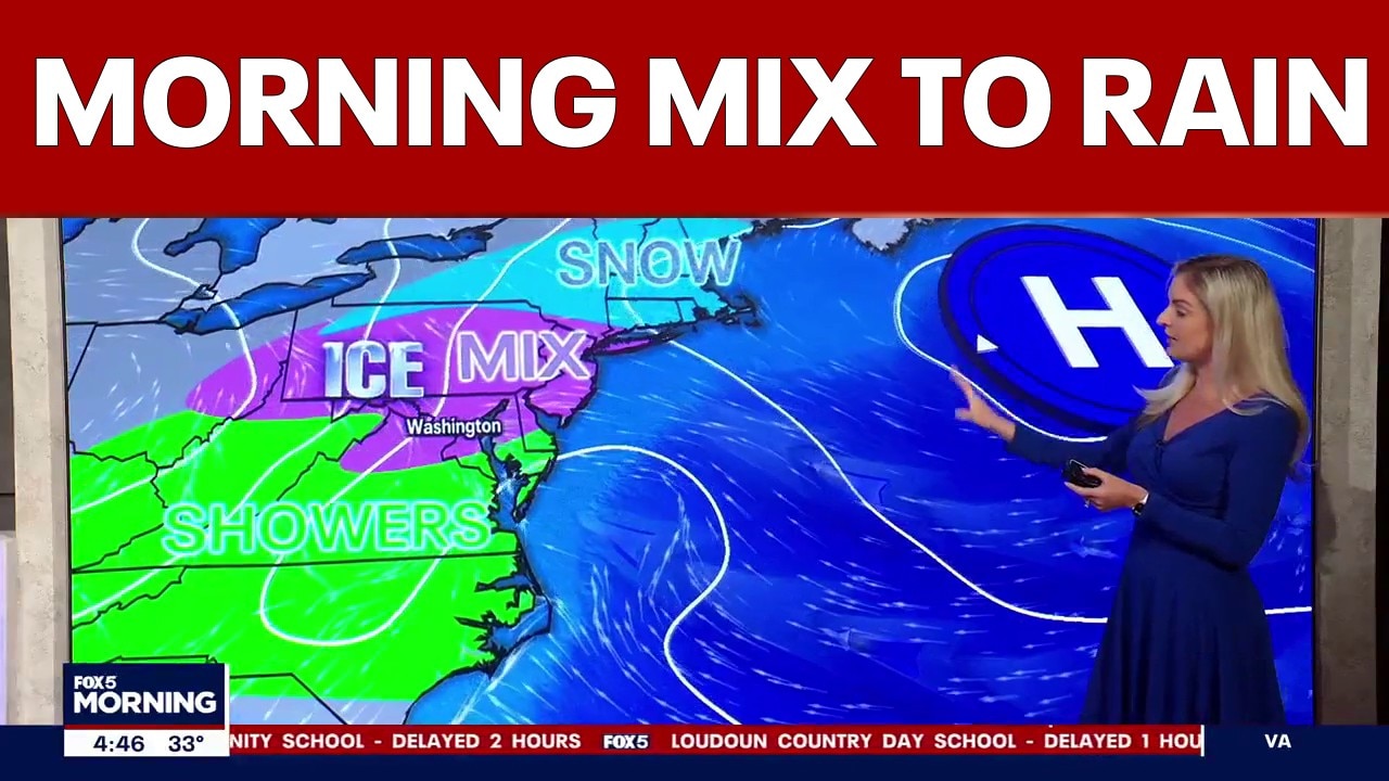
Mixed precipitation continues early Tuesday, with freezing rain the main concern as a Winter Weather Advisory remains in place for parts of the region.
WASHINGTON - A mix of rain, sleet and freezing rain is making for a slick start to Tuesday as a Winter Weather Advisory remains in effect for parts of the D.C. region.
Freezing rain is the main concern, especially for areas north and west of I‑95. Temperatures early Tuesday are hovering near the freezing mark. While ground temperatures are slightly warmer, elevated surfaces, including bridges and overpasses, could still ice over and turn slick.
Most of the region is seeing plain rain, but pockets of freezing rain remain possible through midmorning. Any icy mix should taper off by around 9 a.m. Temperatures will slowly climb through the day, turning all remaining precipitation into rain.
The rest of Tuesday stays damp and chilly. Highs reach only the upper 40s, and scattered showers linger through the afternoon.
School closings, delays in DC, Maryland, Virginia for Tuesday, March 3
More showers redevelop overnight as temperatures continue to warm. Patchy fog and low clouds are possible Wednesday morning, followed by additional showers later in the day. Highs Wednesday should reach the mid to upper 50s.
The rest of the week brings warm temperatures but little sunshine. Fog and occasional drizzle are possible each day through Friday.
Sunshine returns and temperatures could push into the mid‑70s by Saturday, with relatively dry conditions holding into Sunday.
Daylight Saving Time begins this weekend as well, so clocks spring forward and we lose an hour of sleep heading into Sunday.
READ MORE: Wintry mix makes for a messy Tuesday morning commute
WINTER WEATHER ADVISORY REMAINS IN EFFECT UNTIL 10 AM (NWS)
WHAT: Mixed precipitation, primarily freezing rain. Additional ice accumulations up to one tenth of an inch, mainly on bridges and other elevated surfaces. The highest amounts will be on the hilltops.
WHERE: Portions of central Maryland and northern and northwest Virginia.
WHEN: Until 10 AM EST this morning.
IMPACTS: Plan on slippery road conditions. The hazardous conditions could impact the Tuesday morning commute.
PRECAUTIONARY/PREPAREDNESS ACTIONS: Slow down and use caution while traveling. The latest road conditions for the state you are calling from can be obtained by calling 5 1 1.
Stay with the FOX 5 Weather Team for the latest forecast updates. The FOX LOCAL app is your source for live FOX 5 DC weather updates. Click here to download.
The Source: Information in this article comes from the FOX 5 Weather Team and the National Weather Service.