

Wet July week will add to DC region's rain total after soggy May and June

DC Heat Advisory Tuesday; PM storms possible
A heat advisory takes effect at 1 p.m. Tuesday across the Washington, D.C., region as hot and humid conditions push temperatures toward 95 degrees and heat index values climb as high as 105.
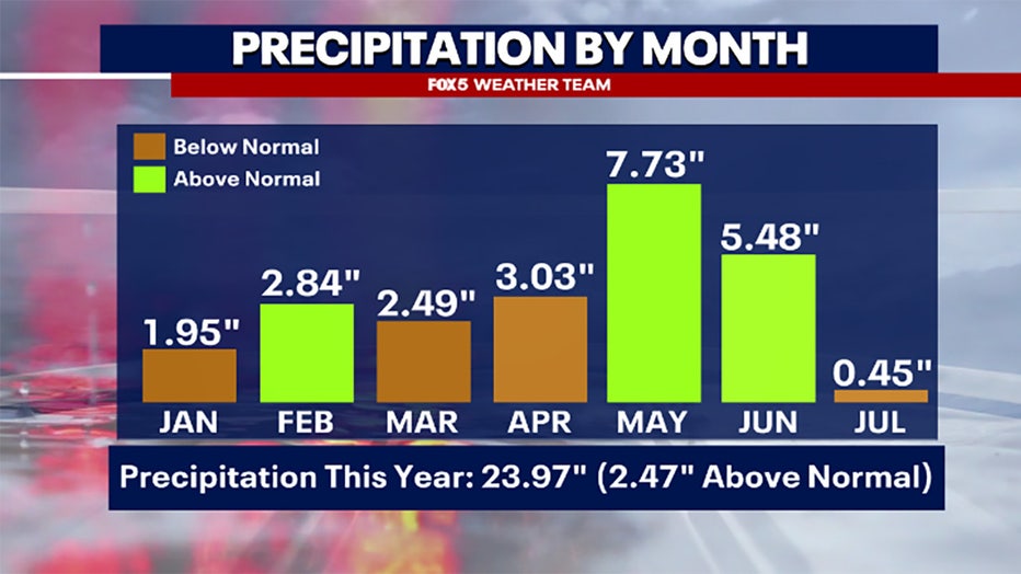
WASHINGTON - More anticipated July rain could add to an already soggy stretch in the D.C. area, where rainfall totals since May 1 have climbed to 13.5 inches — about 4.5 inches above average.
What we know:
May brought 7.73 inches of rain, nearly double the average of 3.94 inches. June remained wetter than usual, with 5.48 inches compared to the monthly average of 3.49.
As of July 7, only 0.45 inches of rain have fallen this month, below the typical 0.88-inch mark. However, daily rain chances this week could raise the total and bring July closer to average.
Wet July week will add to DC region's rain total after soggy May and June
More rain for DC region? Here's what we can expect this week:
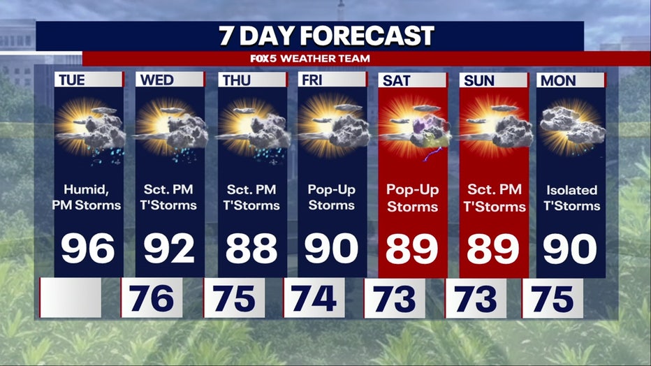
Tuesday
HOT! Temperatures will be in the mid 90s with heat index values expected to reach 100+.
A cold front will move through the area in the evening hours, bringing potentially a line of STRONG thunderstorms through the area. We will be cooling off with a touch less humidity in the overnight hours and temperatures around the low to mid 70s.
READ MORE: DC Heat Advisory Tuesday; PM showers and thunderstorms possible
Wednesday through Friday
Temperatures will be higher in the early week with daily highs expected to cool down as we get into the latter half of the week.
Expect a chance for showers and thunderstorms daily as we see our highest chances in the late afternoon to evening hours. Tropical Storm Chantal will be out of our area by late Monday night to early Tuesday morning, bringing rain through most of the afternoon.
DC Heat Advisory Tuesday; PM showers and thunderstorms possible
The Source: Information in this article comes from the FOX 5 Weather Team and the National Weather Service.