

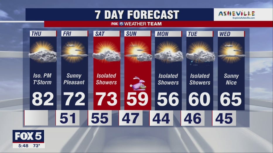
Warm Thursday with temps in the 80s; storms expected in the afternoon

Warm Thursday morning could turn into rainy afternoon
FOX 5's Matthew Cappucci has the full forecast.
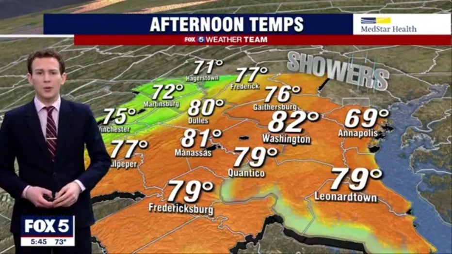
Another day with temperatures expected to peak around 80° before a cold front starts sliding in from the west during the afternoon.
Download the FOX 5 Weather App
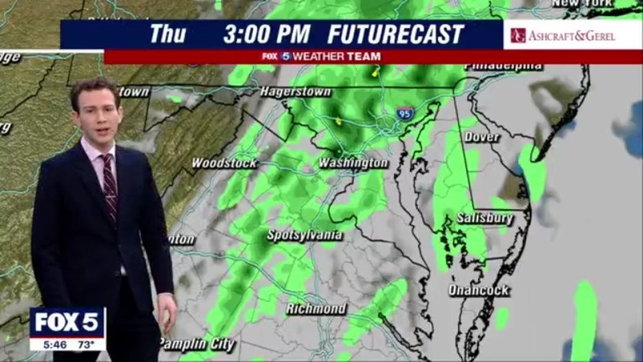
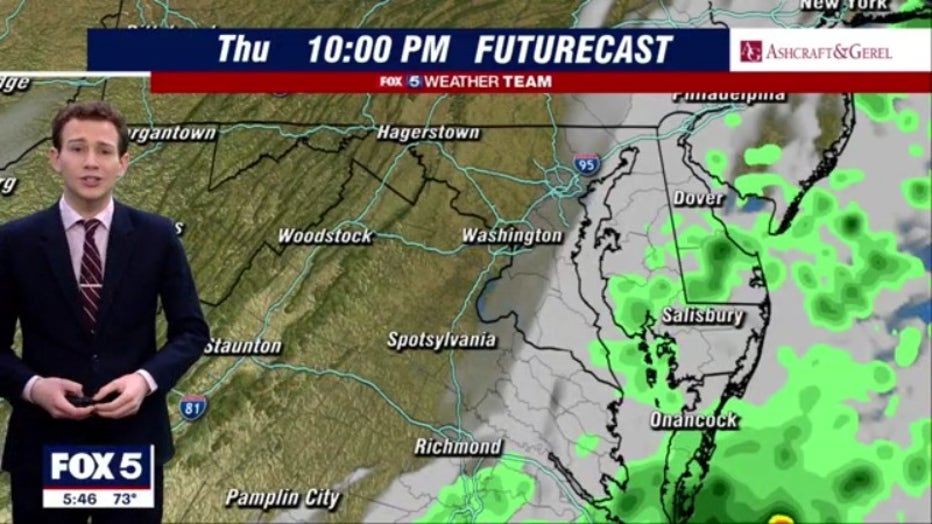
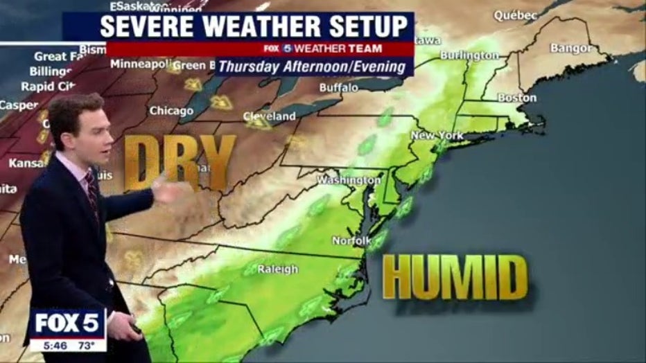
Showers and storms could start any time after about 3 p.m. By 10 p.m., the threat of severe weather should have diminished, however, there could be some lingering showers across our southern zones, particularly south & east of 95. Conditions will dry out overnight.
Friday is expected to be a little breezy, but other than that, just about perfect. A cool start, then a good amount of sunshine and highs in the 70s.
A stronger cold front will move through on Saturday afternoon. Ahead of it, temperatures should reach into the 70s one more time, but as it passes there could be some showers that come along for the ride.
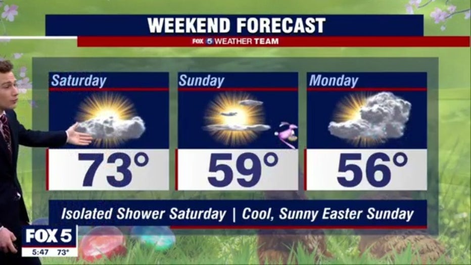
Temps will tumble behind it through, and while Easter Sunday looks dry with a good amount of sun, it will be breezy and much cooler with highs only in the 50s.
Stay with FOX 5 on the app and online for weather updates:
Get the latest FOX 5 forecast here.
Check the latest Closings and Delays
Download the FOX 5 DC News App for Local Breaking News and Weather
Download the FOX 5 Weather App
Check the latest weather radars
Stay up to date with the FOX 5 Weather Team on Twitter: