

Showers, isolated thunderstorms possible Wednesday with highs in the 60s
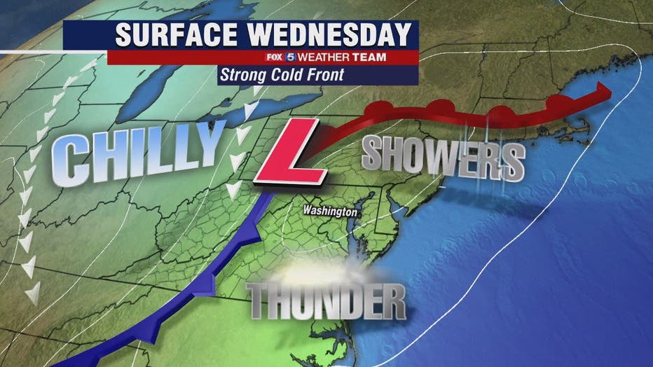
WASHINGTON - Keep your eyes on the skies Wednesday as a strong cold front moves through the D.C. region bringing possible showers and a chance for isolated thunderstorms later in the day.
Download the FOX 5 Weather App

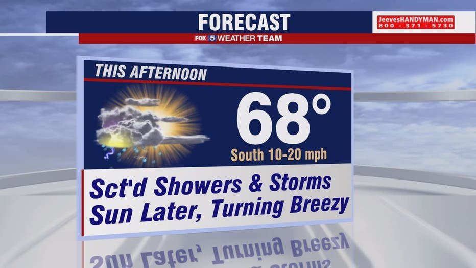
FOX 5 Weather afternoon forecast for Wednesday, April 21
Mike Thomas has the FOX 5 Weather afternoon forecast for Wednesday, April 21
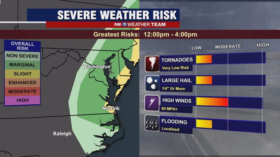
FOX 5's Gwen Tolbart says the front should move through quickly. The Storm Prediction Center has us under a Marginal Risk for severe weather with the greatest risk being damaging winds.
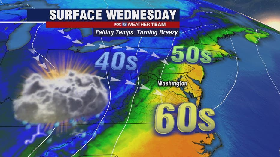
Winds will be chilly from the northwest and gusty and could reach over 30mph. Behind the front very cold air moves in and temperatures will take a dive this evening and into Thursday. Highs will only be in the 50s Thursday after Tuesday's highs in the 70s!
There will be a Freeze Watch for far western zones for late Wednesday night through Thursday morning. A gradual warming trend into the weekend and early next week.
Stay with FOX 5 on the app and online for weather updates:
Get the latest FOX 5 forecast here.
Check the latest Closings and Delays
Download the FOX 5 DC News App for Local Breaking News and Weather
Download the FOX 5 Weather App
Check the latest weather radars
Stay up to date with the FOX 5 Weather Team on Twitter: