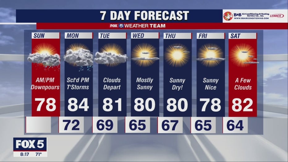
Rainy Sunday across DC region; Thunderstorms possible Monday

FOX 5 Weather forecast for Sunday, September 11
Matthew Cappucci has the FOX 5 Weather forecast for Sunday, September 11
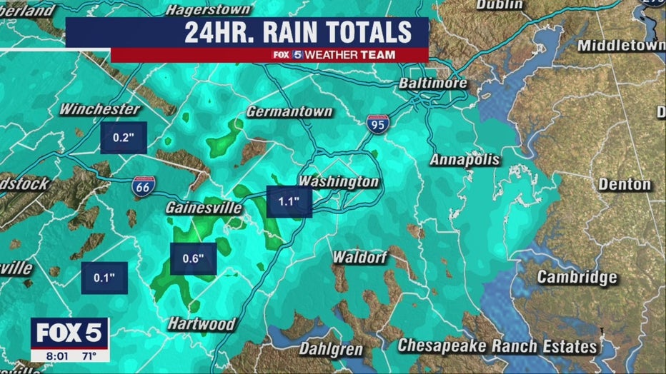
There are reasons to be optimistic about today's game at Fedex Field, but there are still a few showers pushing north and east with time. Most folks south/west of D.C. saw about a half inch overnight, mostly from a quick round that moved through between 5 and 7 a.m.
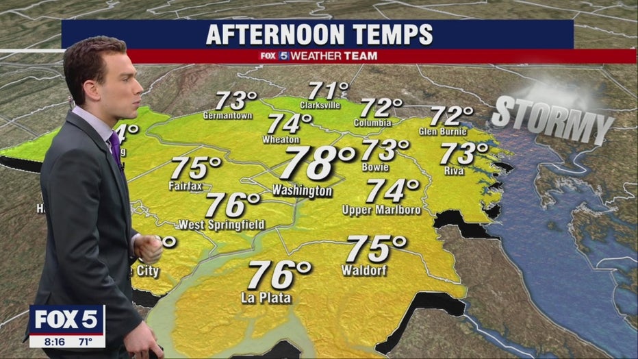
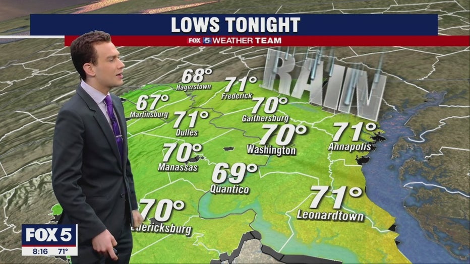
Showers will exit to the northeast around 10 or 11 a.m., and we may even see a few hints of sun this afternoon. If we do, it'd be self-destruct sunshine, meaning it'll heat the ground enough that we'll see more showers/thunderstorms over the Potomac Highlands in the afternoon and evening. A rogue downpour could even sneak east near D.C. or the Chesapeake overnight.
Tomorrow's looking a bit interesting weather-wise. We'll see a mix of sun and clouds during the morning hours into the early afternoon, with highs in the mid 80s. By evening, a cold front enters our western zones, bringing thunderstorms, which will reach the D.C. to Baltimore corridor during the evening commute.
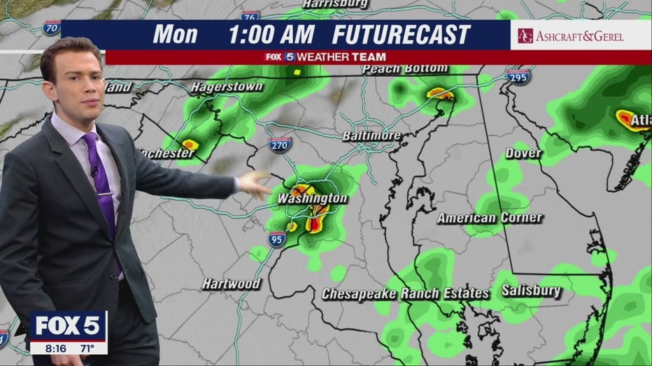
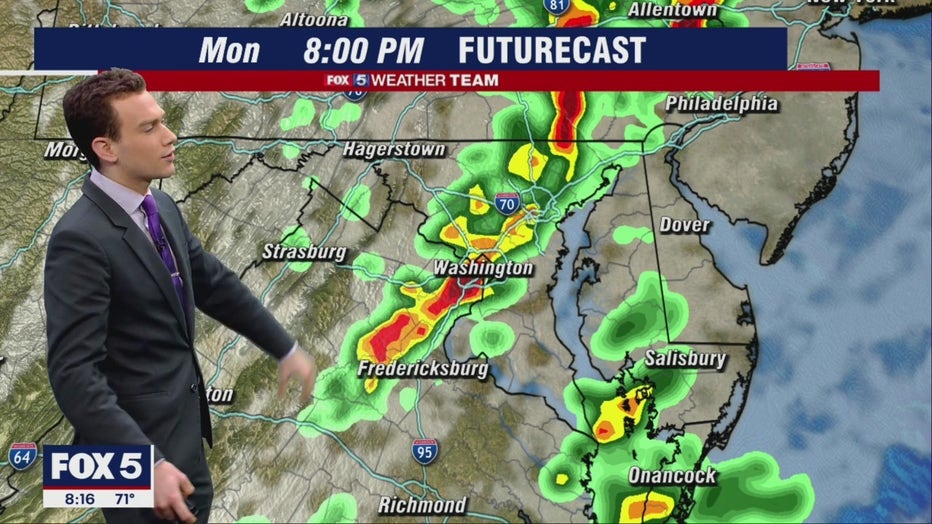
Jet stream dynamics will lag behind the "juice" that'll be fueling storms, but if there's any overlap we could see a very remote risk of an isolated rotating storm, primarily north and west.
Pleasant, dry and sunny weather arrives Tuesday onward.