Hot and humid air sticks around DC region Sunday; severe storms possible later in the afternoon

FOX 5 Weather forecast for Sunday, May 22
Gwen Tolbart has your FOX 5 Weather forecast for Sunday, May 22.
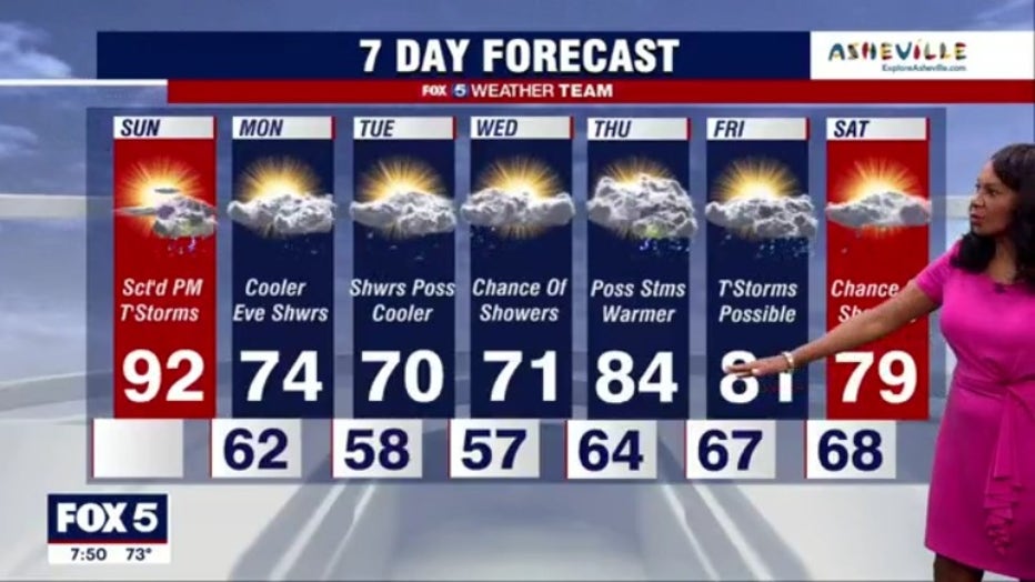
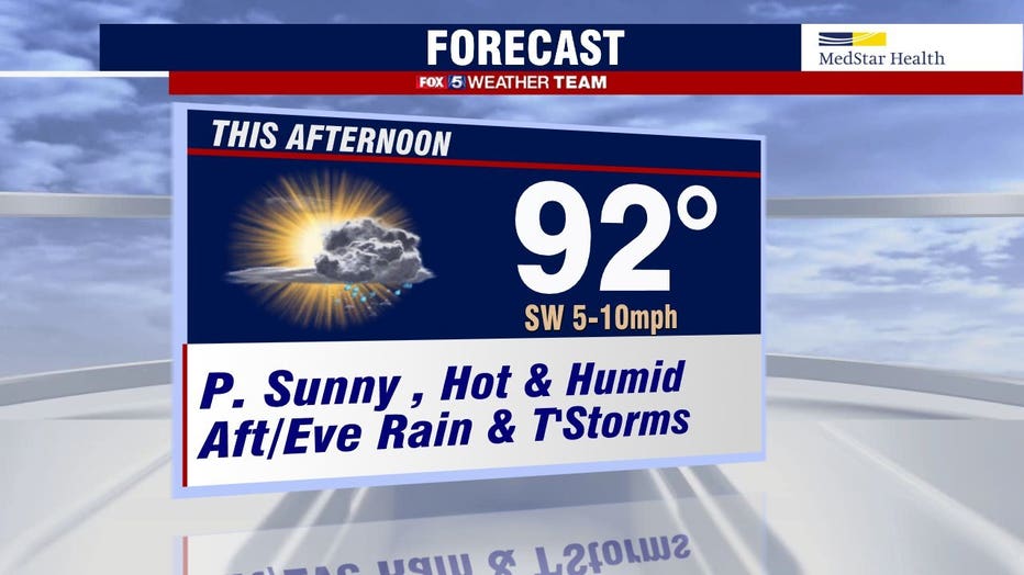
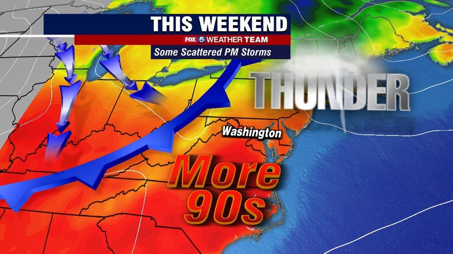
WASHINGTON - Sunday will be another scorching day for the D.C. region with the chance for strong storms later in the evening. But there is some good news, as the storms will bring us cooler temperatures to start the week!

RELATED: DC spray parks to open this weekend amid expected heat wave
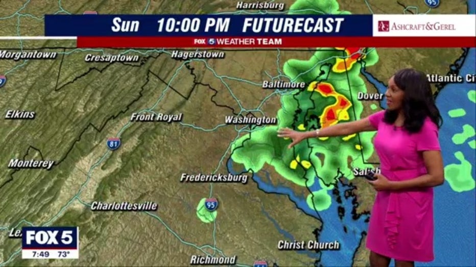
The extreme heat and humidity continue Sunday as high temperatures will stay in the 90s. We will see a mix of cloud and sun throughout the day before a cold front from the west moves into the region bringing with it storms. Those storms could be severe thanks to the incoming front colliding with the warm humid air mass that has been hanging over the area.
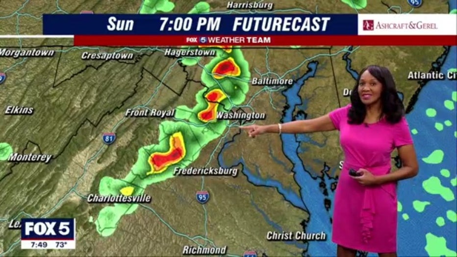
The storm risk will be marginal to slight for D.C. and the surrounding areas Sunday, meaning that damaging winds, hails, and heavy rain are possible. The storms are expected to move into the area around 4 p.m. Sunday afternoon and could stick around through the evening.
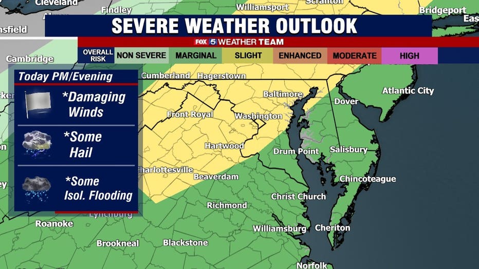
There is also a thunderstorm watch in effect for parts of Maryland and Virginia until 9 p.m. Sunday.

Stay with FOX 5 on the app and online for weather updates:
Get the latest FOX 5 forecast here.
Check the latest Closings and Delays
Download the FOX 5 DC News App for Local Breaking News and Weather
Download the FOX 5 Weather App
Check the latest weather radars
Stay up to date with the FOX 5 Weather Team on Twitter:
The system will clear out of the area overnight Sunday making way for a much cooler and less humid start to the week, with temperatures forecasted to be in the 70s Monday. The day will be mostly clear before more rain and scattered thunderstorms move into the area Monday night.