

Flurries possible Friday morning with a cold, dry afternoon; freezing rain, ice expected over weekend
WASHINGTON - Our active weather pattern continues, but Friday is free of winter alerts. Use it to your advantage because much of our area is under a Winter Storm Watch beginning Saturday morning.
Check the latest Closings and Delays

FOX 5 Weather forecast for Friday, February 12
Mike Thomas has the FOX 5 Weather forecast for Friday, February 12.
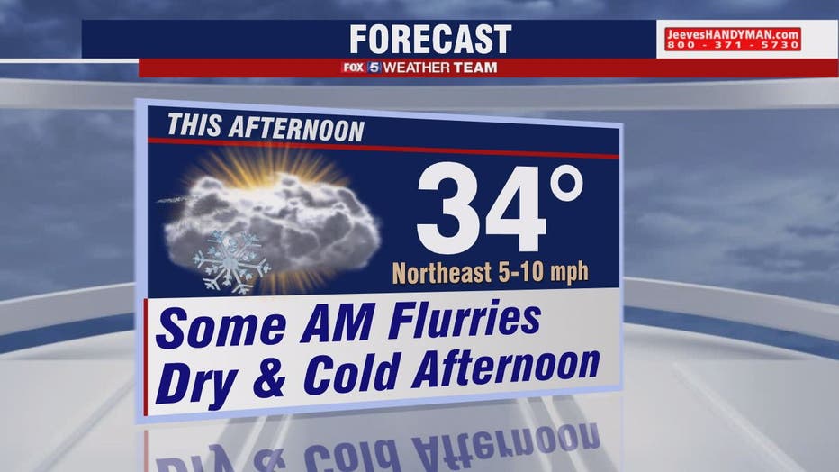
First things first, the light snow from the system that passed across central Virginia and Southern Maryland overnight is now moving away. Some flurries may linger early today, and be careful of slippery spots on untreated surfaces where you got additional snow overnight in southern/western suburbs.
We stay cold today with temperatures in the low-30s and plenty of cloud cover.
Download the FOX 5 Weather App
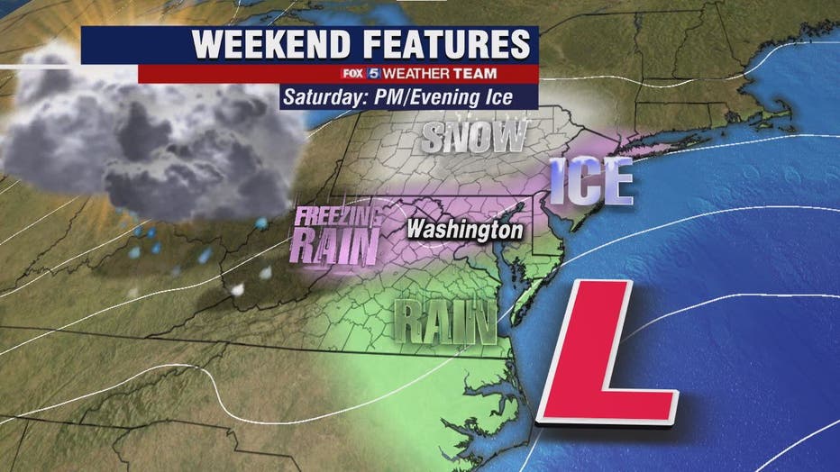
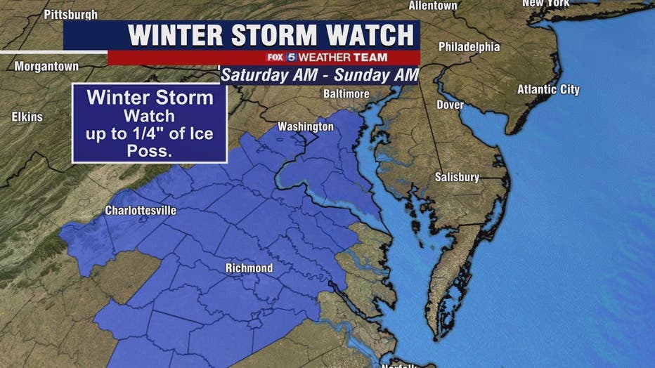
All our attention then shifts to the Saturday set-up. This storm looks to bring mainly freezing rain and sleet with potential for 1/4 inch of ice. Surface temperatures on Saturday will hover near 32 degrees, and a small amount of snow is also possible.
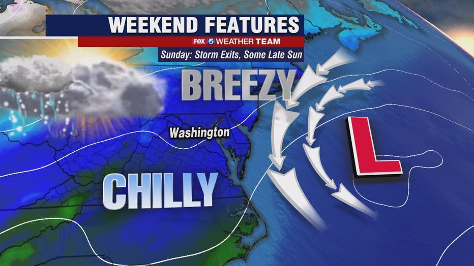
The Winter Storm Watch is for D.C. and points south through Sunday morning. We will alert if you if that changes. Freezing rain will taper off on Sunday but travel could be very hazardous and power outages may occur if the icing is substantial on tree and power lines.
A few degrees will make a big difference in this forecast so we will keep you updated!
Stay with FOX 5 on the app and online for weather updates:
Get the latest FOX 5 forecast here.
Check the latest Closings and Delays
Download the FOX 5 DC News App for Local Breaking News and Weather
Download the FOX 5 Weather App
Check the latest weather radars
Stay up to date with the FOX 5 Weather Team on Twitter: