

DC weather: Snow falls across parts of DMV Thursday as temperatures plunge
Snow comes to DC Thursday after record highs Wednesday
After temperatures in the 80s on Wednesday, snow is moving into the DMV Thursday. The snow won't stick, but it will bring a cold front with it.
WASHINGTON - After two days of springlike, even summerlike warmth, temperatures tumbled Thursday and a mix of rain and wet snow fell across the D.C. region.
Morning temperatures in the 60s and low 70s were the warmest of the day before cold air swept through, said FOX 5’s Taylor Grenda. Winds picked up early and strengthened throughout the day.
RELATED: Snow possible for DC, Maryland, Virginia on Thursday after record high temperatures
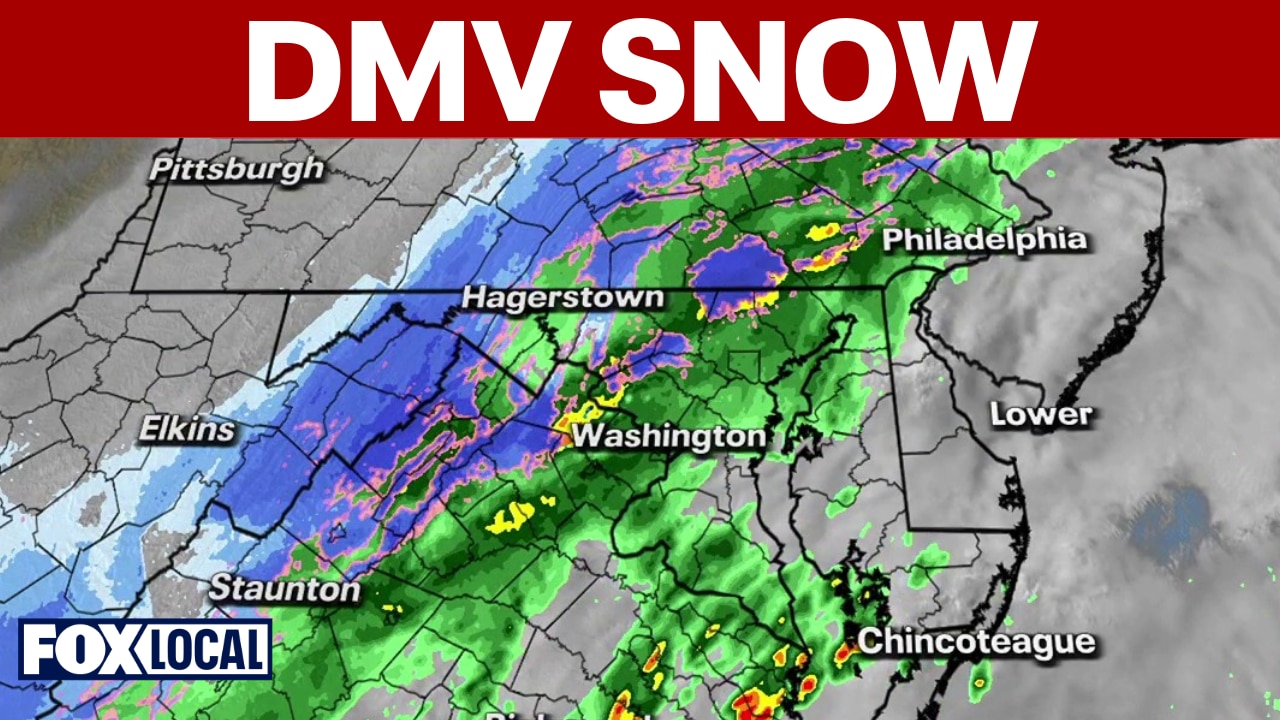
Rain showers moved in from the west during the morning and will continue into early afternoon. As colder air rushed in behind a cold front, wet snowflakes mixed and fell around midday. FOX 5’s Tucker Barnes says most of it will melt on contact, so road impacts are unlikely.
Temperatures fall into the 30s and 40s by late afternoon, then drop into the 20s and 30s overnight. Friday will be cold and windy to close out the workweek.
The weekend starts cool with lighter winds, but temperatures rebound into the 60s Sunday and may briefly reach the 70s Monday ahead of storms. Another round of colder air arrives for St. Patrick’s Day on Tuesday.
When will the snow stop in the DC area?
Timeline:
According to the National Weather Service, the snow will start to taper off by mid-afternoon.
- 2 p.m.: Light rain and snow mix
- 3 p.m. - 4 p.m.: Rain and snow mix likely
- 5 p.m.: Mostly cloudy, with precipitation moving out.
The Source: Information in this article comes from the FOX 5 Weather Team and the National Weather Service.