

DC weather: Hot, humid Wednesday with showers and thunderstorms
DC weather: Hot, humid Wednesday with showers and thunderstorms
Hot, more humid conditions spread across the Washington, D.C., region on Wednesday, with afternoon and evening showers and thunderstorms possible.
WASHINGTON - Hot, more humid conditions spread across the Washington, D.C., region on Wednesday, with afternoon and evening showers and thunderstorms possible.
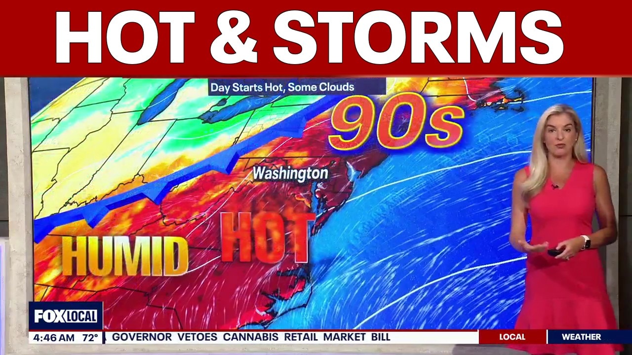
FOX 5’s Taylor Grenda says temperatures will push near record highs, making it a day to stay cool and hydrated during any outdoor activities. Morning temperatures in the upper 60s to low 70s come with higher humidity, giving the day a more summerlike feel. A cold front approaching the region will bring unsettled weather through the second half of the day and into the end of the week.
What we know:
Wednesday temperatures are expected to reach near 96 degrees, with shower and storm chances increasing after 2 p.m. Scattered showers developing between mid‑afternoon and early evening, with breaks in between. Intermittent showers and rumbles of thunder may continue overnight.
We could see another round of rain on Thursday, and conditions are expected to stay wet before gradually drying out Friday, though a lingering shower chance remains.
The region is under a severe weather risk Wednesday, but the threat is expected to be isolated. Heavy downpours, damaging wind gusts and small hail are the primary concerns. The cold front will bring a noticeable cooldown, with Thursday’s highs falling back into the 60s and unsettled weather continuing into the weekend.
While the holiday weekend looks unsettled at times, it will not be a total washout, with shower chances continuing through Memorial Day.
Weather Timeline
Wednesday Morning
Temperatures climb quickly toward the 90s, with highs expected to reach near 96 degrees. Increasing clouds and rising humidity make conditions feel more summerlike.
Early afternoon (noon–3 p.m.)
Heat peaks near record levels. Clouds continue to build. A chance of showers and thunderstorms develops after 2 p.m.
Mid‑afternoon to early evening (3 p.m. - 7 p.m.)
Scattered showers and storms begin to pop up across the region. Activity will be hit‑or‑miss, with breaks in between. Some rumbles of thunder.
Evening (7 p.m. - 11 p.m.)
Storm chances continue as the cold front approaches. Temperatures fall. Intermittent showers linger.
Overnight (11 p.m.–Thursday morning)
Showers and thunderstorms likely before 2 a.m., then a chance of showers toward morning.
Thursday (morning–afternoon)
Widespread showers and thunderstorms return. Temps fall to near 67 degrees.
Thursday night into Friday
Conditions stay wet before gradually drying out Friday, though a lingering shower chance remains.
Hazardous Weather Outlook (National Weather Service)
Hazardous Weather Outlook is for the Maryland portion of the Chesapeake Bay, Tidal Potomac River, and I-95 corridor through central Maryland, northern Virginia, and District of Columbia.
Wednesday morning and evening: Scattered severe thunderstorms capable of producing damaging winds and large hail are possible Wednesday afternoon and evening.
The Source: Information in this article comes from the FOX 5 Weather Team and the National Weather Service.