

DC Snow Forecast: Weekend winter storm could bring several inches to DMV
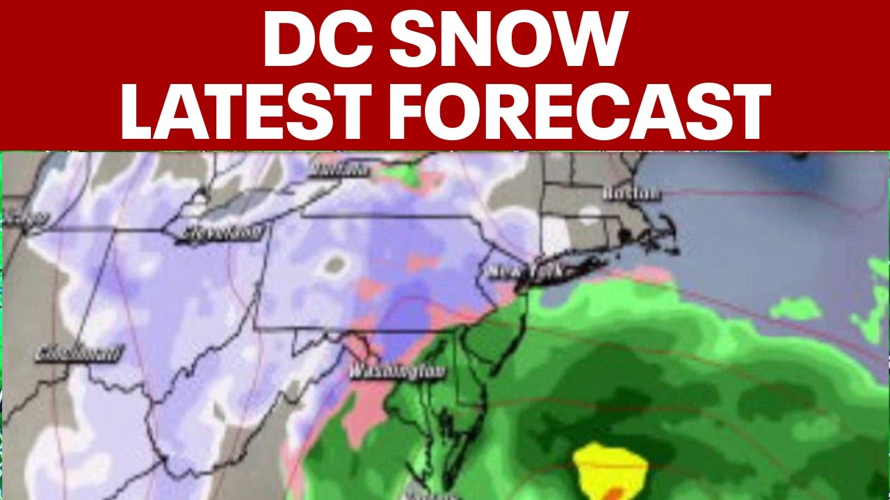
DC SNOW: 3-5" of snow possible for DC metro area Sunday
FOX 5's Caitlin Roth shares the latest on the potential for snow heading to the D.C. area this weekend.
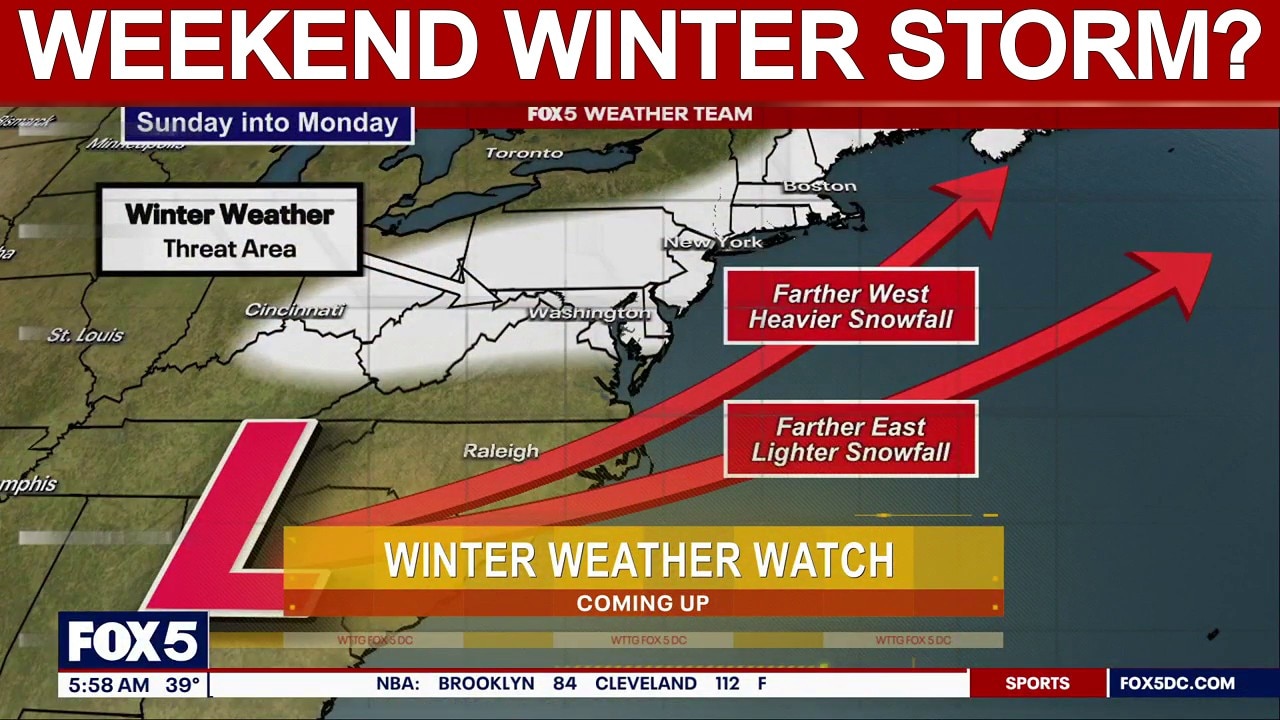
WASHINGTON - The big story this entire week has been what comes our way on Sunday. One thing we can say for certain is that a coastal low will begin to slide into our area early Sunday morning and exit to the northeast by Monday.
READ MORE: What is a nor’easter and a bomb cyclone? How major East Coast winter storms form
Winter storm watches

Winter weather alerts across Virginia and Maryland as of 8 p.m. on Friday, Feb. 20, 2026.
Why you should care:
Just after 2:30 p.m. on Friday, the National Weather Service issued winter storm watches for parts of northern Maryland, including the Baltimore area. The watches will be in effect from Sunday afternoon through Monday morning.
How much snow will the DMV get this weekend?

By the numbers:
Snow isn't expected to start accumulating until Sunday evening, but once it does, the DMV could see several inches.
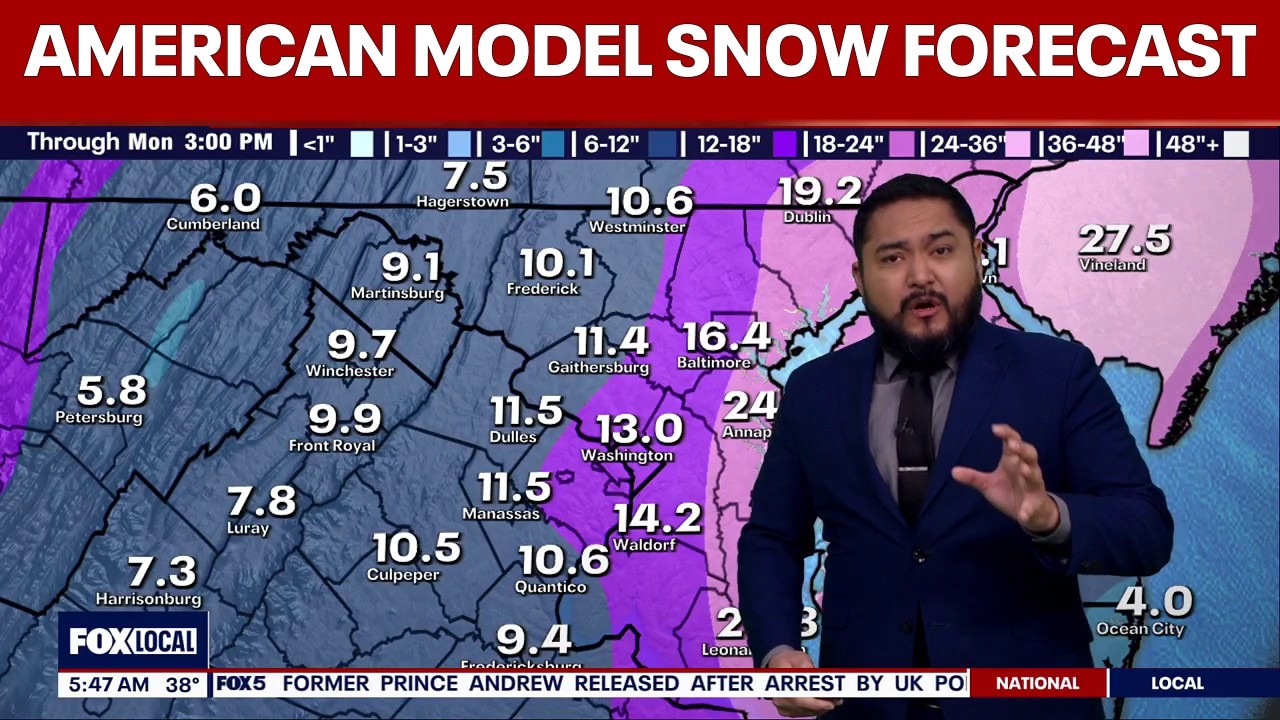
FOX 5's Caitlin Roth says that the DC area, northern Virginia and western Maryland could see between 3 and 6 inches of snow from Sunday into Monday, with projected totals going up as you move further north and east.
The Baltimore area and the western mountains could see six inches or more.
Snow storm forecast
What we know:
Incoming model data Friday morning showed that models like to have this storm system deepening off the coast, which would draw in colder air earlier. But does this equate to snow on Sunday morning?
Yes, and no. While some models have a more pronounced snow profile (colder air dropping temperatures closer to the low 30s), some models show a more marginal profile (temperatures in the mid 30s), which would start us off with some cold rain. The rain snow line will be very important to follow for the morning hours as it will determine who sees snow early. As usual, it looks to follow along I-95 but if deepening begins to occur earlier, this line could move south, which some models are hinting at.
DC snow forecast: Risks rising for DC region ahead of Sunday storm
DC Weather Snow Forecast: Weekend wintry mix threatens DMV
The Washington, D.C., region is keeping an eye on a wintry mix of snow and cold rain that could arrive on Sunday.
While the rain snow line will be important during the morning hours, the next thing we are really focused on is the intensification of this storm system during the second half of the day.
Big picture view:
Models are showing that the coastal low will strengthen and that will increase precipitation rates, which would mean bands of heavy snow. This would rapidly accumulate as the heavy snowfall would drag down cooler air to the surface and have our temperatures dip to the freezing mark.
Given some models are differing on the timing of this intensification, this is why there is such a big pause on what to expect from this storm. Snowfall amounts range from just a few inches of snow to almost a foot. With the timing of this storm being 48 hours out, that is a huge difference, which leads to high uncertainty.
Be sure to stay with us for the latest breakdowns on what to expect out of this storm and for our snowfall map coming out later today!
All eyes on another potential weekend winter storm? | FOX 5 AT 6AM
All eyes are on another potential winter weather threat that could bring a mix of snow and rain to the DMV this weekend.

DC Snow Forecast: Weekend winter storm model uncertainty remains
The Source: Information in this article comes from the FOX 5 Weather Team and the National Weather Service.