

Flood Watch across DC region Friday evening as heavy rain, storms approach

DC weather: Scattered showers and thunderstorms possible Friday
Scattered showers and thunderstorms that could produce heavy rainfall are possible Friday evening across the Washington, D.C. region.
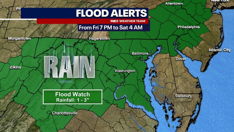
WASHINGTON - A Flood Watch is in effect across the Washington, D.C. area on Friday as showers and thunderstorms push through later tonight, bringing the risk of heavy rainfall and potential flooding.
Scattered showers and heavy fog dampened the early morning commute, but warm and humid conditions built throughout the day. Mostly cloudy conditions were present during the morning. Temperatures are expected to climb to near 80 degrees.
Flood Watch across DC region Friday evening as heavy rain, storms approach
Flood Watch begins Friday
What we know:
Heavy rain and thunderstorms are expected to develop by late afternoon and continue into the evening. The National Weather Service has issued a Flood Watch beginning at 7 p.m. for the District and areas along the I-95 corridor in central Maryland and northern Virginia. Some locations could see up to four inches of rainfall.
Heavy rain, storms expected
The NWS warns that excessive runoff could lead to flooding in rivers, creeks, streams, and other low-lying areas.
Isolated tornado risk
The isolated severe weather also brings the potential for damaging winds and large hail. The chance of a tornado is also possible.
Showers could linger into Saturday morning, with a chance of thunderstorms. Highs will be near 70 degrees. Sunshine returns Sunday, with temperatures climbing to the upper 80s by midweek.
Stay with the FOX 5 Weather Team for the latest forecast updates. The FOX LOCAL app is your source for live FOX 5 DC weather updates. Click here to download.
The Source: Information in this article comes from the FOX 5 Weather Team and the National Weather Service.