

DC region faces increased hurricane impact risk this season amid above-average forecast
WASHINGTON - With the hurricane season now underway, the National Oceanic and Atmospheric Administration (NOAA) is continuing the trend from last year by predicting another above-average Atlantic hurricane season.
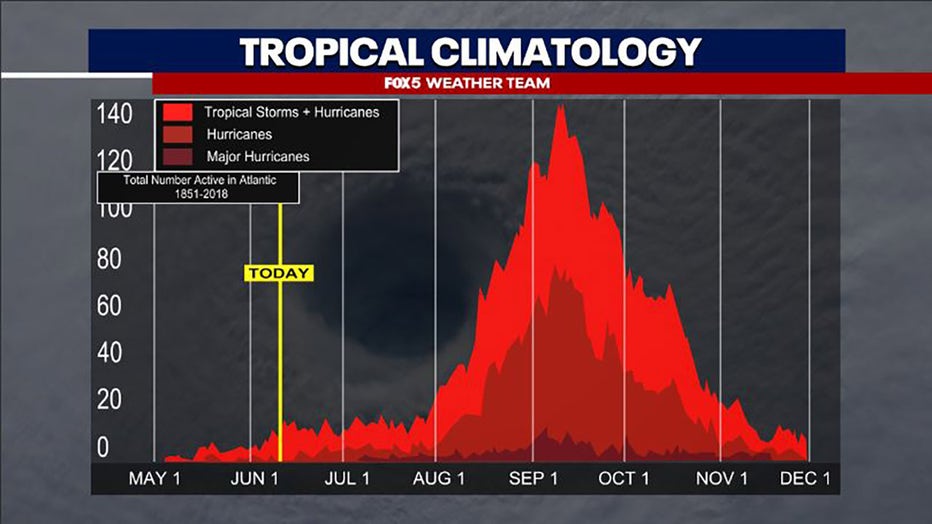
The official season started on June 1st and lasts all the way to November 30 with 97% of tropical cyclone activity occurring within this timeframe.
Currently, there is no activity forecasted in the Atlantic basin, but expect that to change as the statistical peak for hurricane season is September 10th.
DC region faces increased hurricane impact risk this season amid above-average forecast
2025 Atlantic Hurricane Predictions
The NOAA says we can expect this:
• 13 - 19 named storms
• 6 - 10 are predicted to be hurricanes
• 3 - 5 of those to be major hurricanes.
• We are expected to stay in a El Niño Southern Oscillation (ENSO) - neutral phase. Additionally, above-average sea surface temperatures in the Atlantic Basin, combined with forecasted weaker wind shear, will provide ideal conditions for storm development and intensification.
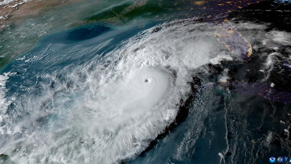
Image of Hurricane Milton from NOAA's GOES-16 satellite on Oct. 8, 2024. (Image credit: NOAA)
Forecasting changes
The NOAA is implementing several changes to the products they produce for hurricane prediction. Some of these include:
Extended lead time to advisories
For the first time, the NHC is now able to issue tropical advisories 72 hours in advance of potential impacts instead of the previous 48 hours.
DC region faces increased hurricane impact risk this season amid above-average forecast
Updated map symbols
Due to feedback from last year's experimental graphics, the NOAA is including a new visual indicator of diagonal pink and blue lines which will indicate areas under tropical storm warnings and hurricane watches.
Smaller forecast cone
Due to improved model accuracy, the average size of the tropical cyclone forecast cone has shrunk by about 3% to 5% from the previous year.

View from navigator's station aboard a NOAA hurricane hunter plane in the eye of Hurricane Milton. Taken approximately 10 a.m. E.T. on October 9, 2024. (Image credit: LT CMDR Andrew Utama/NOAA Corps)
National rip current risk map
Beginning this season, the NHC is launching a national rip current map displaying risks based off of local National Weather Service (NWS) offices.
Previous storms in the area
The last time we saw significant impacts in our area was Tropical Storm Ophelia in 2023, where we saw localized flooding, strong winds, power outages, and rainfall amounts of up to 3 inches.
It is still too early to see if we will face any impacts this season, but due to the above-average forecast, there is an increased risk of a storm having impacts in our area.
The Source: Information in this article comes from the FOX 5 Weather Team and the National Oceanic and Atmospheric Administration.