

DC Heat Wave: Tuesday to see triple digital temperatures as extreme heat continues

Peak of dangerous heat for Tuesday June 24
Tuesday is another day of high heat and humidity, with extreme temperatures.
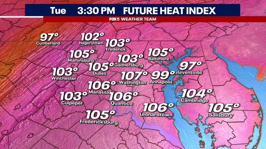
WASHINGTON - The dangerous heat gripping the D.C. region isn’t going anywhere just yet. Tuesday will bring another sweltering day, with temperatures climbing into the mid to upper 90s and heat index values expected to reach 100 to 110 degrees by the afternoon.
What we know:
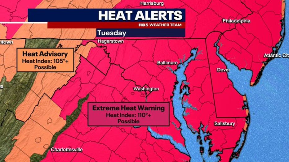
An Excessive Heat Warning remains in effect for much of the area as this prolonged stretch of extreme weather continues under a stubborn heat dome. The high-pressure system parked over the Mid-Atlantic is trapping heat and humidity, keeping conditions dangerously hot both day and night.
The biggest concern Tuesday will be the feels-like temperatures. The combination of intense sun, high humidity, and light winds means your body may struggle to cool down - increasing the risk for heat exhaustion or heat stroke, especially during peak afternoon hours.
Heat wave map
Big picture view:
What you need to know:
- Heat index values could reach 110°
- Excessive Heat Warning remains in place
- Limit time outdoors, especially during the afternoon
- Stay hydrated and check on vulnerable neighbors
- Cooling centers remain open in D.C., Maryland, and Virginia
When is the heat wave over?
What's next:
The heat is expected to ease slightly by the end of the week, but Tuesday will be one of the hottest days of this stretch. Keep up with the latest forecast on air and online — and stay cool, D.C.