

Winter's Revenge: Cold blast may bring quick end to peak bloom
Just when you thought it was safe to pack away the sweatpants and hoodies, winter is once again going to rear its ugly head as we head into the final weekend in March. Now to be completely fair, we have been pretty spoiled in our region this month. In fact, only six days this month came in with below normal temperatures. There have been 14 days over 60°, eight of those days have been over 70° – including one at 80°. With numbers like that, it is hard to believe that we also squeezed in about an inch of snow during the first half of the month as well.
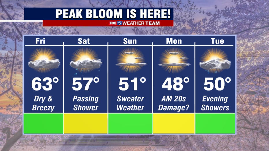
This time of year, it is all about the cherry blossoms, as well as any other plants and flowers that gardeners across our region are excited to get planted as we progress into spring. The biggest enemy to those plants though, a hard freeze. And unfortunately, that appears to be exactly what we could be in for as we head toward the end of the weekend. Now if you still want to go down and get a good view of the blossoms, both Friday and Saturday should offer decent viewing. Friday will feature some sunshine with a cool, gusty breeze kicking up from time to time. Saturday does bring the threat for some showers, but they should be the spotty, hit-and-miss spring variety showers. Nothing too crazy. Even Sunday should offer good, though chilly viewing, as temperatures will only peak near 50°, though there should be a good amount of sun through the afternoon.
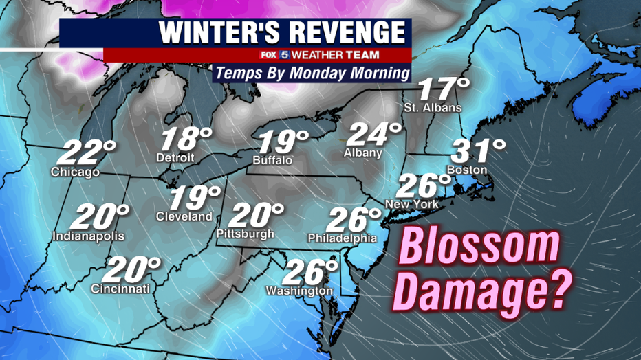
The real concern comes in Sunday night into Monday morning, as a freshly-cold air mass spills down out of Canada. Clear skies and light winds overnight will plunge much of our region – the Midwest,and Northeast – back to winter levels of cold. By sunrise on Monday, widespread 20s are expected with some of our northwest zones spilling into the upper teens. The National Park Service has told us that the magic number for the Cherry Blossoms is 27° and that even a few hours in the morning under this number could cause enough damage to bring peak bloom to a faster end.
A possible break for the flowers though may be their vicinity to the Tidal Basin itself. The water usually keeps air temperatures in the immediate vicinity 2-4° above the land-locked regions in the area, so there is still a chance the blossoms could escape major damage if temperatures remain marginal.
While Monday will be a nice looking day, it will not be the best feeling as highs for many will remain in the 40s. We will then have to watch Tuesday morning for more 20s to start the day as well.
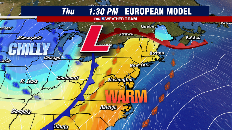
As we look into the extended pattern, the middle of next week should feature a brief but nice warm up. Early projections suggest 60s return by Wednesday with 70s possible on Thursday and Friday. The warmth will be what we refer to as "storm-driven" warmth, however, which is where a strong storm system pushes north through the middle of the country, dragging warm air up on its eastern flank. This storm system is expected to be another active severe weather maker, with the potential for another tornado outbreak across hard-hit regions of the south by the middle of next week. Even our area will have to be on guard in the Thursday-Friday time frame of next week for the potential of some stronger thunderstorms.
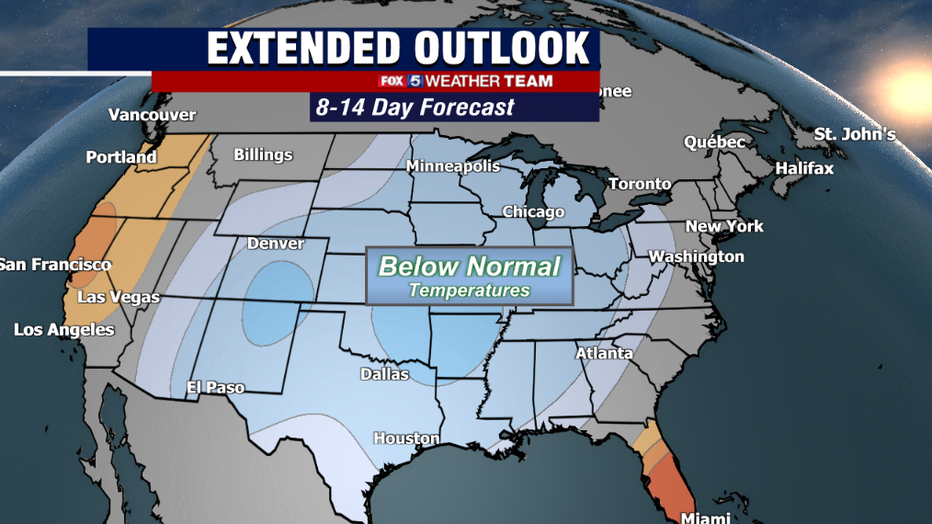
By the end of next week, as that storm passes by, another seasonally chilly pattern is expected to settle into the eastern two-thirds of the country as we head towards early April. At this time that is not expected to be as extreme as the one this weekend. Planters though should still keep their guard up. Historically, the average final freeze of the year does not occur in our region until early April. Even later for those in our northwest suburbs. So even with all the warmth we have had in the past few weeks, it might not be completely safe to break out those gardening tools just yet!