

Wind Advisory issued for much of DC region until Monday evening
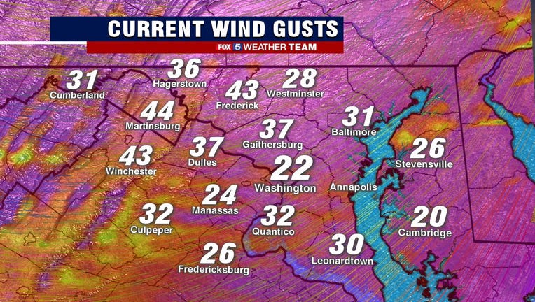
WASHINGTON (FOX 5 DC) - Severe weather that moved across the area Monday placed much of the D.C. region under a Tornado Watch and briefly triggered a Tornado Warning for parts of the area. Now, a Wind Advisory is in effect until 6 p.m.
FOX 5’s Tucker Barnes and Mike Thomas say several other areas were placed under a Tornado Warning briefly Monday afternoon as the severe weather system moved across the region. There were reports of potential tornadoes in the areas of Howard County and Prince William County. No confirmed tornadoes have been reported at this time.
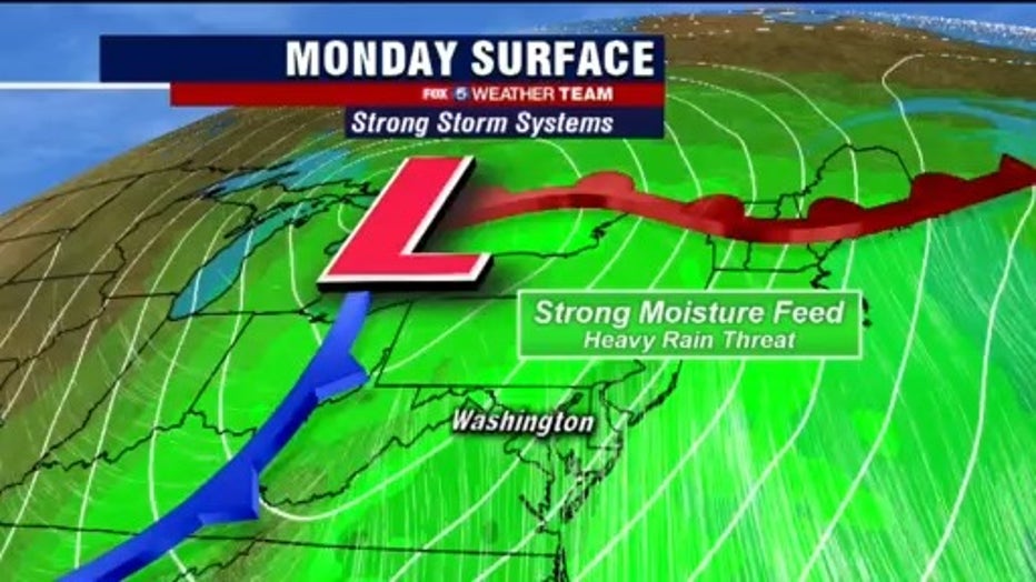
Strong storms and gusty winds slowly moved through the D.C. region Monday morning bringing heavy rain and flooding concers.

FOX 5 Weather forecast for Monday, April 13
Mike Thomas has the FOX 5 Weather forecast for Monday, April 13.
Download the FOX 5 Weather App
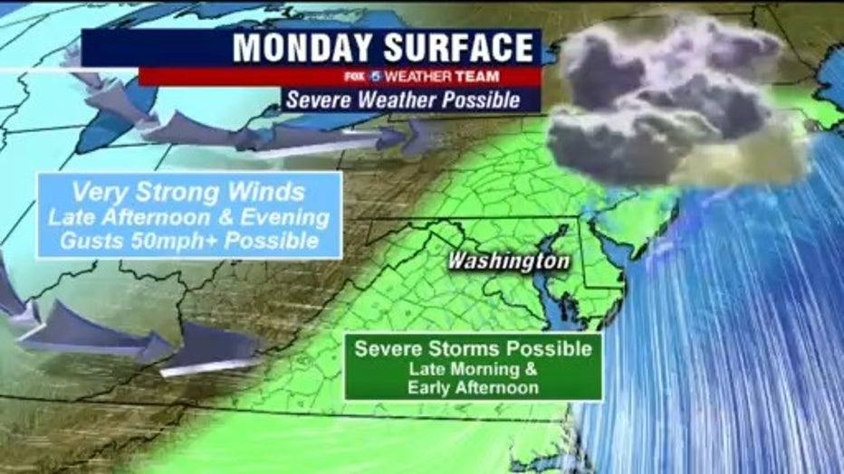
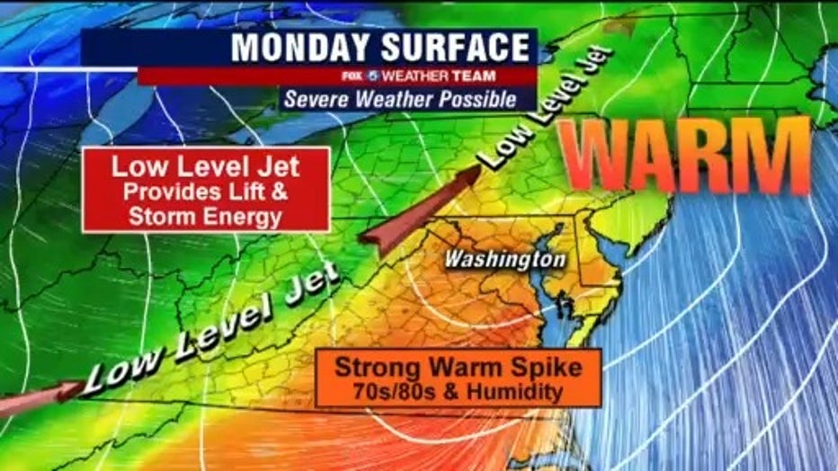
The "severe weather window" will continue to remain a threat with potential for heavy rain, severe storms and gusty winds. Wind gusts could reach anywhere between 40 and 60 mph this evening.
Because of the gusty winds we could see areas of wind rotation this afternoon which could lead to the potential for additional isolated tornado threats.

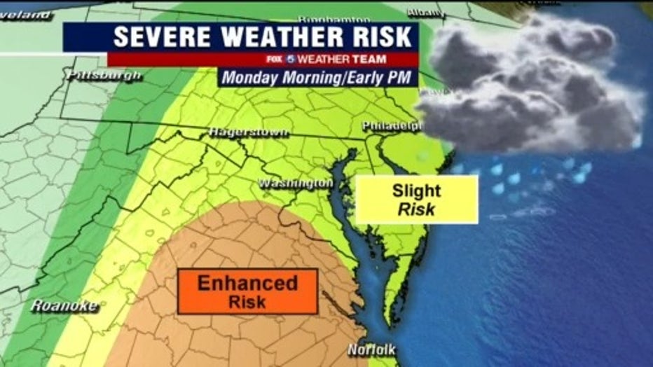
Strong storms, gusty winds expected across parts of DC region Monday
Strong storms and gusty winds are expected Monday as a slight risk for severe weather is expected across parts of the D.C. region.
We can expect weather to clear into the evening hours. Highs on Monday will be near 79 degrees.
Stay with FOX 5 on the app and online for weather updates:
Get the latest FOX 5 forecast here.
Check the latest Closings and Delays
Download the FOX 5 DC News App for Local Breaking News and Weather
Download the FOX 5 Weather App
Check the latest weather radars
Stay up to date with the FOX 5 Weather Team on Twitter: