

Washington DC extreme heat wave prompts Fourth of July weather warnings
Washington DC extreme heat wave prompts Fourth of July weather warnings
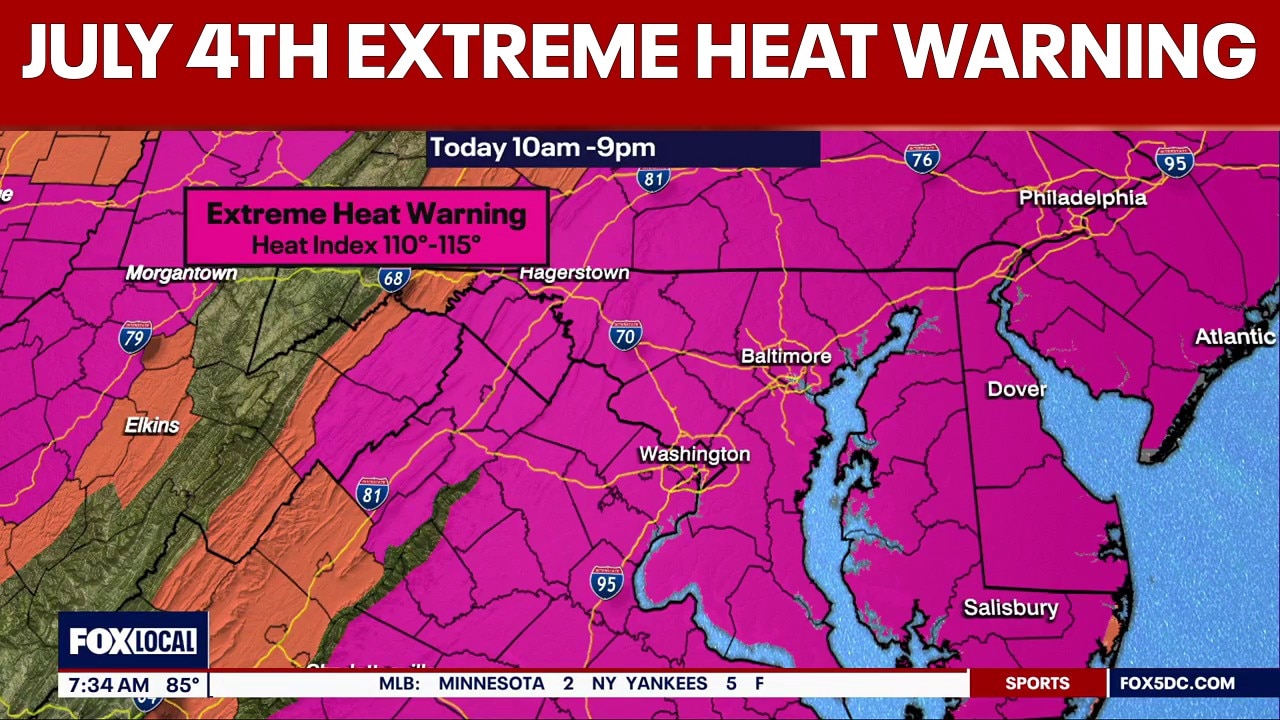
An Extreme Heat Warning remains in effect from 10 a.m. Saturday through 9 p.m. this evening, with dangerously hot conditions expected across the region. FOX 5's Tucker Barnes says heat index values could reach 110 to 115. The warning covers Washington, D.C., along with portions of central, north‑central, northeast, northern and southern Maryland, and central, northern and northwest Virginia.
WASHINGTON - An Extreme Heat Warning remains in effect from 10 a.m. Saturday through 9 p.m. this evening, with dangerously hot conditions expected across the region.
FOX 5's Tucker Barnes says heat index values could reach 110 to 115.
The warning covers Washington, D.C., along with portions of central, north‑central, northeast, northern and southern Maryland, and central, northern and northwest Virginia.
Organizers canceled the National Independence Day Parade in D.C. because of the extreme heat and delayed public entry for the Salute to America program on the National Mall until 5 p.m.
Cities and towns across the region have postponed or pushed back parade and fireworks start times due to the dangerous conditions. We’re updating a live list of those impacts here.
On Friday afternoon, the Great American State Fair on the National Mall closed around 1 p.m. and reopened at 5 p.m. as temperatures eased.
Fourth of July Heat & Storms Timing
Morning (through noon)
Hot and increasingly cloudy; heat index already climbing.
Afternoon (noon–5 p.m.)
Heat peaks near 100°; heat index up to 110. Storm chances remain low but begin to build.
After 5 p.m.
Showers and thunderstorms likely; some could be severe.
Early evening (6–9 p.m.)
Storm coverage increases; lightning risk may impact outdoor events and fireworks staging.
Late evening (9 p.m.–midnight)
Storms remain possible; heavy downpours and strong gusts in any severe cells.
Before 2 a.m.
Showers and thunderstorms likely; isolated severe storms still possible.
After 2 a.m.
Isolated showers linger as storms weaken.
Overnight lows
Around 75° with mostly cloudy skies.

Washington DC extreme heat wave prompts Fourth of July weather warnings
The Source: Information in this article comes from the FOX 5 Weather Team and the National Weather Service.