

Super El Niño on the way: What it means for DC weather
Super El Niño on the way: What it means for DC weather
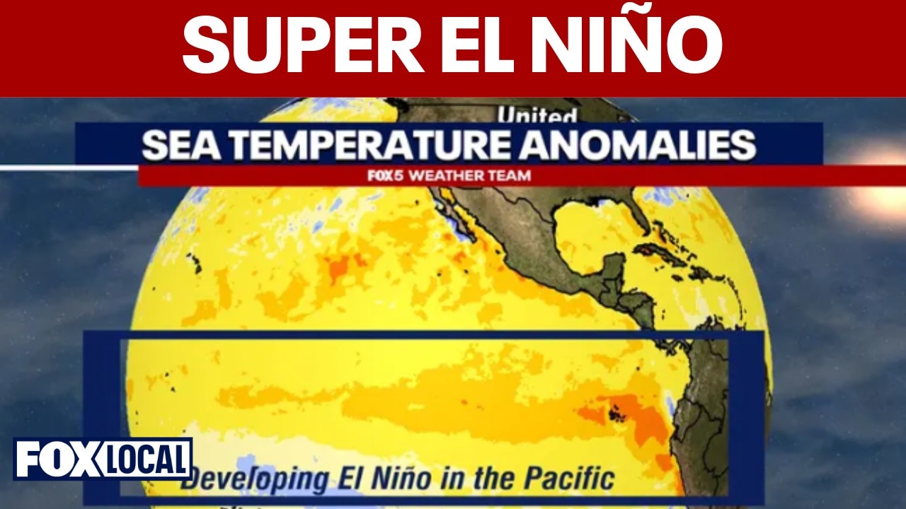
A potentially powerful, so called "super" El Niño is rapidly developing in the Pacific Ocean as we continue our journey through the spring months. Most forecast models from major climate centers are increasingly suggesting that the event could rival or even exceed some of the strongest recorded El Niño episodes seen in 1982-83, 1997-98 and 2015-16.
WASHINGTON - A potentially powerful, so called "super" El Niño is rapidly developing in the Pacific Ocean as we continue our journey through the spring months. Most forecast models from major climate centers are increasingly suggesting that the event could rival or even exceed some of the strongest recorded El Niño episodes seen in 1982-83, 1997-98, and 2015-16.
There has even been chatter that it could rival the "Super El Niño of 1877", which many scientists believe based on computer simulations of reanalysis data may have been the strongest in recent history, though limited data from this time does provide some skepticism. What is known is that the period coincided with some of the worst droughts in recorded history for parts of Asia and South America. The "Great Famine of 1876-78" in India, the "Great Drought of 1877-79" in Brazil, and the "Great Drought of 1876-78" in China were all blamed primarily on this super El Niño event, along with poor crop management and detrimental crop export political policies. The combined impacts are estimated to have led to the deaths of 30-60 million people.

The impacts of an El Niño event are different throughout the world, as the above Columbia University/NOAA graphic shows.
In North America, a super strong El Niño tends to have significantly different impacts, though still vastly different from what would be considered an "average" year. During the 1877 El Niño event, the western United States (particularly California) dealt with some extreme rainfall events. The southern United States dealt with periods of intense rainfall as well. Locally here in the Washington, DC region, this El Niño coincided with "The Great Flood of 1877" where, following 3-5 days of near constant and at times heavy rainfall, the Potomac, Antietam, and the Conococheague rivers rose to extreme levels, causing major damage to bridges an infrastructure particularly with the C&O Canal and the areas around Martinsburg, WV and Cumberland, MD.
Most notable were the impacts during the winter months. The North American winter of 1877-78 was referred to as "The Year Without a Winter" by many of the era. It stood as the warmest winter in Minnesota history for over a century until it was just recently surpassed by the winter of 2023-24. In DC, the temperature impacts were not as noticeable. That winter, DC’s recorded average temperature for the season was 38.7°. While that is high enough to place it in the warmest third of winters in DC’s 154 year history that we have reliable data for, it’s near the bottom of that list. Snowfall wise, there were no official measurements taken during that winter, though newspapers at the time did not report any significant snowfall events during the winter, though some made note that it was more rainy than snowy in the Mid-Atlantic region.
For the Washington region and the broader Mid-Atlantic, El Niño can dramatically reshape weather patterns for months. The most recent super El Niño of 2015-16 actually began in October of 2014, and did not dissipate until May of 2016. While every event behaves differently, stronger El Niño episodes tend to influence the jet stream, storm tracks, and temperatures, across the eastern United States.
So what could that mean for D.C. this summer, fall, hurricane season...and eventually next winter?
Summer 2026: Wetter, steamier, and more stormy?

NOAA’s Climate Forecast System showing an intense, strong El Niño in the Pacific Ocean by August 2026. Source: NOAA
El Niño’s influence on Mid-Atlantic summers is usually weaker than its winter signature, but a strengthening event can still alter the atmosphere in important ways.
This summer, the biggest signal may be increased humidity and a more active subtropical jet stream over the southern and eastern United States. That could translate into more frequent rounds of thunderstorms across the Mid-Atlantic, especially later in July and August as the El Niño intensifies.
For DC, this could mean...
• More humid air masses lingering for longer stretches
• Warmer nights as temperatures struggle to cool
• Active pattern, with more chances for showers/thunderstorms
• More moisture heavy storms/rainfall and increase risk for flash-flooding
Much of the DC region has been dealing with severe drought conditions, so an active thunderstorm pattern could begin to chip away at rainfall deficits. However, summer rainfall tends to be uneven. One suburb could receive three inches of rain while another gets almost nothing. That is just the general nature of summer thunderstorm activity.
One positive impact is that El Niño summers do tend to produce fewer extreme heat domes than what’s often seen during La Niña. Temperatures may still run above average overall, particularly due to high humidity keeping low temperatures at night elevated, but this same humidity does tend to keep temperatures from rising to the extreme levels (100°F+ days) seen during the intense La Niña summers of 2011 and 2012.
That said, stronger El Niño years sometimes create volatile contrasts: humid tropical air colliding with occasional intrusions of cooler air aloft. That combination can fuel severe thunderstorms with damaging winds and torrential rain.
Atlantic Hurricane Season: Fewer storms, but bigger East Coast risks

While NOAA’s Offical Hurricane Forecast does not release until May 21st, most hurricane outlooks from other establishments including Colorado State University (CSU) are pointing towards below normal activity this hurricane season.
One of El Niño’s clearest impacts is on the Atlantic hurricane season.
Strong El Niño events typically increase upper-level winds across the tropical Atlantic, what we call vertical wind shear. That hostile environment tears apart developing tropical systems and usually suppresses the total number of hurricanes. This means the Atlantic basin could see fewer named storms overall and reduced major hurricane activity compared to other recent seasons. However, that does not eliminate East Coast risk.
Historically, some El Niño years still produced major Mid-Atlantic impacts because storm tracks can curve northward along the East Coast. Even a quieter hurricane season only takes one storm to create disaster. Additionally, warmer Atlantic Ocean temperatures may partially offset some of El Niño’s suppressing effects this year. So that will be something that forecasters carefully monitor.
What it could mean for our drought

The Drought Monitor for our region as of early May 2026, showing most of our region in a severe drought.
The Mid-Atlantic drought situation may improve gradually if El Niño driven storm tracks become more active by late summer and autumn. Historically, stronger El Niño patterns increase precipitation across much of the southern and eastern United States during the cooler half of the year, fall and winter.
But drought recovery is rarely immediate. Long-term deficits often require multiple wet seasons to fully erase. Our region is likely to hold on to at least some level of drought through most of the summer, unless a tropical remnant is able to provide a dose of widespread heavy rainfall this summer.
Fall 2026: A more active storm pattern may develop

NOAA has an 80% chance of El Niño conditions by the summer months, rising to a greater than 90% chance by the fall. Source: NOAA
By autumn, El Niño’s influence on North American weather usually strengthens considerably. For the Mid-Atlantic, that often means more frequent coastal storm systems and above-average precipitation. Temperatures also tend to stay on the milder side, most notably in overnight low temperatures.
The fall could become notably wetter than normal across the DC region and much of the Interstate 95 corridor. Autumn may stay relatively mild deep into November because polar air masses often struggle to establish themselves in the eastern United States during strengthening El Niño years. So the onset of winter will likely be delayed compared to last year, for example.
Winter 2026-27: Could the Mid-Atlantic get a classic El Niño winter?
The winter pattern during an average El Niño event, though stronger El Niño cases are noted to come with much milder conditions for most of the country with a much stronger tropical jetstream.
The winter is where things get especially interesting. Historically, strong El Niño winters often bring a more active southern storm track, resulting in wetter conditions across the Southeast and Mid-Atlantic as well as milder than normal temperatures overall. While the jetstream pattern is generally much more favorable for coastal storms and nor’easters, this does not mean that these coastal systems are producing snowfall for the DC region.
For winter, if we look at the other three major El Niño events of the last 75 years that we do have reliable data for, there are some interesting results.
• Super El Niño of 1982-83

Snowfall during the February Blizzard of 1983. Source: NOAA
The winter of 1982-83 was extremely active and stormy along the East Coast. Many areas saw major coastal storms and above-average precipitation. For the Mid-Atlantic, the season was generally mild overall but featured dramatic storm systems and periods of heavy snow where cold air aligned properly. In DC, it was a top 25 warmest winter historically, but also featured the Blizzard of February 1983 which dropped nearly 17" of snow on Washington, DC. The winter finished with 27.6" of snowfall for DC.
• Super El Niño of 1997-98

Satellite data showing the super El Niño event in December of 1997. Source: NASA
The 1997-98 super El Niño became one of the warmest winters on record across much of the eastern United States. Washington saw plenty of rain and storminess, but sustained cold was lacking. It currently stands as the 10th warmest winter in DC history, and is tied with the winter of 1972-73 as the least snowy winter on record with just 0.1" of snow for the entire season.
• Super El Niño of 2015-16

Snowfall data from the Blizzard of January 2016. Source: NOAA
The 2015-16 event produced one of the most fascinating Mid-Atlantic winters ever. Overall temperatures were very warm nationally, but the East Coast still experienced blockbuster snowstorms, including one of the strongest blizzards in our region’s history in January of 2016. The storm dropped nearly 18" on Washington, DC (the fourth largest on record) while it buried Baltimore in 29.2" of snow (their largest on record. In DC, the winter wrapped up with a total of 22.2" of snowfall...despite being the 12th warmest winter on record.
So, what could happen next winter?
Looking at these more recent "super El Niño" events, and I’ll even include the 1877-78 event since it was talked about earlier, the screaming message that they all do share is one word: mild. So, there is a high likelihood that we are looking at an unusually warm winter coming up for 2026-27.
Now, that being said, half of these cases do still have major snowfalls. So, another message that a super El Niño does send us is a word of caution...that warm overall winter pattern does not prevent major snowstorms if the storm track aligns correctly with a burst of cold. In fact, they may even increase the likelihood as while the so called "window" for a blizzard to occur may be smaller, if one does occur, due to the more moisture rich atmosphere that a super El Niño creates, the odds for a more historic and memorable snow event do go up. So, it is likely to be a boom-or-bust type winter ahead regarding snowfall, either picking up a lot from maybe one or two snow events, or very little at all for the whole winter.
So, if indeed the developing event truly reaches "super" status, several themes may emerge during winter 2026-27...more coastal storms and wetter than average conditions, though matched with a milder than average temperatures, expect that the majority of precipitation events next winter will more than likely be rainfall as opposed to snowfall makers. That being said, all it takes is one high moisture storm coming up the coastline at the same time as an injection of cold Canadian air to make a historical snowstorm. That potential is not off the table.
The Bottom Line

The most recent Super El Niño of 2015-2016, the strongest in recorded history for which reliable weather data exists, could offer a very similar analog to what the upcoming fall and winter potential could be. Source: NOAA
A developing super El Niño could reshape weather patterns across the Mid-Atlantic for the next year. For the DC region, the most likely impacts would be...
• A stormier and more humid late summer
• Wetter conditions during fall
• Gradual drought improvement
• A somewhat quieter Atlantic hurricane season overall
• An active, but milder winter with heightened nor’easter potential
We will be monitoring this developing El Niño throughout the upcoming summer of course, and continue to keep you updated on it’s likely impacts to our region throughout the year ahead!
The Source: Information in this article comes from the FOX 5 Weather Team and the National Weather Service.