DC weather: Severe storms move across region Friday; Storms to clear out for Memorial Day weekend
Morning storms prompted multiple tornado warnings across the DMV, with quick-forming areas of rotation that may or may not have produced touchdowns. Damage was reported near Dulles, and a possible tornado also potentially occurred near South Gate south of Glen Burnie. Very strong rotation was seen on the Baltimore airport's radar.
Download the FOX 5 Weather App
There was a confirmed significant tornado in southern Virginia in Goode in Bedford County, with at least 20 homes damaged and multiple destroyed. Local police reported "catastrophic" damage.
Storms exited the coast shortly after 1 p.m., and clearing will ensue thereafter. That will be "self destruct" sunshine, however — it'll heat the ground and destabilize the atmosphere ahead of a cold front once again. We still have strong jet stream winds aloft, and a change of wind speed/direction with height, known as wind shear, will foster rotation within storms. Tornado activity will again be possible between 4 p.m. and 9 p.m.
We also have a flood watch up for the Interstate 81 corridor west of town, since training storms — those which move over the same areas repeatedly — could yield multiple rounds of heavy downpours.
The action finally draws to a close late tonight.
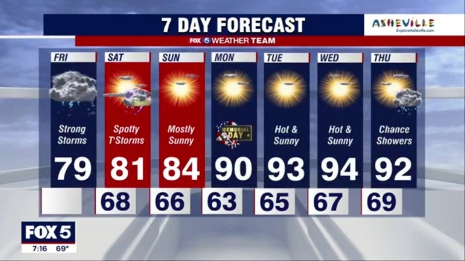
Tomorrow we'll see mostly sunny skies and highs around 80, with an isolated afternoon shower thanks to cold air aloft left behind by our parent upper-level low.
Sunday we'll see sunshine and mid 80s, with upper 80s to near 90 for Memorial Day Monday.
Stay with FOX 5 on the app and online for weather updates:
Get the latest FOX 5 forecast here.
Check the latest Closings and Delays
Download the FOX 5 DC News App for Local Breaking News and Weather
Download the FOX 5 Weather App
Check the latest weather radars
Stay up to date with the FOX 5 Weather Team on Twitter: