

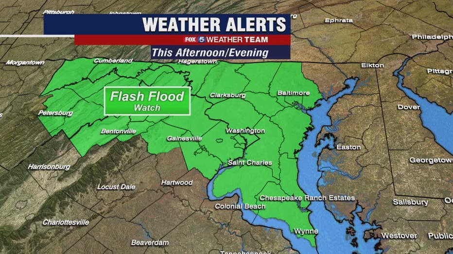
More showers, thunderstorms expected Thursday; Flash Flood Watch this afternoon and evening
WASHINGTON - We know the gloom, tropical humidity and scattered daily downpours are getting "old" but hang in there -- the forecast improves this weekend!
Download the FOX 5 Weather App
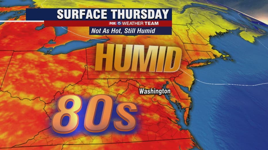
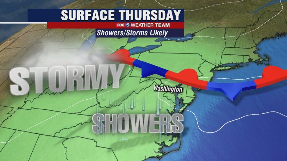
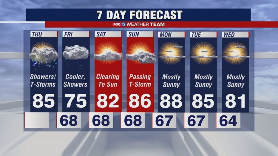
FOX 5's Sue Palka says we have a trigger for more widespread showers and scattered storms today as a cool front passes through the region. The threat will be for heavy rain as there is plenty of moisture available. Temperatures will mostly be in the mid-80s.

FOX 5 Weather forecast for Thursday, June 10
Mike Thomas has the FOX 5 Weather forecast for Thursday, June 10
We are significantly cooler on Friday as the cool front will be stalling a bit south of the metro area. Temperatures will range from the upper-60s to low-70s which may be a bit of a shock to the system but should feel better if the heat wore you out.
It's still humid and yes we still have showers in the forecast on Friday but since the atmosphere will be cooler and more stable we don't expect thunderstorms.
Finally, Saturday looks sunny and dry in the low-80s!
Stay with FOX 5 on the app and online for weather updates:
Get the latest FOX 5 forecast here.
Check the latest Closings and Delays
Download the FOX 5 DC News App for Local Breaking News and Weather
Download the FOX 5 Weather App
Check the latest weather radars
Stay up to date with the FOX 5 Weather Team on Twitter: