

WINTER WEATHER PREDICTION: MLK Jr. weekend could see snowfall

FOX 5 Weather forecast for Wednesday, January 12
Mike Thomas has the FOX 5 Weather forecast for Wednesday, January 12
WASHINGTON - Following up our snowiest week in three years here in DC, which saw DC pick up 9.5 inches of snowfall, the weather team once again has their eyes on a potential winter storm taking aim at our region for the upcoming Martin Luther King Jr. holiday weekend ahead.
A word of caution that this is a forecast that is for five days in the future, and things like storm tracks and exact amounts are still likely to change as we get closer to the event. But here is how things are shaping up as things stand at the moment.

Snow possible later in the week
Following up our snowiest week in three years here in DC, which saw DC pick up 9.5 inches of snowfall, the weather team once again has their eyes on a potential winter storm taking aim at our region for the upcoming Martin Luther King Jr. holiday weekend ahead.
Download the FOX 5 Weather App
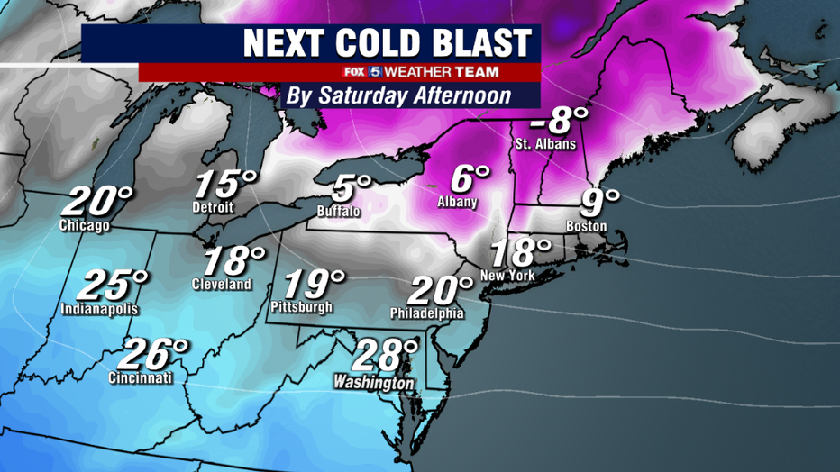
It all begins on Friday, when another arctic front will cross our region. This will plummet our temperatures Friday night into Saturday, and much of the region is unlikely to get out of the 20s on Saturday afternoon. This would be one of the stronger cold air outbreak of the winter so far.
Cold and dry air is, relatively in the atmosphere, very heavy and can be slow to move out. Meaning the cold will likely linger as we shift into the day on Sunday as well.
Get the latest FOX 5 forecast here.
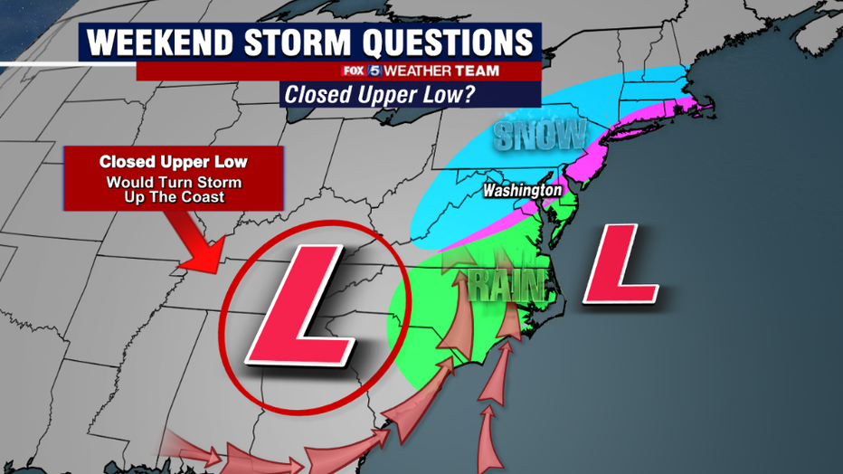
At the same time, a piece of upper atmospheric energy will dive through the Plains and into the Deep South. This energy will trigger a storm over the southeastern United States during the second half of the weekend. The question then becomes a relatively simple one, will the storm turn up the coastline and become a nor'easter?
Or will the storm get pushed out to sea pretty harmlessly to our south, while our region stays cold and dry. It is this question that our various weather models are battling with at this time.
We have two major weather models that we use in the extended range, the American and the European. They are certainly the two you hear about the most whenever a storm is in the forecast. The American model did exceptionally well with the storm last Monday, as it was the first to capture that we would be seeing some heavy snows across the region.
This time around, the American once again remains the snowier solution. As this time, it is calling for a much stronger piece of upper level energy to dive into the south and strengthen, a feature known as an upper level low. This feature allows the storm to turn to the north up the coastline, bringing heavy snows to portions of the Northeast & Mid-Atlantic.
It was this very feature that caused the intensification of the storm last Monday, where parts of our region got 10-15 inches of snow.
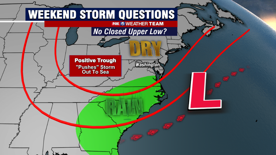
The second option is that the energy that dives down through the Plains is not nearly as intense. This was the solution from this morning's European model. This would overall lead to a weaker storm, and would arrange the pattern in such a way that the storm would take what we call a "suppressed" track, where it gets pushes out to sea to our south and east.
The result would be a drier end to the weekend, and a chilly, but sunny Martin Luther King Jr. Holiday Monday.
Obviously these are two very extreme solutions, and it is honestly anyone's best guess at which will be correct at this moment. All we can do at this stage is monitor the guidance, and alert when things become more consistent one way or the other.
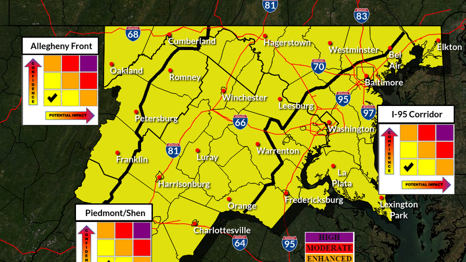
The National Weather Service did go ahead and place our region at a "slight risk" for a winder storm this weekend, just to make sure that forecasters are monitoring this time period. If the storm does end up turning north up the coastline, then this storm will have the potential to be a significant snowmaker for our region, so we will have a very close watch on it in the days ahead. We will continue to bring you update throughout the week!
Stay up to date with the FOX 5 Weather Team on Twitter: