

Hot and humid Monday as heat wave returns; heat index values from 100 to 110 degrees
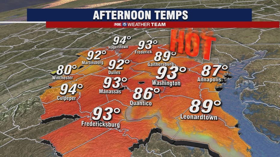
WASHINGTON - It will be oppressive heat Monday as temps climb to the mid-90s under mostly sunny skies.
Download the FOX 5 Weather App
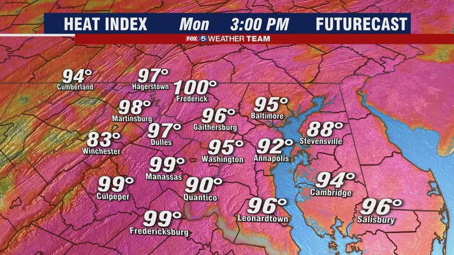
We start the day with very warm conditions and the humidity will not give us a break at all throughout the afternoon or evening. Dew point values in the low-70s will make it "feel like" it's in the upper-90s to 1100 degrees.

FOX 5 Weather forecast for Monday, June 28
Mike Thomas has the FOX 5 Weather forecast for Monday, June 28
Some spotty storms and showers are possible to the west, primarily over the Blue Ridge. A stray late afternoon spotty shower may move East over Intersetate-95 but nothing much is expected.
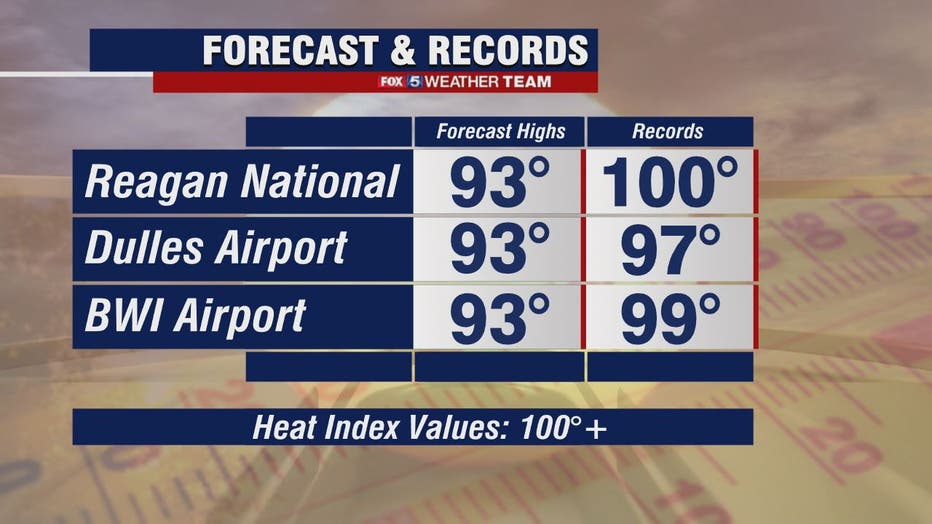
Temperatures on Tuesday will be high again and conditions may possibly prompt a Heat Advisory to be issued -- still a "wait and see".
Wednesday through the end of the week is when storm chances begin with a chance of some stronger storms and heavy rain by Thursday with an unsettled pattern through the end of the week.
Stay with FOX 5 on the app and online for weather updates:
Get the latest FOX 5 forecast here.
Check the latest Closings and Delays
Download the FOX 5 DC News App for Local Breaking News and Weather
Download the FOX 5 Weather App
Check the latest weather radars
Stay up to date with the FOX 5 Weather Team on Twitter: