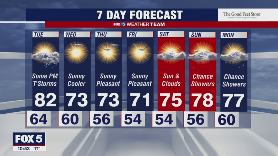
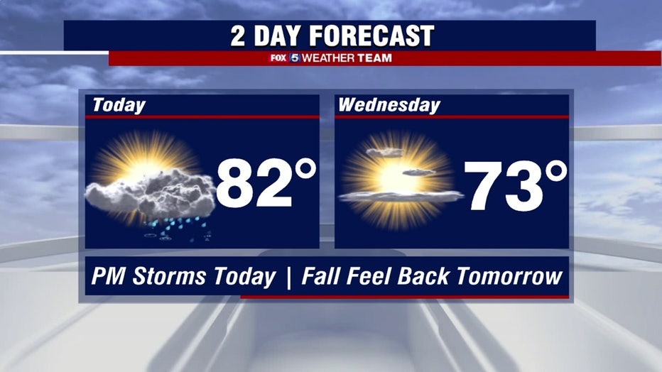
Highs in the 80s Tuesday; afternoon thunderstorms possible for parts of DC region
(FOX 5 DC) - Today is our last day this week near or above 80 degrees. A cold front will cross the area later today and by Wednesday we’re in the low 70s.
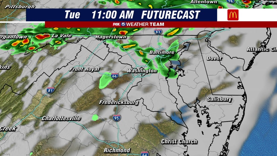
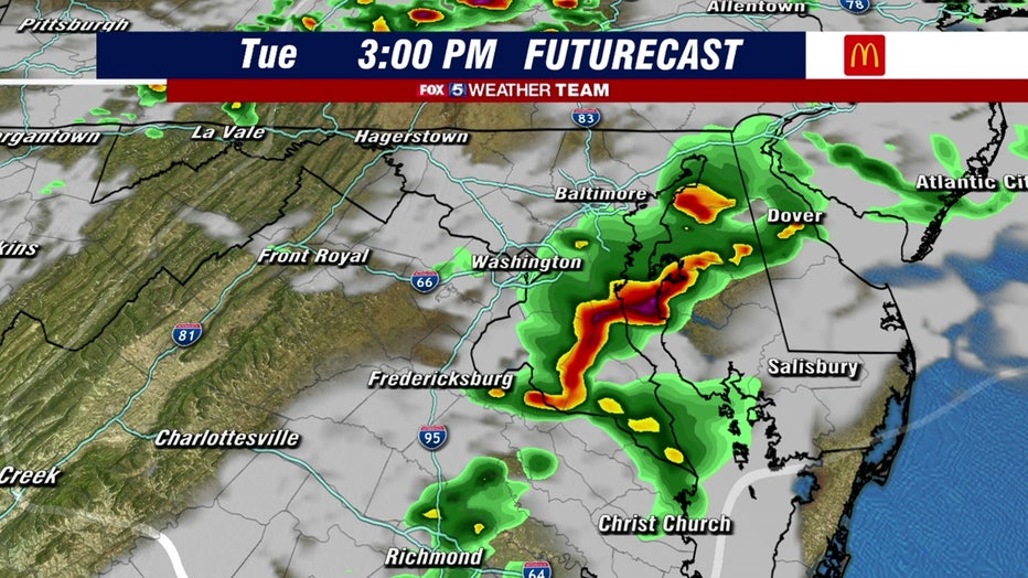
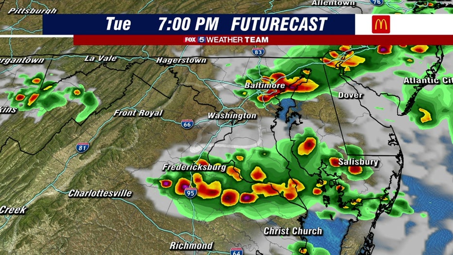
That same front may touch off some scattered showers this morning and a better chance of stronger storms this afternoon and evening.

FOX 5 Weather forecast for Tuesday, September 28
Tucker Barnes has the FOX 5 Weather forecast for Tuesday, September 28

FOX 5 Weather forecast for Tuesday, September 28
Mike Thomas has the FOX 5 Weather forecast for Tuesday, September 28
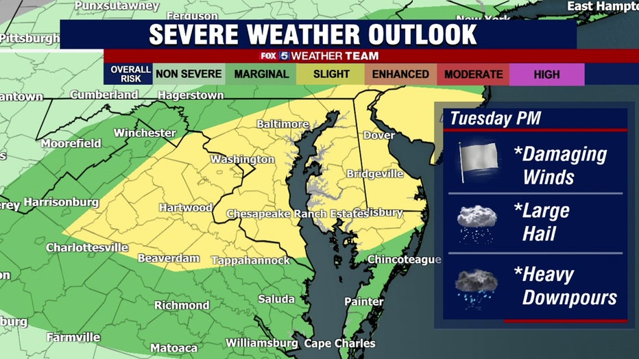
The Storm Prediction Center has outlooked our region for the marginal risk of severe storms. The threats would be damaging wind gusts, possible hail, and heavy rain. Watch for these stronger storms anytime after 3 p.m., and they may tend to favor areas south and east of DC.
Skies clear after midnight and a sunny, comfortable stretch of Autumn days await.