

LIVE | Winter Storm Warnings: How much is it going to snow in DC, Maryland, Virginia?
Winter storm winds down in DC area as blizzard conditions intensify to the north
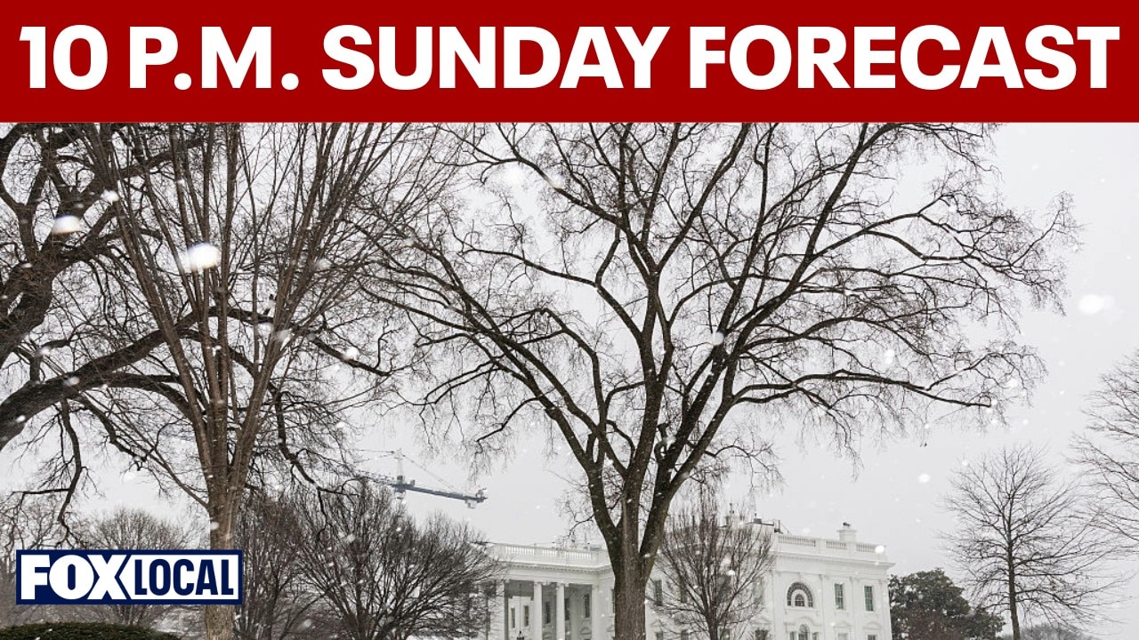
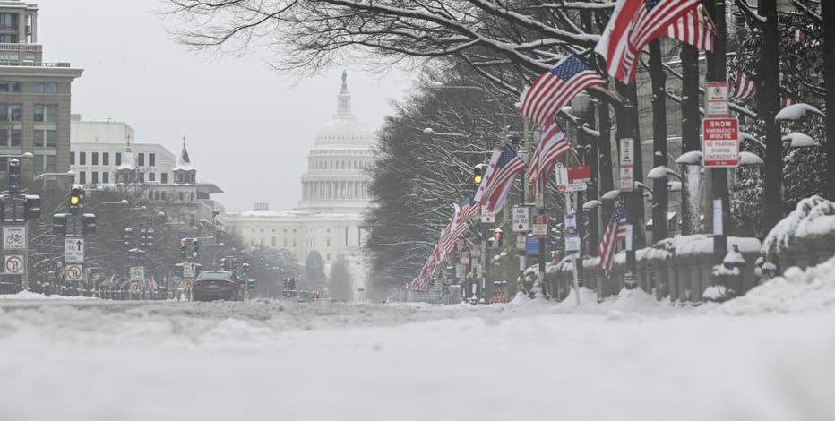
Winter storm warnings were scaled back in parts of the Baltimore metro area as snowfall totals came in lower than expected, but steady snow continues across Washington, DC. Gusty winds up to 40 mph and reduced visibility remain concerns, with up to a few more inches possible before the storm exits early Monday.
WASHINGTON, D.C. - The National Weather Service has issued Winter Storm Warnings for portions of the DC metro region as confidence increases that accumulating snow will impact the area late Sunday into Monday.
Warnings in effect

The National Weather Service has issued Winter Storm Warnings for the following areas:
- Frederick County, Md.
- Montgomery County, Md.
- Calvert County, Md.
- St. Mary’s County, Md.
- Anne Arundel County, Md.
- Loudoun County, Va.
Some surrounding counties remain under a Winter Storm Watch, meaning confidence in exact snowfall totals is still evolving there.
A Winter Storm Warning means significant accumulating snow is expected, and hazardous travel conditions are likely.
Maryland State of Preparedness
Late Saturday night, Maryland Gov. Wes Moore declared a State of Preparedness ahead of the storm.
"In declaring a State of Preparedness for Maryland, I am directing the Department of Emergency Management to coordinate readiness efforts across state government in advance of the incoming winter storm," Moore said. "The safety of Maryland families comes first. I am urging residents to prepare early, stay informed, and adjust plans, including postponing travel, as conditions change."
DC weather: Several inches of snow come Sunday
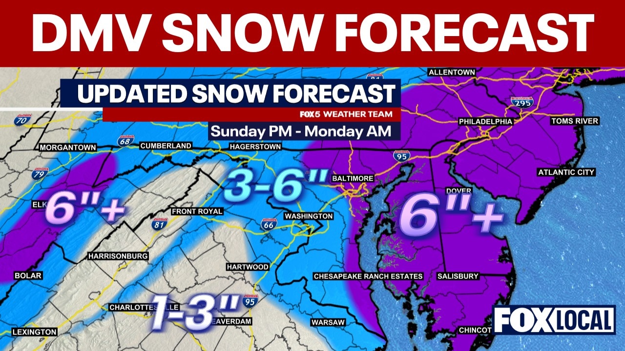
Most of the DMV is expected to see between three and six inches of snow starting, with some areas in the mountains and further east seeing more.
What we know:
A coastal storm is expected to move up the East Coast Sunday, bringing precipitation to the Mid-Atlantic.
Rain to snow transition
- Precipitation is expected to begin as rain overnight Saturday, becoming a rain/snow mix by Sunday morning.
- Temperatures will initially be above freezing across much of the region.
- Rain is expected to change to snow Sunday evening as colder air moves in from the northwest.
- The snow will accumulate the most overnight Sunday into Monday.
Little accumulation is expected during the first half of Sunday due to warm ground temperatures.
Snow totals
Current projections suggest:
- Washington, D.C.: Around 3–6 inches possible under the most likely scenario.
- Northern Maryland: Higher totals possible, especially north and east of the metro area.
- Northern Virginia: 3–6 inches possible, with lower totals farther south and west.
- Eastern Shore: Snow more likely, though totals vary based on track.
Snowfall is expected to accumulate mainly Sunday night through early Monday.

Wind and additional impacts
Northeast winds will increase Sunday evening into Monday.
- Inland wind gusts up to 30–40 mph are possible.
- Higher gusts are possible near the Chesapeake Bay and open water.
Blowing snow and reduced visibility could create hazardous driving conditions during peak snowfall.
Virginia impacts
Across Virginia, the highest snow probabilities are focused east-central portions of the state, including:
- Northern Neck
- Eastern Shore
Accumulations of 2–6 inches are possible in these areas.
Farther south and west across central Virginia, lower totals are expected, with some areas seeing a dusting to 2 inches depending on how quickly rain changes to snow.
Gale Watches have been issued for the Chesapeake Bay and nearshore coastal waters Sunday evening through early Monday afternoon, with northerly winds increasing to 25–35 knots and gusts up to 40–45 knots.
Maryland impacts
Across Maryland:
- The Eastern Shore has the highest likelihood of accumulating snow.
- Areas north and east of D.C. have a better chance of higher totals.
- Western Maryland could see some snow but may miss the heaviest bands.
Winter Storm Watches have been issued for parts of the region where five inches or more of snow is possible.
Minor tidal flooding is possible late Sunday night into early Monday along portions of the Maryland beaches, with up to one foot of inundation in vulnerable areas.

FOX Weather
Timeline:
According to the National Weather Service:
- Sunday morning: Rain moves into the region. Temperatures remain above freezing for most locations.
- Sunday afternoon: Rain continues. Colder air begins filtering in from the northwest.
- Sunday evening: Rain transitions to snow from north to south. Accumulation becomes more likely after sunset.
- Sunday night: Most widespread accumulating snowfall expected across the D.C. region.
- Monday morning commute: Snow-covered roads and reduced visibility could create travel disruptions.
- Monday afternoon: Storm pulls away. Snow tapers to flurries. Temperatures rise above freezing, helping with melting.
Stay connected with FOX LOCAL. For 24/7 winter storm coverage—Download Now.
What we don't know:
Exact snowfall totals remain uncertain.
Temperature differences of just a few degrees could significantly affect accumulation.
The strength and track of the coastal storm will determine how far west heavier snow bands extend.
If the storm tracks closer to the coastline and strengthens, totals in D.C. could trend higher. If it remains weaker or farther offshore, amounts could stay on the lower end.
Featured
Winter storm watch vs. warning: What's the difference?
FOX 5's Weather Team says as of Thursday afternoon, models are showing a potential of a foot or more of snow for the D.C. area.
Why you should care:
Even moderate snowfall Sunday night could disrupt the Monday morning commute.
Unlike January’s deep freeze, warmer temperatures next week should help melt snow more quickly, limiting long-lasting impacts.
Residents are encouraged to monitor updated forecasts Saturday and Sunday as confidence improves.
Stay ahead of the snow with FOX 5’s expert meteorologists, streaming LIVE on FOX LOCAL. We’re streaming nonstop coverage with the newest forecasts, snow potential, and preparation tips—before the storm and all weekend long. Download FOX LOCAL for 24/7 weather coverage on your smart TV and mobile devices.
The Source: This article was written using forecast information from FOX Weather and the National Weather Service.