

DC region dodges another round of snow, but bitter cold and wind chill remain this weekend
DC snow watch: Cold remains as snow passes to the southeast
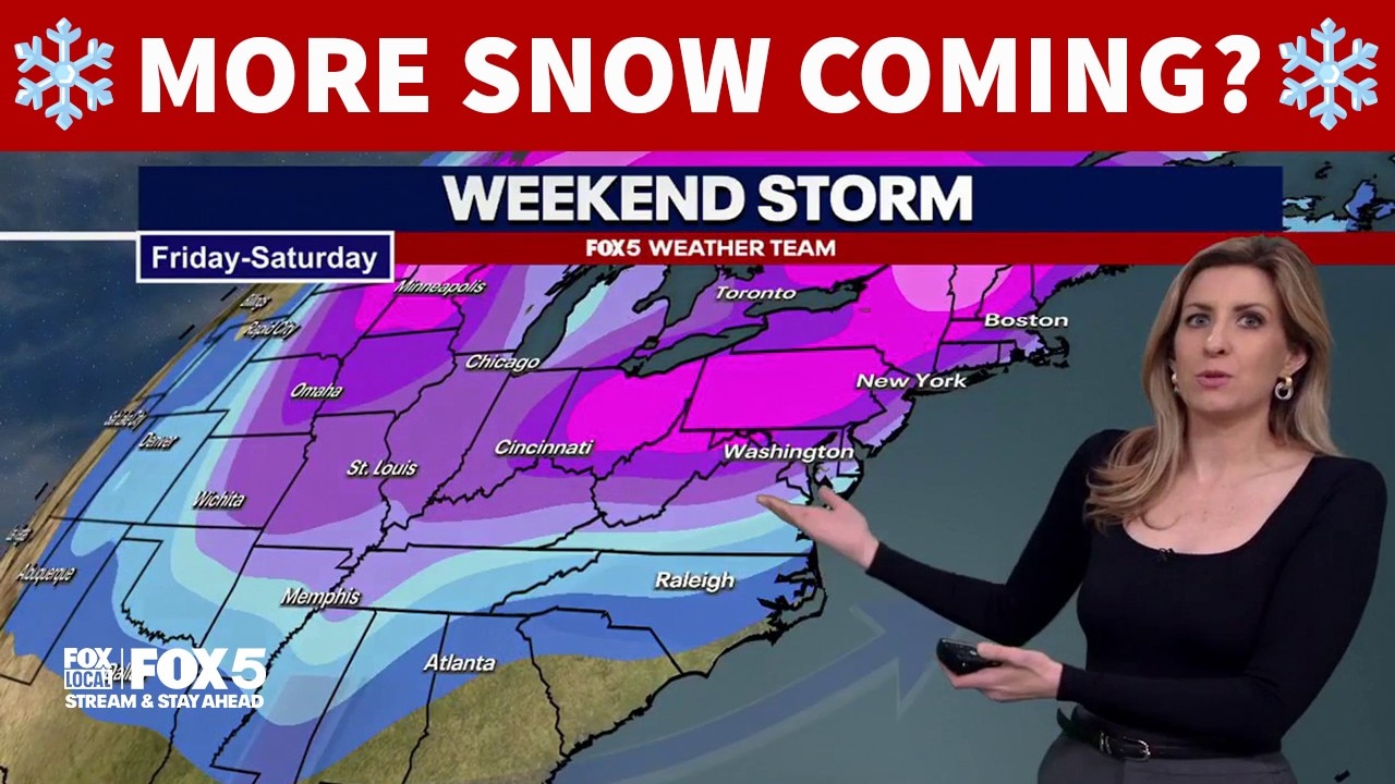
We're tracking another snow storm passing by the DC region. FOX 5's Caitlin Roth has the latest forecast.

A near miss:
WASHINGTON - We were close to another big one here in DC. Since about the time the sleet stopped falling last weekend in D.C., weather models hinted that a big storm was going to form near the East Coast this weekend.
While they were correct in that thinking, they were thankfully off just enough with the track of the storm earlier in the week, with all models agreeing that this system will not pass well to the East of the D.C. area.
Had the storm hit at full intensity this weekend, its very likely based on the model simulations that DC would have been digging out from another 10-20" of snowfall, but with the storm well off the coastline the city will be lucky to pick up a few snow flurries at best.
Far eastern parts of our area, closer to the beaches, will have a shot at some lighter accumulations, but the heaviest snow bands are expected to stay offshore through the weekend.
No snow, bet definitely wind:
All the snow with the weekend storm system will fall south of the DC region, with widespread 3-8" amounts expected for much of northern Georgia, the
Carolinas, and southern Virginia over the weekend. While we will not see the snowfall ourselves in DC, we will see another significant impact from the storm — the wind.
The strongest winds look most likely late Saturday night through the lunchtime hours of Sunday, when the potential for wind gusts over 40 mph are possible. With air temperatures struggling to make it into the low to middle 20s each afternoon, expect those wind chill values to feel like the single digits and teens for much of the weekend.
Wind chills will be downright dangerous on Sunday morning, possible as low as -10°F around the D.C. area. This puts us in the range of potentially seeing rare extreme cold warnings here in D.C. on Saturday night through Sunday morning. At levels that low, frostbite on exposed skin is possible in about 30-45 minutes.
Please take the cold seriously, bundle up, and keep yourself warm!

Persistent polar vortex:
Stating the obvious here: it has been cold.
By the numbers, this past week has likely been the coldest week in Washington, D.C. since early January 2018, eight years ago. This type of extensive and prolonged cold is not something the average winter gives us here in Washington, D.C.
Many winters here in our region the question I get the most is "when are we going to get cold, and when is it going to snow?" After this week, the questions I have been getting are "when are we going to warm up again?"
That is actually a harder question to answer at the moment. The honest truth is there are a lot of cold signals still showing up for our region well through the middle of the month.
A feature known as a sudden stratospheric warning event is helping power a strong block up near Greenland, trapping a piece of the polar vortex in southern Canada, near the Hudson Bay. Like an axel on a wheel, this feature continues to rotate around up there, grabbing cold from central and northern Canada and directing it down towards the eastern half of the country.
While temperatures are finally expected to crawl above freezing next week here in DC, the extended forecast features a lot of 30s as opposed to 40s or even 50s, which do become more common as we head into February typically.
Naturally, the next question is if it is going to stay cold, does that mean more snow could be on the way?
It is certainly a possibility, but whether we are talking about shovels or brooms type of snowfall, that is a harder question yet. What we can say is the pattern does look to remain both cold, and active as we get through at least the first half of February. This means that the occasional snow or other winter threat is likely to arise at some point over the next couple weeks.
For example, we do have our eyes on a system centered around Wednesday to Thursday of the upcoming week. Now at the moment, it appears to be a rather harmless wave that passes mostly to our south, but if weather models adjust a few key features, it could end up shifting north and becoming more of an accumulating snow.
There are no indications that this would be any significant storm at this time, just something that would have the next change for accumulations. While it is not in our forecast at the moment, we will continue to monitor the threat and keep you up to date with forecast shifts as we examine the data.
Stay tuned! FOX 5 will keep you ahead of this cold winter stretch, and let you know should any additional snowfall threats arise in the near future! Have a safe weekend and STAY WARM!