DC Heatwave: Will temperatures reach 100 degrees next week?

DC Heatwave: Will temps reach 100 degrees next week?
We have a chance to see some record-breaking heat days with our greatest chance being in the middle of the next week!
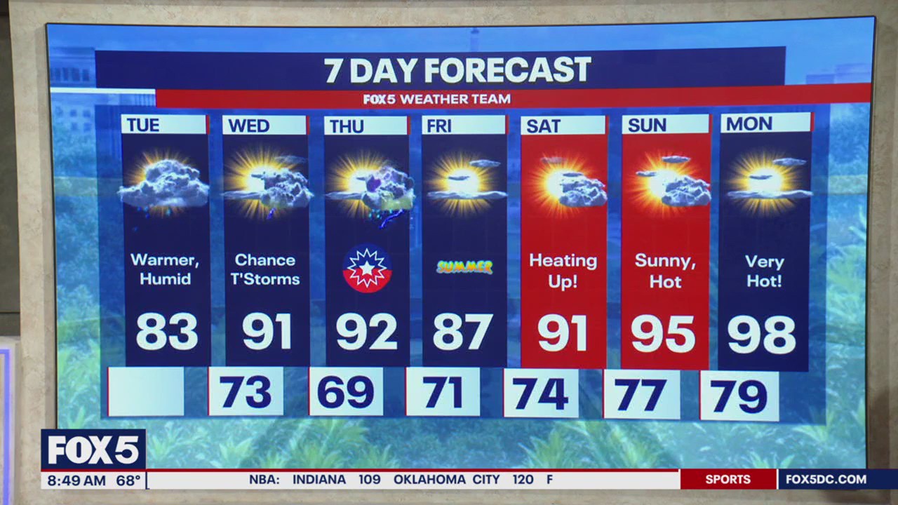
WASHINGTON - As the first day of summer approaches this Friday, we expect the first real blast of summer heat to arrive this weekend. Starting Sunday, a building ‘Bermuda High" will move into the mid-Atlantic region, sending temperatures soaring into the mid-to-upper-90s with heat indexes over 100 degrees much of next week.
DC Heatwave: Here is what we can expect:
Sunday marks the first day of our heat wave with high temps well into the 90’s! We expect higher than average temperatures throughout the entire week
Impacts will be widespread for us as we see our entire region being engulfed in hot air.
We have a chance to see some record-breaking days with our greatest chance being in the middle of the week
The Heat Index which measures heat and humidity together could exceed 105 degrees many days next week.
DC Heatwave: Possible record highs?
As the heat moves in, we have a decent chance to break several temperature records.
Most of the existing records range from 99-104 degrees, so our best opportunities will come on days where the forecast highs align with the lower end of those records.
Based on current data, next Monday and Friday fit that criteria. Monday and Friday stand out - both have record highs of 99 degrees, and forecast temperatures are expected to range from 96-99 degrees, giving us the best shot at tying or surpassing those marks.
DC Heatwave: Will DC region see 100 degrees?
Timeline:
The peak of our heatwave is expected early to mid-next week, with parts of our area expected to crack the 100s.
Tuesday and Wednesday are shaping up to be the hottest days, with highs potentially reaching 101 degrees.
The biggest question still remains: Will D.C. break 100 degrees? Last year it was incredibly hot, and we reached 100 degrees six times.
In past heat waves, surrounding areas have broken 100 degrees while the city itself stayed in the upper 90s. That’s largely because official temperature readings for the city come from Reagan National Airport - not downtown.
The airport’s location near the Potomac River often allows cooler air to blow in, keeping readings lower. Luckily for heat lovers and record chasers, there’s good news. Current forecast guidance suggests that the cooling effect should not play a major role but can’t be ruled out.
The Source: Information in this article comes from the FOX 5 Weather Team and the National Weather Service.

