

First round of snow moves out Thursday AM; second round of winter weather expected south of DC area tonight
WASHINGTON - Two rounds of snow: one tracks north and one tracks south!
Check the latest Closings and Delays

FOX 5 Weather forecast for Thursday, February 11
Mike Thomas has the FOX 5 Weather forecast for Thursday, February 11

Snow for parts of DC region Thursday; second wave expected south of metro area later tonight
FOX 5’s Melanie Alnwick is out in Damascus tracking the winter snow!
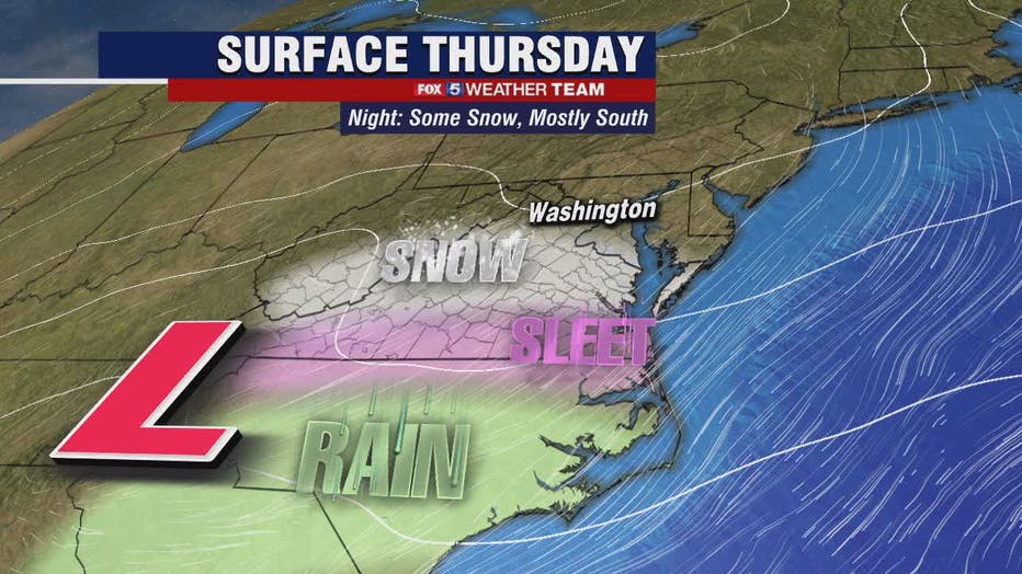
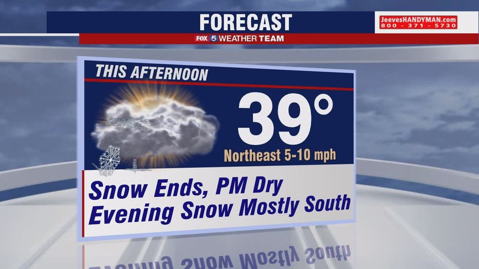
Extra time will be needed for Thursday morning commuters -- especially across parts of counties in northern Maryland -- where the more significant snow fell in round one overnight.
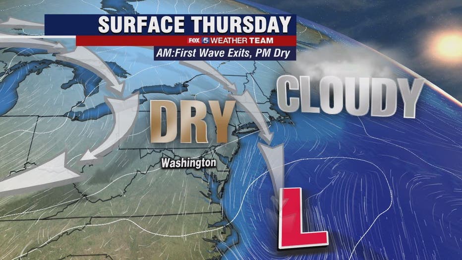
FOX 5’s Sue Palka says this first wave of snow and wintry mix will wind down during the morning hours. Several dry hours are expected. Not much melting is expected Thursday as temperatures will remain in the low to mid-30s.
Download the FOX 5 Weather App
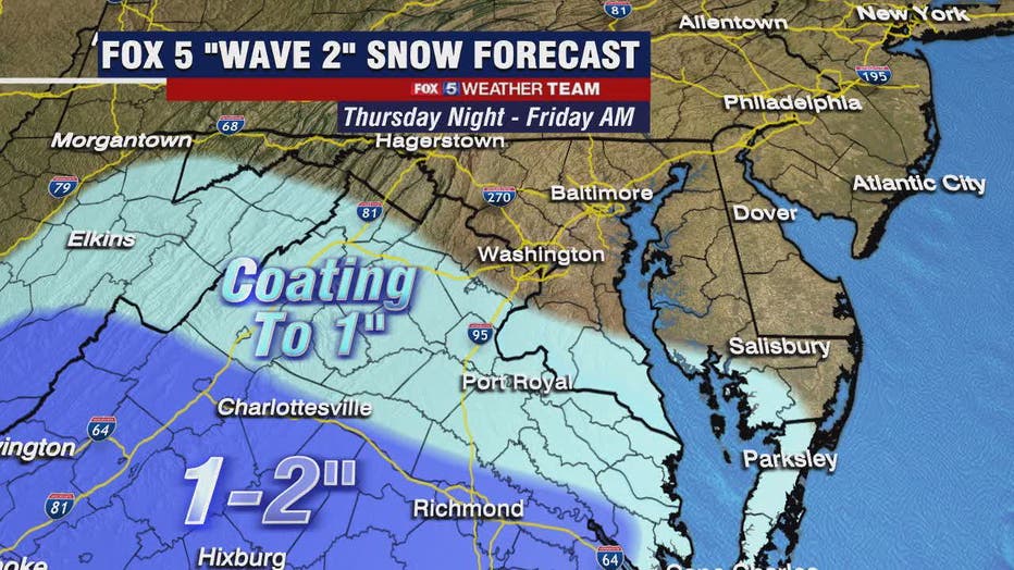
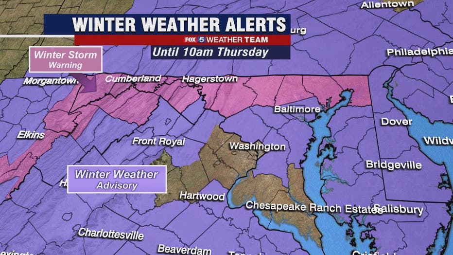
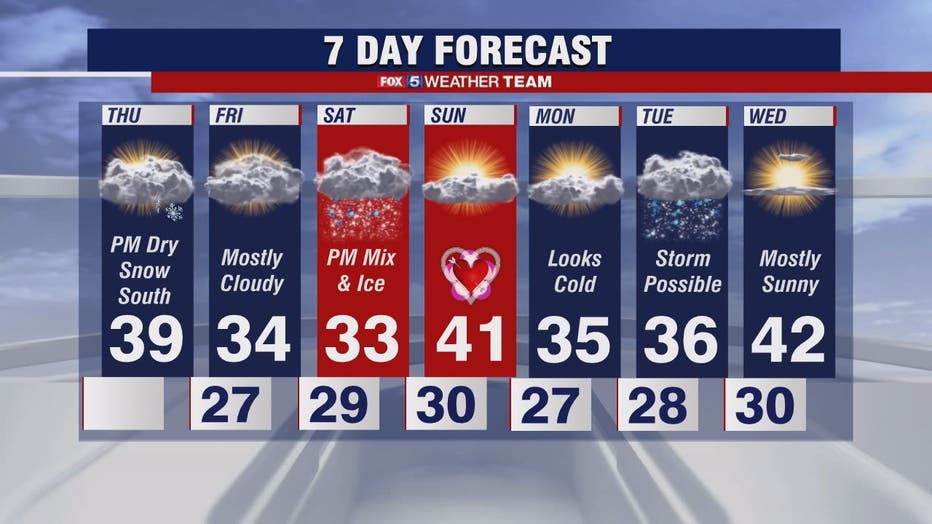
The second wave of low pressure and wintry mix is trending farther south in areas of central and southern Virginia and parts of southern Maryland. This second wave may produce additional accumulations in those areas -- and possibly a coating in the D.C. region. Winter Weather Advisories will be in place for much of central Virginia from Thursday evening until Friday morning. Round two of the storm should exit early on Friday morning.
The pattern stays active and cold. We’re also watching Saturday for another storm that could bring a round of ice or snow. For those not enjoying the snow and ice, spring begins on March 20th!
Stay with FOX 5 on the app and online for weather updates:
Get the latest FOX 5 forecast here.
Check the latest Closings and Delays
Download the FOX 5 DC News App for Local Breaking News and Weather
Download the FOX 5 Weather App
Check the latest weather radars
Stay up to date with the FOX 5 Weather Team on Twitter: