

Potential nor’easter could bring some rare May snow to parts of northeast this weekend
WASHINGTON - Following a mild and nearly snowless winter, one might expect an early summer to have been in the forecast for 2020. Weather often dances to the beat of its own drum, however, and warm has not been the way I would describe the second half of spring so far. And yes, you did read the headline correct. Parts of the interior Northeast may even see a little snow this weekend!
Download the FOX 5 Weather App

FOX 5 Weather afternoon forecast for Wednesday, May 6
Tucker Barnes has the FOX 5 Weather afternoon forecast for Wednesday, May 6.
After a mild and mostly sunny Thursday here in the D.C. region, a cold front will pass on Friday afternoon, once again overspreading our region with some rain showers. A wave of low pressure will develop along this front and push off the Northeast coastline. As it does so, cold air will be pulled in from the north, changing some rain to snow across parts of the Northeast.
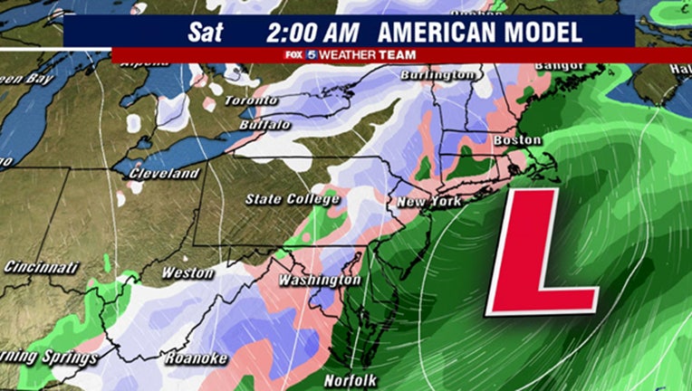
As for local impacts around the immediate D.C. area, it all depends on which weather model you trust. Wednesday morning’s run of the American model suggests that areas around the District might see some flakes around or just beyond the midnight hour into early Saturday morning. Before we go blindly trusting it though, we should look at history. As far back as records go (late 1800s) D.C. has never seen measurable snow in the month of May. I could only find three reliable cases (1963, 1923, and 1903) where snow was falling at all during the month.
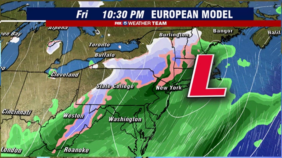
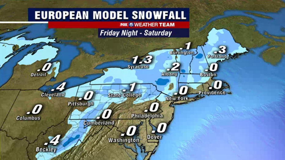
What is much more likely to happen is what is depicted in the European model. A chilly rain into the evening hours of Friday for most of our region. Only the mountain zones west of the I-81 corridor see a changeover to snowfall, though some of the higher peaks could receive several inches. Still, even this is impressive for a time of year where high temperatures in our area range from the low to mid-70s. The threat for snow even in far interior regions is a testament of the cold pattern that we are in.
The one thing that is certain is that as this storm passes our area by, it will intensify. Winds will become gusty Friday night through the day on Saturday. Late season freezes will be possible both Saturday and Sunday mornings for our northwest zones. The one bit of good news is the weekend is expected to be dry. Winds should die down by Saturday night, and some low 60s should return to the region with sunshine for Mother’s Day on Sunday. Model projections currently suggest the cooler than normal pattern should persist until the latter half of next week, when some 70s and perhaps even 80s may return.
Stay with FOX 5 on the app and online for weather updates:
Get the latest FOX 5 forecast here.
Check the latest Closings and Delays
Download the FOX 5 DC News App for Local Breaking News and Weather
Download the FOX 5 Weather App
Check the latest weather radars
Stay up to date with the FOX 5 Weather Team on Twitter: