

Severe storms, damaging winds and heavy downpours possible across parts of DC region Thursday
WASHINGTON - For the second time in the past three days, some in central Maryland and Northern Virginia are waking up without power after a severe thunderstorm downed trees and powerlines in parts of our region.
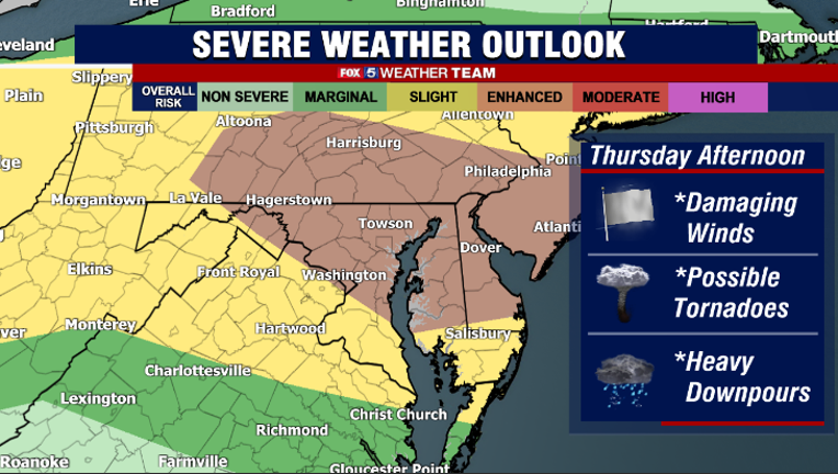
While this Thursday morning is starting off quiet, today has the potential to be a very active severe weather day, with damaging winds and perhaps even a tornado or two. The storm prediction center has placed DC and much of Maryland under an Enhanced Risk for severe weather today, their third highest category.
LEFTOVER MIDWESTERN DERECHO COULD BRING STRONG STORMS TO DC THURSDAY

FOX 5 Weather forecast for Thursday, July 29
Mike Thomas has the FOX 5 Weather forecast for Thursday, July 29
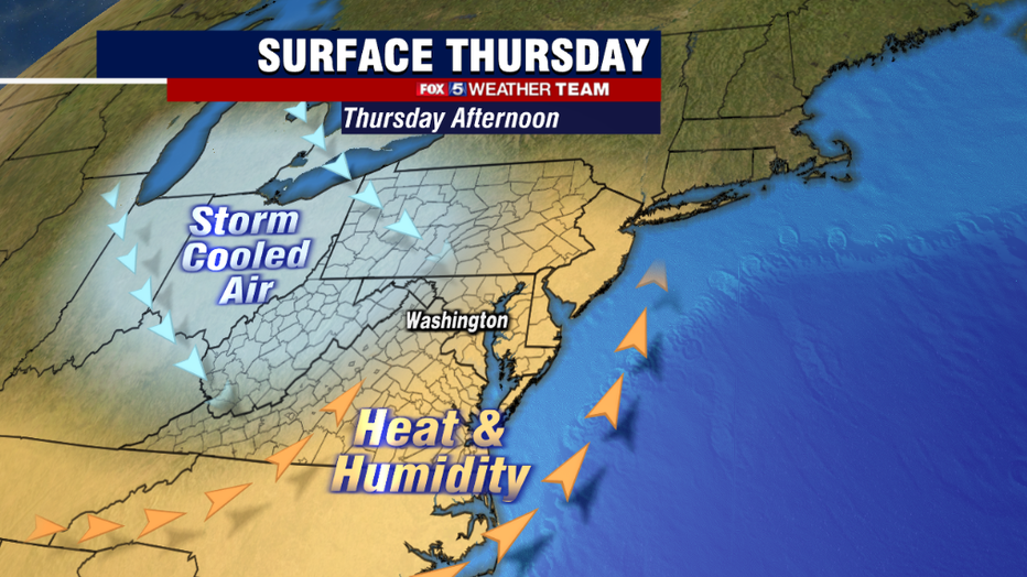
The key word though in the above paragraph was "potential" however, as there is a way that today's storms could end up sparing much of our region. The storms today will be fueled by both a cold front and the leftover, rain cooled outflow from storms overnight in the Midwest. In order for storms to initialize, sufficient warmth and humidity must build up ahead of these boundaries as they push their way eastward.
Should sunshine fail, and cloud cover holds too thick…temperatures this afternoon will likely fall short of expected forecast highs and the atmosphere will stay more stable. As a result, storms would be much less widespread, particularly in southern zones where storms could miss entirely.
A wise person once said "prepare for the worst and hope for the best" however, so if the sun does shine and the atmosphere destabilizes in the afternoon, how bad could it potentially get?
Morning weather models have suggested that the stronger storms today regardless of how much sun we get, would primarily be to our north. Maryland, specifically northern Maryland, has a better shot at seeing storms today compared to Virginia. DC is sort of right on that fine line of storm potential today.
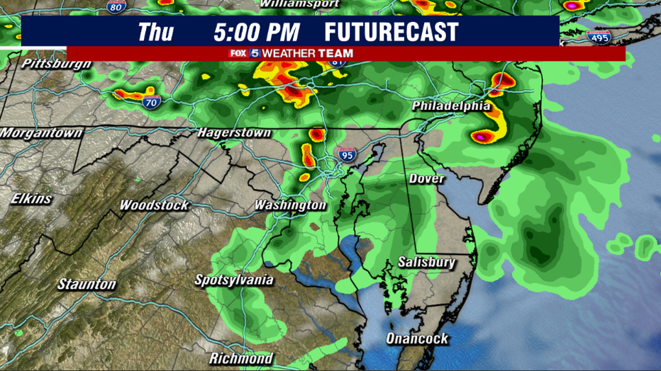
Should storms fire today, it would likely be after 3pm today as the boundaries near our region and a wave of low pressure passes north of our area. The greatest risk for today is that a squall line develops across northern Maryland, which is a strong line of thunderstorms that brings damaging winds to a widespread area.
There is also an elevated risk of tornadoes today, and while we do not expect any sort of an outbreak, there could be one or two with the highest odds north of the I-70 corridor. It is a great day to keep that Fox 5 Weather App at the ready!
Regardless of whether or not we end up seeing a lot of storms or just a few, the cold front will cross our region tonight and any lingering showers or storms should die down during the overnight hours.
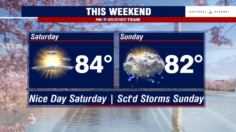
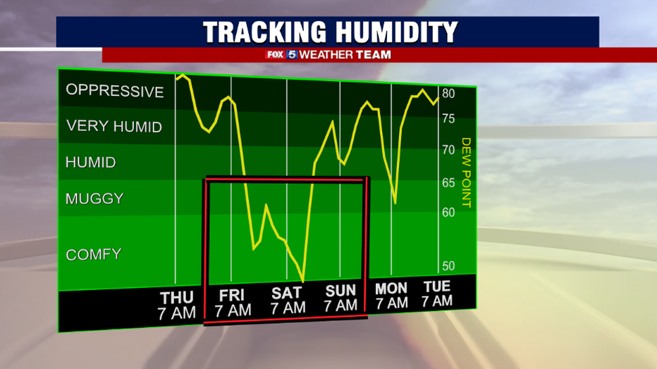
Behind the front, dew points will take a tumble. This means much drier, more comfortable air will be pushing into our region through the day on Friday. We will wrap up the month of July on a spectacular note. Friday will be a little breezy but also bring comfortably warm sunshine, with Saturday likely the pick of the week weather wise.
The next chance for showers and storms after today will be on Sunday afternoon.