

Leftover Midwestern derecho could bring strong storms to DC Thursday

FOX 5 Weather forecast for Thursday, July 29
Mike Thomas has the FOX 5 Weather forecast for Thursday, July 29
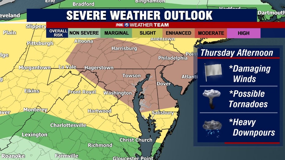
WASHINGTON - Residents of the Mid-Atlantic are bracing for severe weather ahead of a destructive windstorm that's expected to move toward the region Thursday.
Download the FOX 5 Weather App
The so-called derecho, or an arcing squall line bowed outwards by widespread damaging winds, is moving across the Great Lakes and Ohio Valley early this morning.

Leftover Midwestern Derecho could bring strong storms to DC Thursday
Residents in the Midwest are bracing for hurricane-force winds ahead of a destructive windstorm expected to develop Wednesday afternoon.
The wind-propelled squall line will likely weaken on approach around sunrise Thursday morning, but the same instigating cold front could kick up storms across the D.C. region during the afternoon.
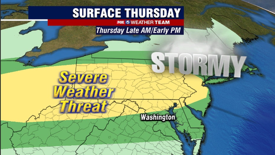
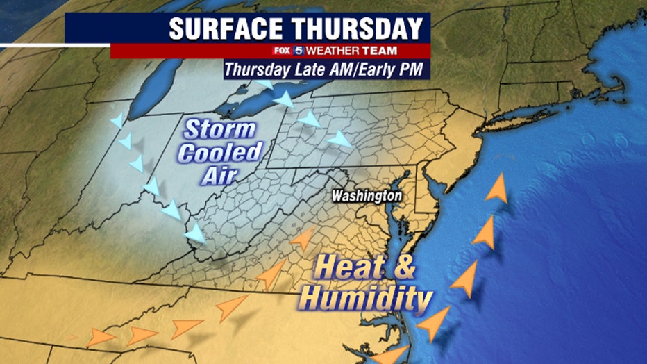
Cold air at the upper levels left by the decaying derecho will foster pockets of rising air, boosting the chance of gusty thunderstorms.
Highs Thursday will peak in the upper-80s or lower-90s depending on the exact timing of the cold front.
Storms should fire by early afternoon, particularly near and north of the District. There are some indications that multiple waves of storms may sweep across the area. Strong to locally damaging winds are the main concern, though hail or an isolated tornado can’t be ruled out.
Modestly cooler and more refreshing air should arrive Friday, with highs in the upper-80s.
Saturday should feature an invigorating air mass with dew points in the lower-50s and temperatures peaking in the mid-80s.
Stay with FOX 5 on the app and online for weather updates:
Get the latest FOX 5 forecast here.
Check the latest Closings and Delays
Download the FOX 5 DC News App for Local Breaking News and Weather
Download the FOX 5 Weather App
Check the latest weather radars
Stay up to date with the FOX 5 Weather Team on Twitter: