Hot, humid start to Fourth of July weekend; Severe pop-up storms possible Saturday

FOX 5 Weather forecast for Saturday, July 2
Meteorologist Gwen Tolbart has your FOX 5 Weather forecast for Saturday, July 2.
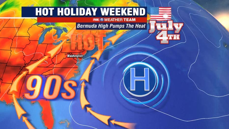
WASHINGTON - The Fourth of July weekend in the D.C. region is getting off to a hot and sticky start with storms possible later in the day Saturday.
Download the FOX 5 Weather App
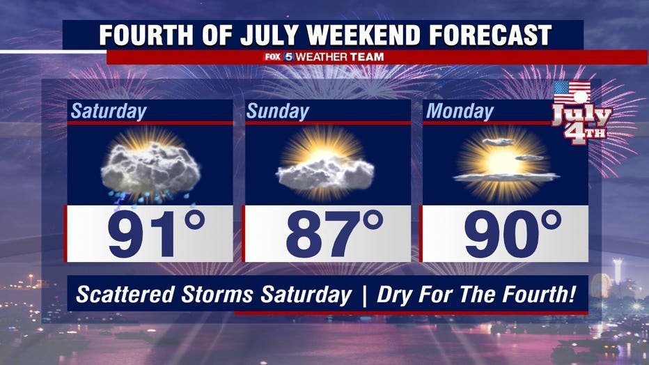
Highs Saturday afternoon will be in the low 90s. The high temperatures added to the high humidity the region is experiencing will make Saturday feel like a hot and sticky summer day.
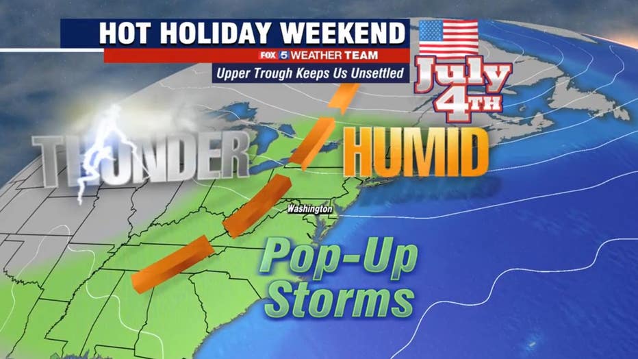
A frontal system will make its way across the D.C. region starting around 1 p.m. triggering possible pop-up storms. Make sure to keep up to date with the latest FOX 5 weather forecast for your neighborhood if you are holding outdoor Fourth of July events on Saturday afternoon.
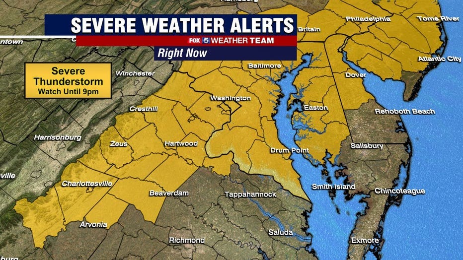
The National Weather Service's Storm Prediction Center has put most of the D.C. region under a slight risk for severe weather, meaning isolated flash flooding, damaging winds, hail, and isolated tornados are possible.
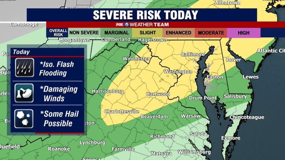
A severe thunderstorm watch was issued for most of the D.C. region until 9 p.m. Saturday.
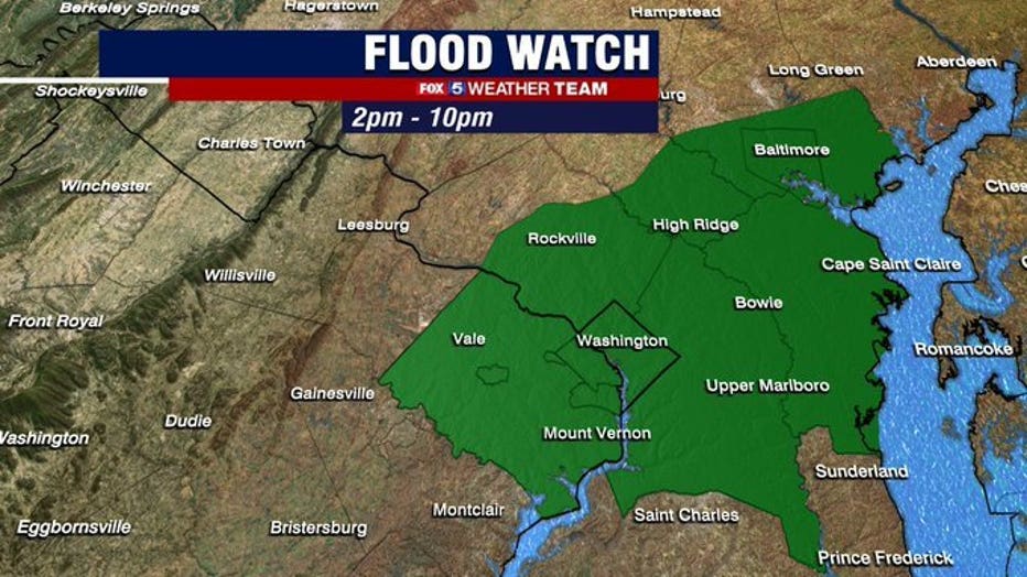
A flash flood watch was also issued for most of the area from 2 p.m. until 10 p.m. Saturday.
The storms will mostly move out of the D.C. region Saturday evening, but some lingering showers are possible overnight.
Those showers will clear out in the pre-dawn hours Sunday, setting up a drier and mostly sunny day.
Stay with FOX 5 on the app and online for weather updates:
Get the latest FOX 5 forecast here.
Check the latest Closings and Delays
Download the FOX 5 DC News App for Local Breaking News and Weather
Download the FOX 5 Weather App
Check the latest weather radars
Stay up to date with the FOX 5 Weather Team on Twitter:
The high heat and humidity will hang around on Fourth of July Monday, but we are expected to get plenty of sunshine making it a perfect day for holiday celebrations!