

Heavy storms, flooding concerns Friday as severe weather moves across DC region
WASHINGTON - The weather will have a high impact on our area Friday and for those of you living near a tidal coast, be prepared for moderate to perhaps even major flooding at times of high tide through Saturday morning.
Download the FOX 5 Weather App

FOX 5 Weather forecast for Friday, October 29
Mike Thomas has the FOX 5 Weather forecast for Friday, October 29

FOX 5 Weather forecast for Friday, October 29
Mike Thomas has the FOX 5 Weather forecast for Friday, October 29
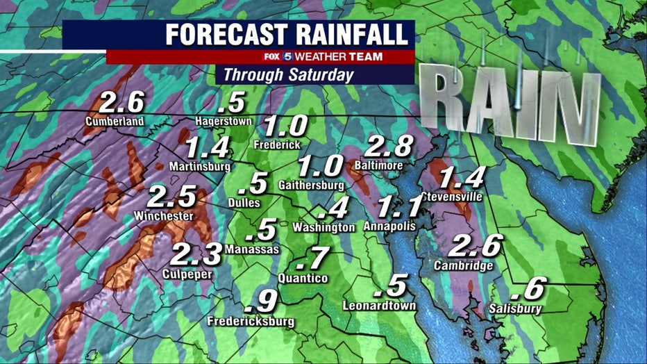
Water is already running high due to runoff from the powerful nor’easter that affected the northeast earlier this week. Strong onshore gusts of 40 to 50 mph will push water up the Bay and Tidal Potomac which could potentially produce the highest water levels in several years.

Severe storms bring flood waters to Alexandria
Flood waters are rising in Alexandria severe storms bring flood waters to the area
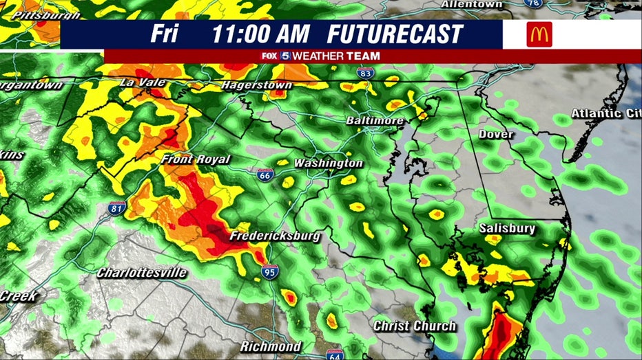
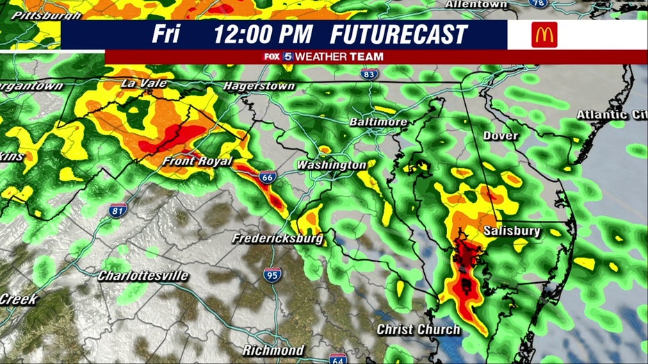
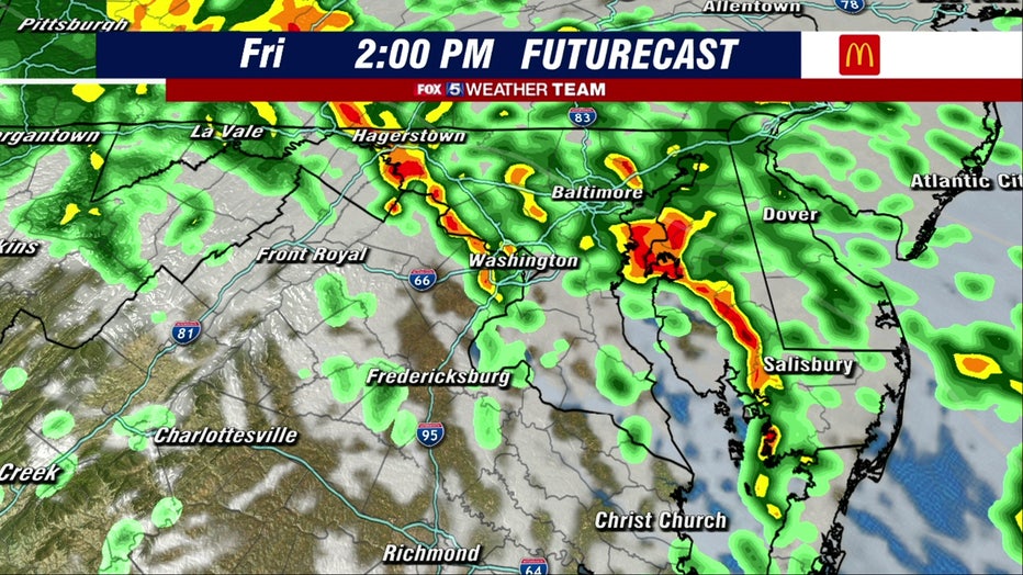
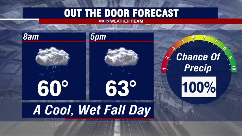
We expect a soaking rain through the day that could drop an additional 1 to 2 inches of rain on the area. There could even be a thunderstorm in the mix from DC south.
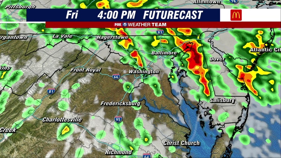
The rain tapers to showers by evening rush hour, but tides of 2 to 3 feet above ground level will continue to inundate low lying areas through Saturday morning.
A few showers linger into Saturday but Halloween looks sunny, dry and cool.

Huge rat runs for cover as storms move across DC region
Even the rats are running for cover Friday as heavy storms move across the D.C. region!
Stay with FOX 5 on the app and online for weather updates:
Get the latest FOX 5 forecast here.
Check the latest Closings and Delays
Download the FOX 5 DC News App for Local Breaking News and Weather
Download the FOX 5 Weather App
Check the latest weather radars
Stay up to date with the FOX 5 Weather Team on Twitter: