

Calm before the storm Tuesday ahead of Wednesday winter weather
WASHINGTON - Tuesday is the proverbial "calm before the storm" and a perfect day to plan and prepare for Wednesday's impactful nor'easter!
Download the FOX 5 Weather App
FOX 5's Sue Palka says while it will be chilly Tuesday with temperatures topping out near 40, it will be dry and mostly sunny. Clouds increase tonight and the stage will be set with temperatures dropping back into the 20s.

FOX 5 Weather forecast for Tuesday, December 15
Mike Thomas has the FOX 5 Weather forecast for Tuesday, December 15
Snow begins Wednesday morning and where you live will determine how much you have to shovel. The area near the Interstate 95 corridor will be the "battle zone" where warmer air from the ocean looks to change snow over to rain or a mix by afternoon. Lighter accumulations of 1-3 inches look possible here -- south and east of Interstate 95 it's mainly rain.
Snow storm forecast: DC region braces for midweek winter weather
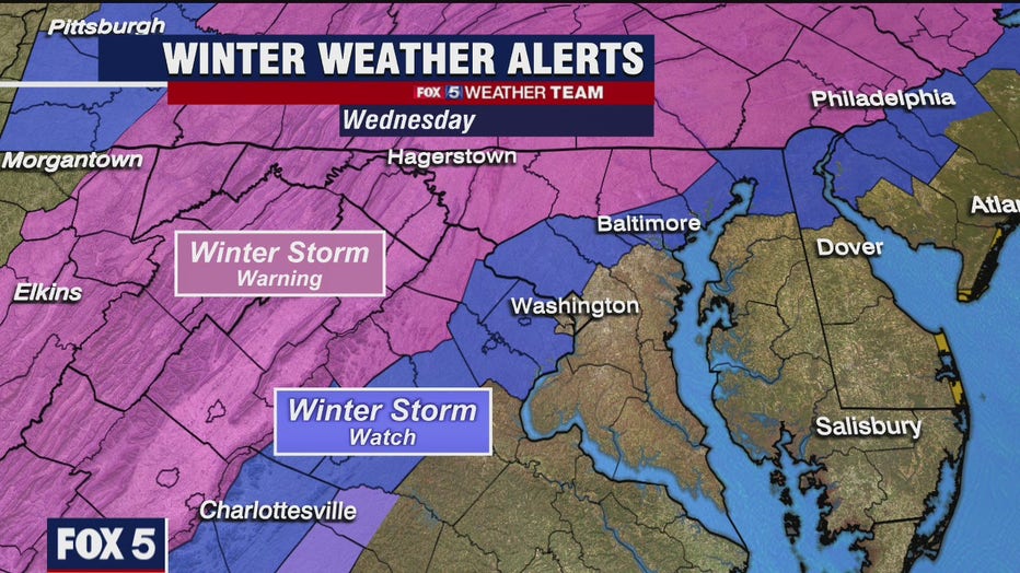
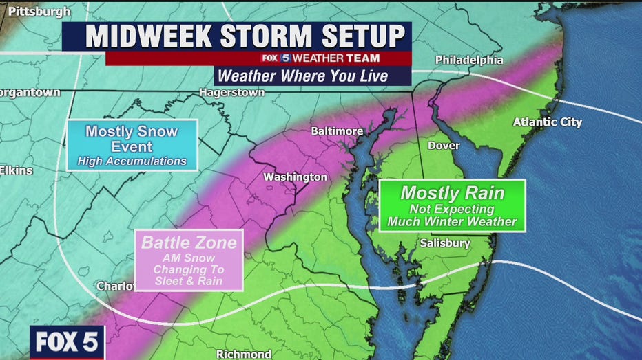
The colder northern and western suburbs and beyond are expected to stay all snow and here the accumulations could be upwards of 5 inches to over a foot as you head toward the Interstate 81 corridor! Travel will be hazardous in these areas as the snow could come down in heavy bands.
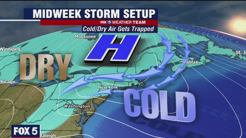
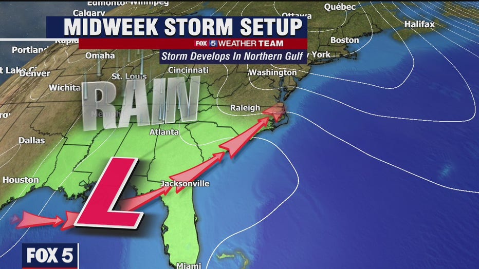
It all looks to taper off early Thursday morning. Tracking the very tight gradient between heavy snow versus the areas that see rain mix in will be a challenge and we will continue to update you as we get new information!
Stay with FOX 5 on the app and online for weather updates:
Get the latest FOX 5 forecast here.
Check the latest Closings and Delays
Download the FOX 5 DC News App for Local Breaking News and Weather
Download the FOX 5 Weather App
Check the latest weather radars
Stay up to date with the FOX 5 Weather Team on Twitter: