

Severe weather, damaging winds to threaten D.C. region Tuesday

DC WEATHER: Strong thunderstorms expected Tuesday
Strong to severe thunderstorms could impact the D.C. region on Tuesday.
BETHESDA, Md. - The new week started on a quiet note in the D.C. region, with Sunday and Monday presenting more comfortable humidity and moderate temperatures compared to much of last week.
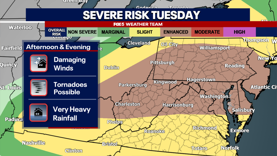
The Storm Prediction Center placed the DC region under an enhanced risk of severe weather for Tuesday afternoon and evening.
Tuesday returns us to what has been business as usual for much of this July: heat, high humidity, and the chance for some powerful thunderstorms during the afternoon and evening hours.
Severe storms expected Tuesday
Timeline:
The National Weather Service, Storm Prediction Center (SPC) has placed our area under an enhanced risk for severe weather on Tuesday. This is essentially a level 3 of 5 alert level from the SPC, signifying that they see the potential for more widespread severe weather.
The stage is set in the early morning, around dawn, as a warm front crosses the D.C. region from south to north. Along this front, cloud cover along with some scattered showers and perhaps a few thunderstorms will be possible for early risers. These are not expected to be severe though.
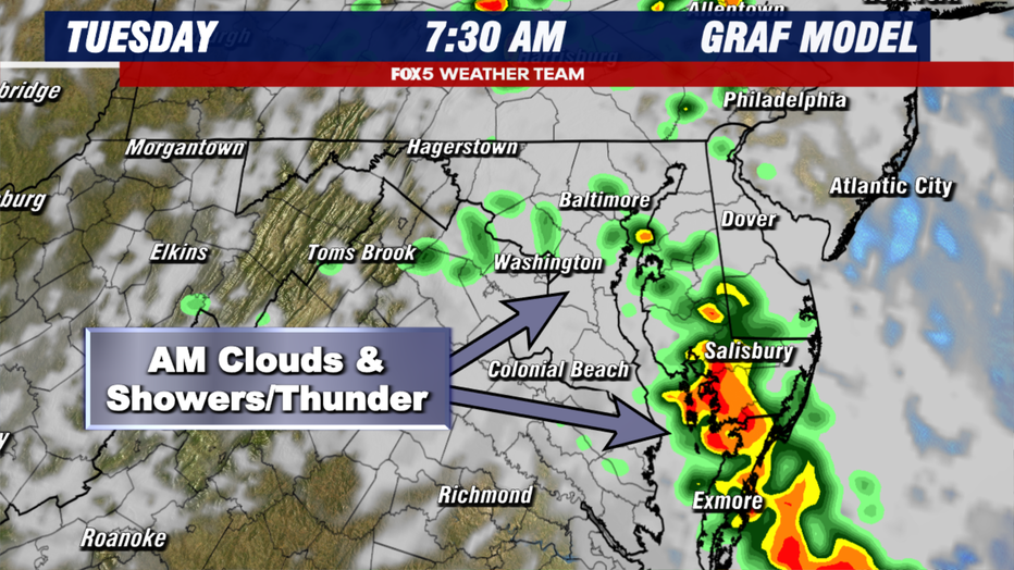
The GRAF weather model, showing a forecast radar projection for 7:30am on Tuesday morning.
We will then watch the progression of this front closely. Behind the front sits warm and very humid air. The farther north the warm front progresses, the deeper into the unstable airmass our region will get later in the day.
By the late morning into the early afternoon, expectations are that the warm front will have lifted far enough to the north that some clearing skies are expected.
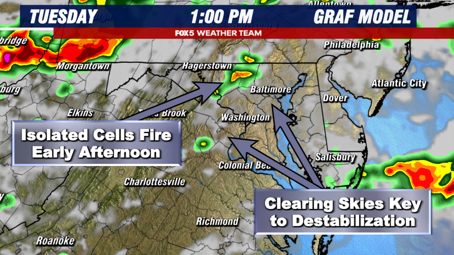
The GRAF weather model, showing a forecast radar projection for 1:00pm on Tuesday afternoon.
Sunshine is expected to warm temperatures into the upper 80s and lower 90s, with heat index values approaching 100°F in a few spots thanks to very high humidity. As upper-atmospheric winds begin to increase in the early afternoon as an unusually strong July jet stream energy crosses the region, thunderstorm are expected to begin to fire in the unstable airmass.
Initially, these are likely to be discrete and isolated in nature, but could become severe rather quickly in the heat of the afternoon.
If sunshine is a little more widespread earlier than expected, these storms could be a bit more numerous. If so, atmospheric wind shear profiles suggest a few of these storms could rotate, and isolated tornados are a threat that we are on guard for tomorrow afternoon.
During the mid-afternoon, a more organized cluster of thunderstorms is expected to move out of the mountains of western Pennsylvania and West Virginia and advance eastward, through the I-81 corridor near the West Virginia/Virginia border, and toward the I-95 and D.C. region, likely around the time of the evening commute.
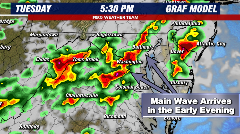
The GRAF weather model, showing a forecast radar projection for 5:30pm on Tuesday evening.
These storms will likely be organized into clusters, which could contain some sections of damaging winds within them. In addition, frequent cloud to ground lightning and potentially blinding downpours will be possible.
The potential for some scattered areas of downed trees and power lines, as well as isolated flash flooding are all possible as these storms work their way through the region.
This wave of stronger storms will then advance eastward through Southern Maryland and then the Eastern Shore into the later evening hours. After sunset, conditions should be much quieter around the immediate D.C. area, though humidity will remain very high on Tuesday night.
More storms possible Wednesday
Looking Ahead:
While Tuesday looks like the greatest potential for more widespread strong to severe thunderstorms across the D.C. region, the threat of thunderstorms does not completely vanish on Wednesday.
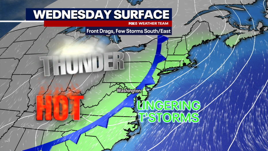
Tuesday’s cold front will be slow to exit the region on Wednesday.
The cold front associated with the storm system traversing eastern Canada will be a bit slow to cross our region on Wednesday. Areas caught along and east of this front will have the chance to pop a few more thunderstorms on Wednesday afternoon.
At this time, it appears the I-95 corridor between Richmond and Baltimore, along with all areas to the east of there, will have the greatest risk of seeing storms again on Wednesday afternoon.
Unlike Tuesday, these should be more hit-and-miss in nature, though a few may be strong to severe. Parts of eastern Virginia are under a slight risk of severe weather, while the Eastern Shore is under a marginal risk.
As the front advances eastward through the day, humidity levels will fall as drier air works its way into the region, and it should end up being a very nice evening in D.C.
Unusually cool air follows
Dig deeper:
By Thursday, it is going to feel like a change of seasons. An unusually cool (for July) air mass will work its way out of Canada, through the Midwest, and encompass our region.
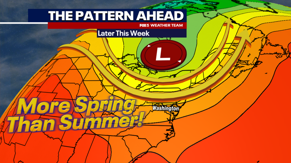
A big pattern shift by the end of the week will bring in much more comfortable temperatures into the Northeast and Mid-Atlantic for the end of the week.
Dry, comfortable air will drop overnight temperatures into the 50s in the suburbs and 60s in the city by the end of the week, while afternoon highs will peak only in the upper 70s and lower 80s, feeling much more like late spring than mid-summer.
And the best part? Much of the remainder of the month and into early August looks like a much calmer, and not as extreme in the heat and humidity department type of weather pattern.
Now, by no means does it look likely to stay this way for the remainder of the summer, but it is certainly a nice break to what has been (through Monday) the fourth-hottest summer on record here in Washington, D.C.
The Source: This information is from FOX 5 DC reporting.