Pleasant weekend conditions bring early taste of fall to DC region

FOX 5 Weather forecast for Saturday, August 13
Matthew Cappucci has your FOX 5 Weather forecast for Saturday, August 13
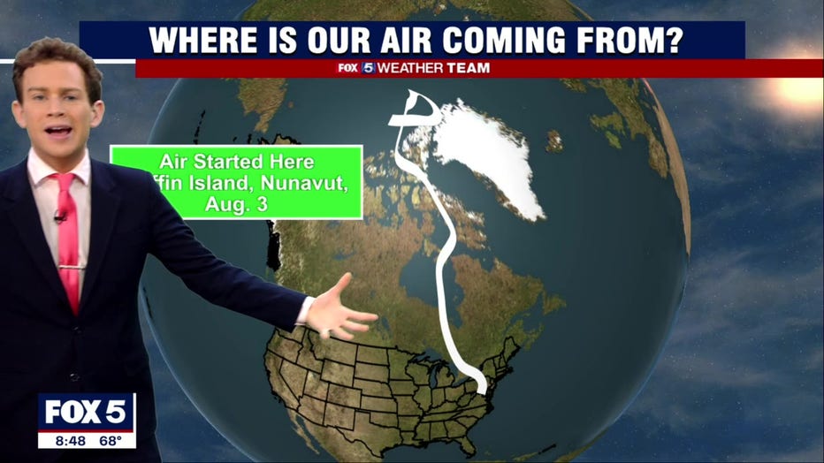
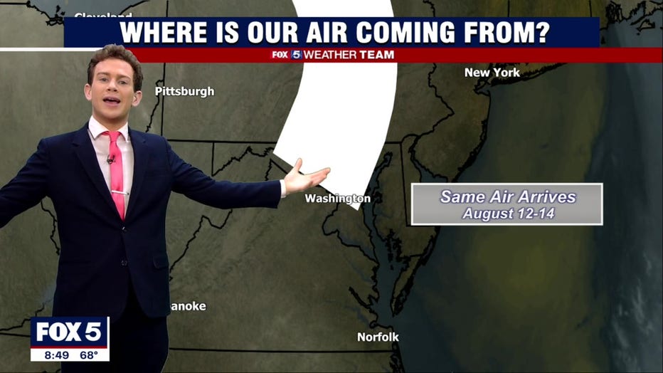
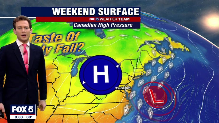
If you like Saturday's air mass, thank a Canadian! We've got Canadian high pressure in control, which is pumping in air from, believe it or not, north of Greenland, making it an extra pleasant summer Saturday for the D.C. region.
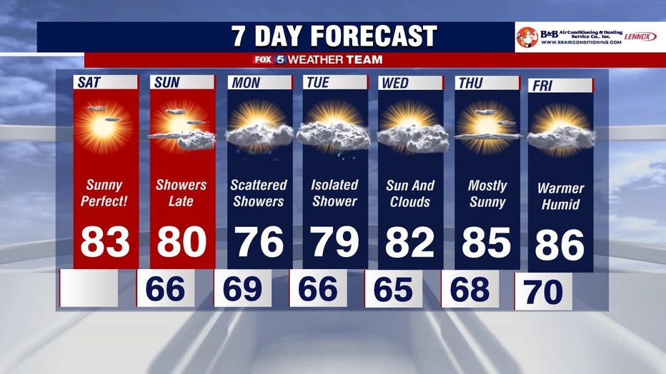
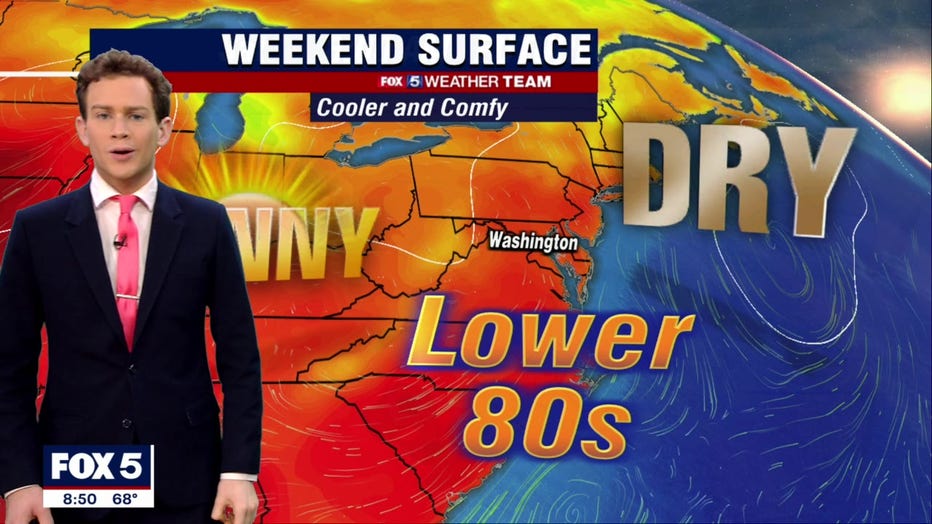
Temperatures Saturday stay on the cooler side with upper 70s north and west of D.C. to lower 80s in the city. There are also no rain chances either creating just sublime conditions with low humidity and dew points in the 50s.
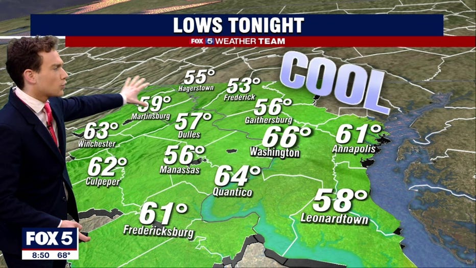
Saturday night we'll fall back to about 65 degrees in D.C., with 50s north and west. It'll be a great night to open those windows.
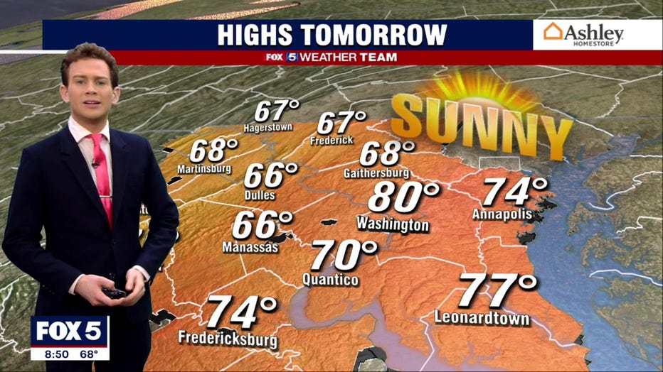
For Sunday, highs will again be in the lower 80s, with a couple showers far inland over the higher terrain. It's unlikely any make it to the Beltway, but there's a chance. About 95 percent of folks will stay dry, however.
Monday through Wednesday, we're nestled beneath a dip in the jet stream, which could spill a couple spot storms into our area. Tuesday has a better chance, but Monday and Wednesday could both feature an isolated shower or thunderstorm somewhere about the area.
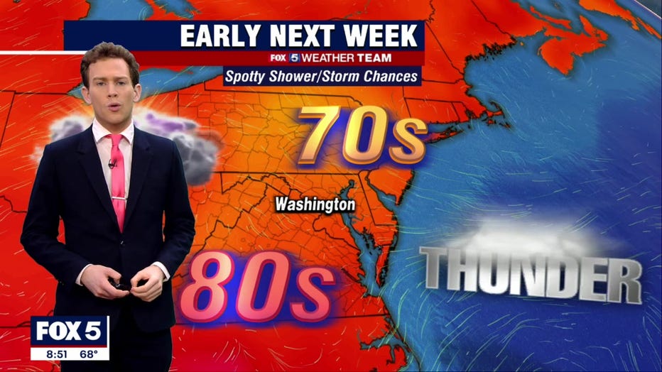
A strong storm or two can't be rule out, since northwest flow environments are notorious for "overachieving" beyond model simulations.
Late next week the humidity begins to return, but there are no 90s anywhere in the seven-day forecast. Enjoy!