

DC weather: Severe thunderstorm warnings issued after heat index pushes 105 Friday
DC Weather: Thunderstorm warnings issued Friday night
Several thunderstorm warnings have been issued in Virginia and Maryland after another hot and humid day Friday. Cooler weather is expected by the weekend.
WASHINGTON - A final day of extreme heat and humidity triggered thunderstorm warnings across the Washington D.C. region Friday night.
Severe thunderstorm warnings
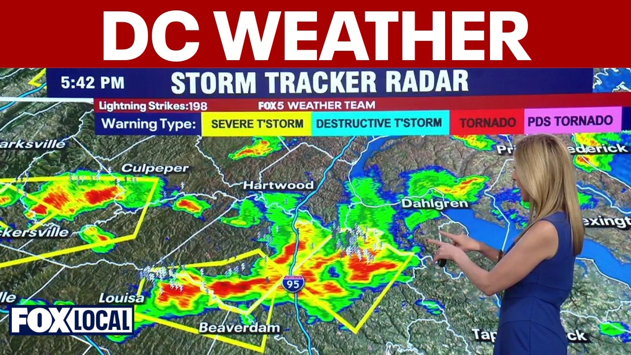
What we know:
The National Weather Service has issued Severe Thunderstorm Warnings for much of th region, including D.C., Arlington and Alexandria.
That warning is in effect until 7:45 p.m. Officials warn of wind gusts up to 60 mph and pea-sized hail possible.
Nearly 1.5 million people are in the affected areas, according to the NWS.
The latest warnings from the NWS can be found on their website here.
One final humid push
What they're saying:
The FOX 5 Weather Team emphasizes that Friday marks the end of this stifling tropical air mass.
"Today will be the last day of the high humidity," says FOX 5's Taylor Grenda. "We will finally get a break heading into the weekend."
Forecasters warn that the extreme heat and humidity will provide fuel for volatile weather later Friday. With a cold front closing in, the combination of energy and moisture will cause intense storm cells to start bubbling up rapidly across the afternoon.
Storms popping this afternoon
Timeline:
- Friday Morning: Mostly sunny and dry. Temperatures will warm up very quickly through the 70s and 80s with thick humidity already in place.
- Friday Afternoon (2 p.m. – 8 p.m.): Thunderstorms develop and expand in coverage. Expect heavy downpours, strong winds, and localized severe weather warnings.
- Friday Night (After Midnight): The cold front clears the coast. Storms exit the area and humidity levels begin a noticeable drop.
- The Weekend: Dry, refreshing air takes over by Saturday morning, setting up a nice day for outdoor plans.
Cold front breaks the block
Big picture view:
A strong cold front pushing in from the west is finally breaking down the atmospheric block that has trapped heat and moisture along the East Coast according to FOX 5. As this cooler, denser air mass collides with the unstable tropical air over the DMV, it lifts the moisture and triggers a line of strong to severe convective storms. Once the front moves through tonight, high pressure will usher in refreshing Canadian air.
Safety during peak heat
Why you should care:
With heat index values climbing above 100 degrees ahead of the storms, heat exhaustion is a real threat. It is vital to take necessary breaks, get into the air conditioning, and stay hydrated if you are working outside.
Seven days of change
By the numbers:
Washington, D.C. and Immediate Suburbs:
Friday: 97° | Mostly sunny; PM severe storms (Heat Advisory)
Saturday: 88° | Sunny, comfortable, and less humid
Sunday: 92° | Hotter with evening storms returning
Monday: 85° | Sunny, dry, and pleasant
Tuesday: 84° | Partly sunny with a chance of showers
Wednesday: 82° | Mostly cloudy with scattered showers
Thursday: 85° | Partly cloudy with a lingering shower chance
Refreshing relief arrives tomorrow
What's next:
The severe storm threat will sweep out of the area before dawn on Saturday morning. The weekend will start on a beautiful note with plenty of sunshine and comfortable humidity. Temperatures heat up briefly on Sunday with another quick storm chance, followed by several days of unsettled but much cooler weather next week.