

DC, Maryland & Virginia Forecast: Heavy rain, flooding, damaging winds hit area Tuesday

Water levels rising after brutal storm near Georgetown Waterfront
FOX 5's Sierra Fox reports from the Georgetown Waterfront where rain continues to fall and the water levels continue to rise.
WASHINGTON - A powerful storm moving across Washington, D.C., Maryland, and Virginia on Tuesday brought heavy rain, threats of flooding, and damaging winds to the region.
Here’s the updated list of school closings, delays, and early dismissals in Washington, D.C., Maryland, and Virginia.
The storm made its way into the area during the morning hours and is expected to continue into the evening. The rain, quickly becoming heavy at times, will be the heaviest during the afternoon. Widespread rainfall totals between 1 and 3 inches are expected across the region.

DC Weather: Heavy rain, flooding, gusty winds hit DMV
FOX 5 Chief Meteorologist Tucker Barnes walks through Tuesday's wet weather forecast for D.C. and surrounding areas.
WARNINGS, WATCHES & ADVISORIES
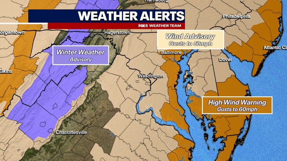
Coastal Flood Warning in effect from January 9, 10:00 PM EST until January 10, 10:00 AM EST
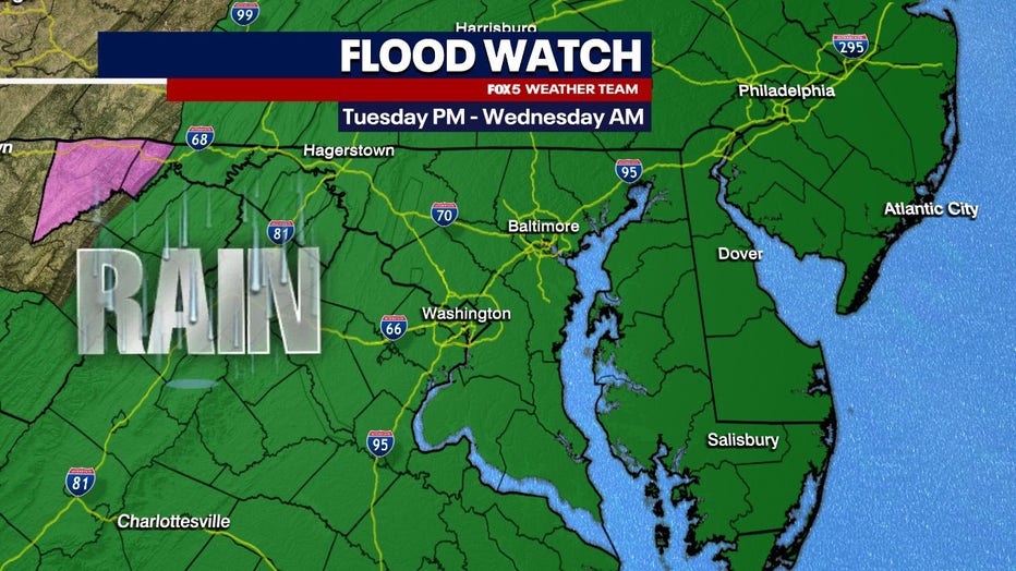
Flood Watch in effect from January 9, 01:00 PM EST until January 10, 07:00 AM EST
Wind Advisory in effect from January 9, 03:00 PM EST until January 10, 01:00 AM EST
DC, Maryland & Virginia Forecast: Rain, flooding, damaging winds expected Tuesday
Areas to the north and west of D.C. saw some ice and snow at the onset of the storm before changing to all rain. FOX 5’s Tucker Barnes said that if the precipitation in the D.C. metro area all fell as snow – we would be looking at accumulations of 12 inches or more!
When news breaks, stream FOX 5 DC anytime. Get the FOX Local app on your smart TV.
The soaking rain will remain in the Washington, D.C. area throughout the day Tuesday and will be accompanied by strong to potentially damaging winds.
Featured
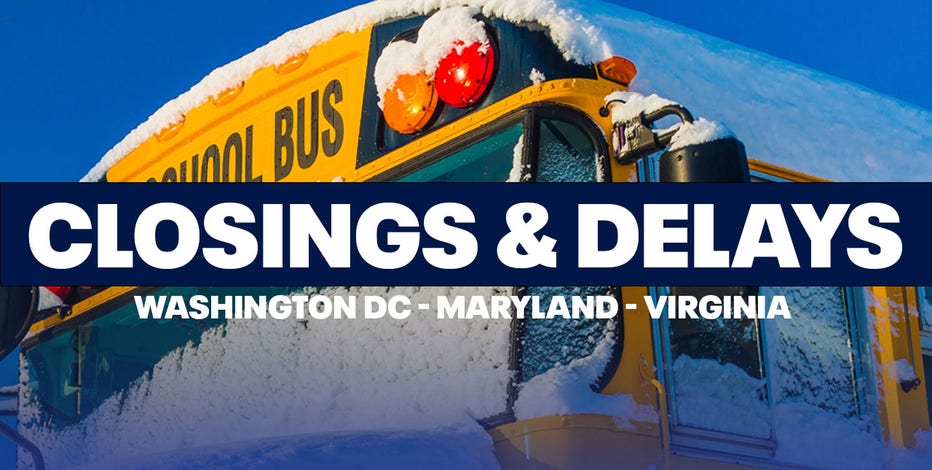
DC, Maryland & Virginia storm-related school closings, delays, and early dismissals for Tue., Jan. 9
The threat of severe weather has prompted school closings, delays, and early dismissals across the Washington, D.C., Maryland, and Virginia regions. Here's the FULL LIST.
DC, Maryland & Virginia Forecast: Rain, flooding, damaging winds expected Tuesday
Gusts around 60 mph could be seen across parts of the region, which could be strong enough to knock out power for some residents.
The heavy downpours will leave flood-prone areas at risk. Flood Watches and Coastal Flood Warnings are in effect for most of the area until Wednesday morning. If travel is required, motorists are advised not to drive around barricades or through water of unknown depth.
Alexandria, VA, was seeing flooding throughout the afternoon ahead of the heaviest expected rainfall.
Drivers are advised to use extra caution when driving, especially if operating a high-profile vehicle. Residents should also secure all outdoor objects.
DC Weather: Heavy rain, flooding, gusty winds hit DMV
FOX 5 Chief Meteorologist Tucker Barnes walks through Tuesday's wet weather forecast for D.C. and surrounding areas.
TIMELINE | TUESDAY (NWS)
Rain. High near 58.
Windy, with a southeast wind 16 to 21 mph increasing to 23 to 28 mph in the afternoon. Winds could gust as high as 40 mph.
The risk for flooding increases later this afternoon and evening as rain intensity increases.
Rain rates up 0.5"/hr are expected between 5-10pm. Wind gusts of 40-55 mph are also expected during this time.
Major to moderate tidal flooding is expected during multiple high tide cycles later this afternoon and into early Wednesday morning.
Rain before 1am, then a chance of rain and thunderstorms between 1am and 4am, then a slight chance of rain after 4am.
Some of the storms could produce heavy rain. Low around 42.
Windy, with a southeast wind 23 to 28 mph becoming southwest 15 to 20 mph after midnight.
Winds could gust as high as 47 mph. Chance of precipitation is 100%.
New rainfall amounts between a half and three quarters of an inch possible.