

Winter Storm Watch in effect Monday for areas west of DC
WASHINGTON - As we continue to monitor the two winter storm systems for this week, the Monday through Tuesday storm forecast has continued with the models to indicate more of a widespread rain event for D.C., and areas to the south and east of the nation's capital.
However, the European Model wants to bring in a bit of mix and snow Monday evening.
The best chance of accumulating snow will be for areas north, west and northwest of Interstate 95 near the Mason-Dixon Line and from the District to Fredericksburg and North of US-50 in Maryland and over the higher elevations of Virginia and West Virginia.
Be aware that we can expect to see rain with the possibility of a bit of sleet later in the day/evening on Monday.
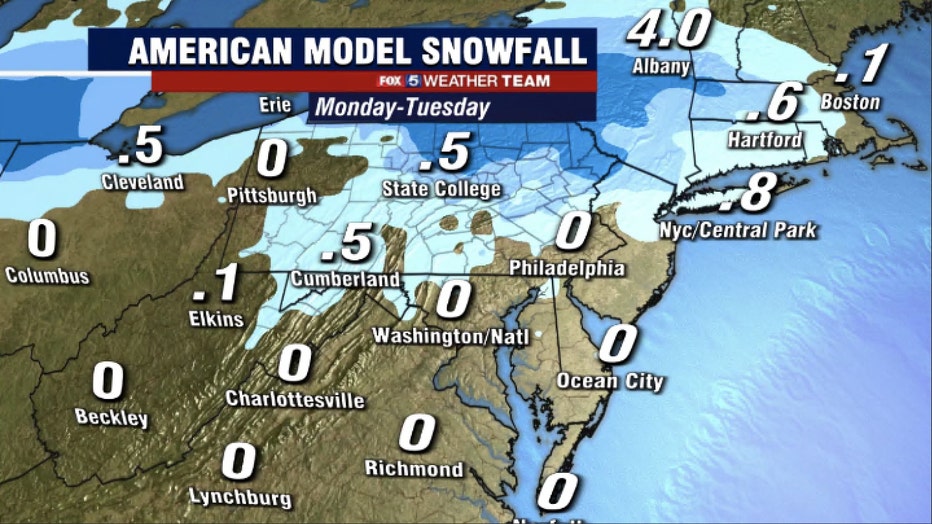
Both the American and European Models are not giving us any snow totals inside the Beltway to speak of.
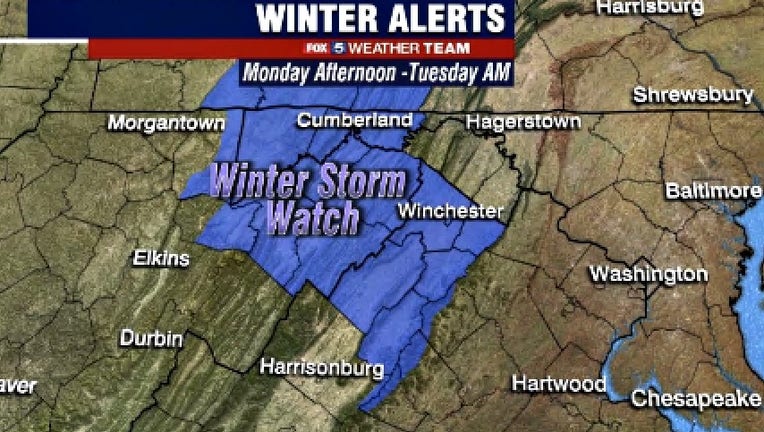
The National Weather Service has issued a Winter Storm Watch for areas to the west where the threat will be more ice than snow.
The Watch is in effect from Monday afternoon through Tuesday morning. A mix of snow, sleet and freezing rain is expected in the Watch area where a quarter-inch or more of ice accumulation is possible.
The storm is expected to arrive late Monday afternoon and impact the Monday evening commute.
So stay aware and cautious especially on any secondary roads that may be untreated and of course as always in inclement winter weather on bridges and overpasses, sidewalks and walkways.
Late night as temps drop icy, slick spots are possible. The models are showing the precip will last into late Tuesday afternoon before moving out, but we may see it pull out earlier.
We will get a break on Wednesday with some sunshine before the next Wednesday-Thursday storm system arrives, and it is one that will give is a better chance of more widespread snow.
So far it looks like precipitation will begin to arrive late Wednesday night.
For Thursday, the European model wants to bring us mainly a snow event Thursday morning while the American Model wants to bring us more of a mix with sleet and freezing rain and some snow.
The main challenge with the Thursday storm is the strength and track of the low pressure system, so there is still a lot of uncertainty.
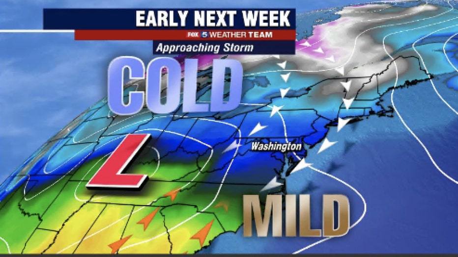
This map shows high and low pressure systems moving through our area.
The cold air will already be in place and a ridge of high pressure will be to our North.
The strength of the high-pressure system will be a main factor. If it is weaker than the low-pressure system, it will have the opportunity to move more to the north and we would get more snow.
However, if the high is weaker than the wow, it will stay more to the south and that will limit the snow chances but also lessen the accumulation of any snow we receive. We will need to keep an eye on the rain/snow line.
Temperatures are also a factor and because we will have cold air in place with temperatures below freezing. We could see any precipitation that arrives as rain or snow. Whatever happens it will all move out by Friday by early Friday as the low pulls away.
Stay posted as the forecast on this storm continues to develop, and as the Fox 5 Weather Team monitors both storms this week to keep you informed and safe.