

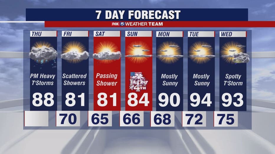
Hot Thursday with highs in the 80s; strong afternoon and evening thunderstorms possible
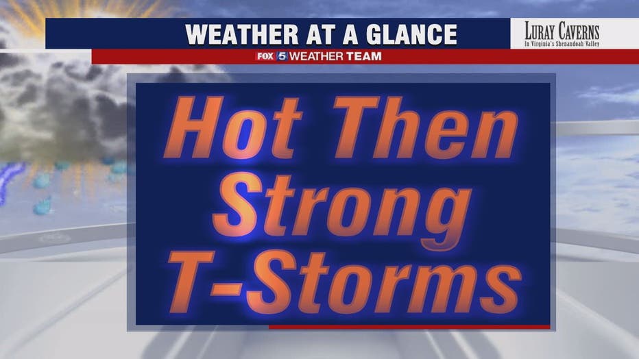
WASHINGTON - The good news in Thursday's forecast is that the heat is going to break thanks to a cool front moving through the D.C. region in the next 24 hours. The bad news is that it will come through with a few rounds of storms, some of which look to be strong to severe.
Download the FOX 5 Weather App
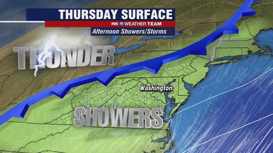
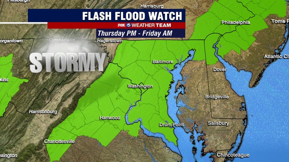
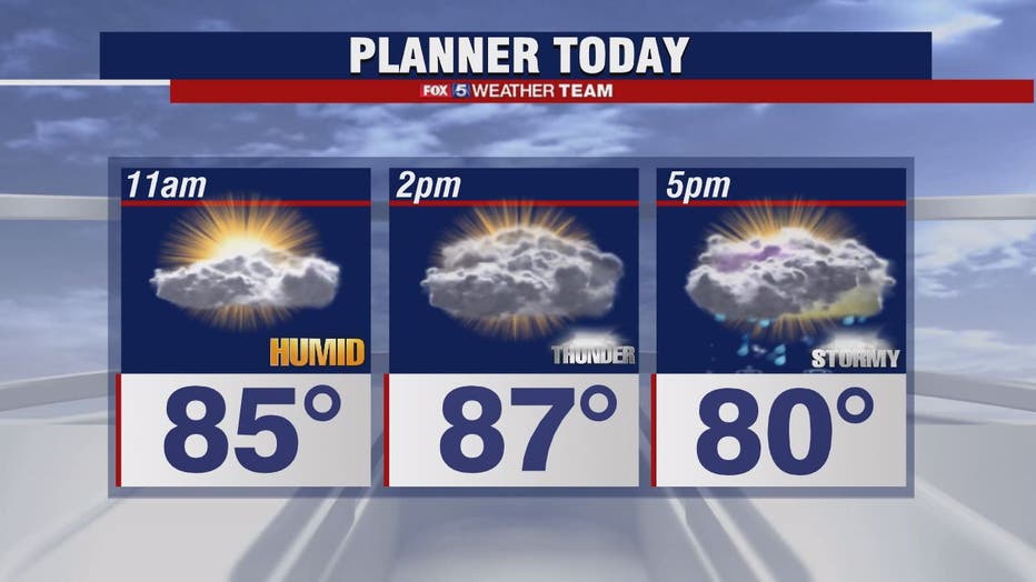
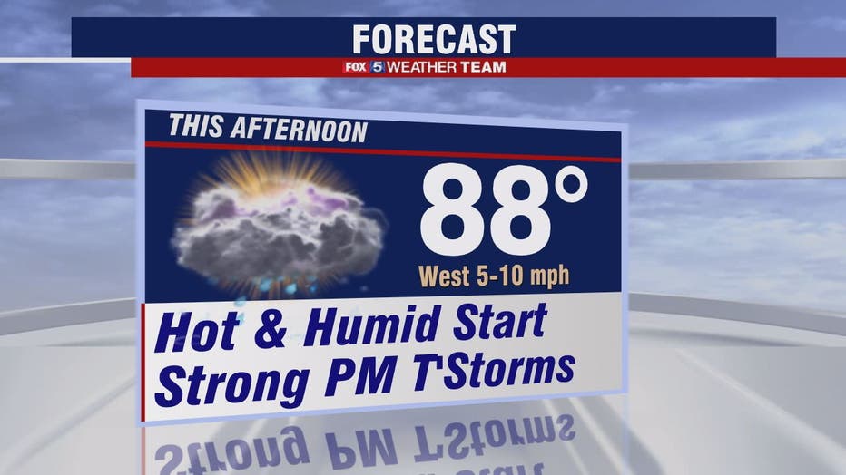
The first round of showers is possible this morning, but the severe storms should cross the region from west to east between 2 p.m. to 8 p.m. These storms may produce wind damage and torrential rain. The Storm Prediction Center has placed the metro areas under a Slight Risk for severe weather, and we are also under a Flash Flood Watch beginning at 2 p.m. and continuing until 8 a.m. Friday.

FOX 5 Weather forecast for Thursday, July 1
Tucker Barnes has the FOX 5 Weather forecast for Thursday, July 1

FOX 5 Weather forecast for Thursday, July 1
Mike Thomas has the FOX 5 Weather forecast for Thursday, July 1
There is potential for one to three inches of rain to fall in a short period of time which may produce quickly rising streams and creeks as well as urban flooding.
Showers likely continue into Friday morning but the frontal boundary now looks to push farther south instead of stalling nearby, which means temperatures top out in the upper 70s on Friday! The weekend forecast also now looks dryer and much more comfortable!
Great news for your 4th of July celebrations!
Stay with FOX 5 on the app and online for weather updates:
Get the latest FOX 5 forecast here.
Check the latest Closings and Delays
Download the FOX 5 DC News App for Local Breaking News and Weather
Download the FOX 5 Weather App
Check the latest weather radars
Stay up to date with the FOX 5 Weather Team on Twitter: