

First winter storm of 2021 may bring rain, sleet or snow to parts of DC region early next week
WASHINGTON (FOX 5 DC) - The FOX 5 Weather Team continues to monitor the potential of a winter weather event on Tuesday.
With a look at the updated models, right now, we are seeing less potential of a snow event, and a better chance of widespread rain.
As we enter the weekend, we have a pretty dry air mass in place with daytime highs in the 40's but overnight lows dipping to the 20’s. The temperatures will play a major factor in what we may get on Tuesday.
What will temperatures be when the precipitation from the system moves in?
If milder air settles in ahead of the system, we will have less of a chance for snow and more of a chance for a rain event, sleet or even freezing rain for metropolitan D.C. and surrounding areas with the snow and winter mix over the far West, the mountains, far West Virginia, the Allegheny Front, and Blue Ridge.
If the colder airmass setup we have stays in place, then we would have a more likely chance of seeing snow or a wintry mix for metropolitan areas. However, daytime highs are forecasted to be in the 40’s, so the timing of the arrival of the precipitation is also a main factor.
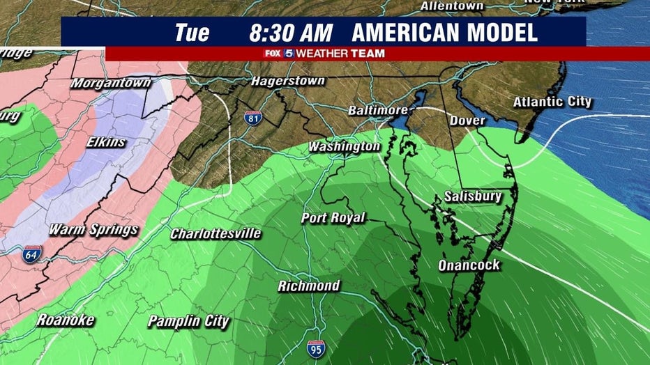
Today, the American model is giving us a widespread, moderate to heavy rain event beginning in the South pre-dawn into the morning commute.
It has the heaviest rain staying South and Southeast and pulling out before the evening commute.
The same model is keeping a mix and snow West and North of the I-81 corridor and over the West Virginia panhandle and West if I-79 and I-64.
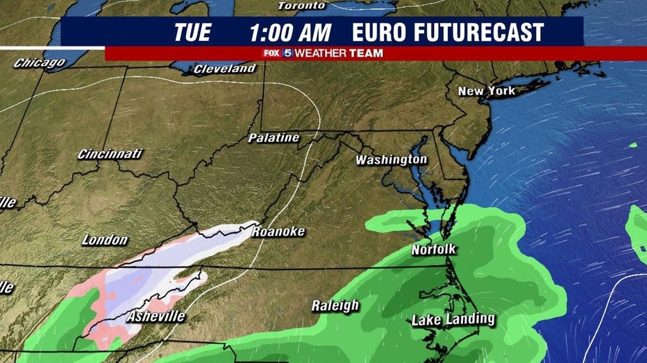
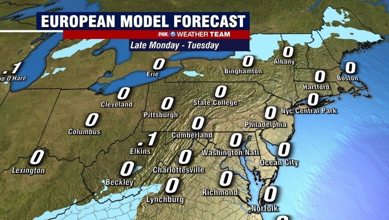
The European model has pulled back and is not giving us any precipitation at all. It brings rain across the far southern tip of Delmarva and Southern Virginia while keeping any wintry mix or snow along I-81and West.
So far, the models are not giving us any snow accumulation, but we are still a few days out so we will continue to monitor the models and provide updates.