

DC region braces for snow, sleet and rain as winter weather takes aim Wednesday
WASHINGTON - Hope you're prepared and hunkered down for a changeable, messy and impactful storm that will feature snow, heavy rain, sleet and freezing rain at various points throughout the day and night. FULL LIST of Snow Closings
Download the FOX 5 Weather App

FOX 5 Weather forecast for Wednesday, December 16
Mike Thomas has the FOX 5 Weather forecast for Wednesday, December 16
FOX 5's Sue Palka says is all starts by mid-morning and for most areas -- this will begin as snow even in D.C. Initially this will accumulate lightly as it will be cold. Untreated surfaces may quickly become slippery!
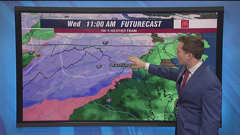
As the afternoon begins, warmer air aloft starts to produce a mix of rain/snow/sleet for much of the area west of Interstate 95. This looks to transition to rain which could be heavy at times. A Flood Watch is in effect for D.C. and surrounding areas for potentially 1-2 inches of rain. Primarily rain is in the forecast for counties east of I-95 through the afternoon.

DC region prepares for winter weather mess
FOX 5‘s Maureen Umeh reports as the D.C. region prepared for a winter weather blast.
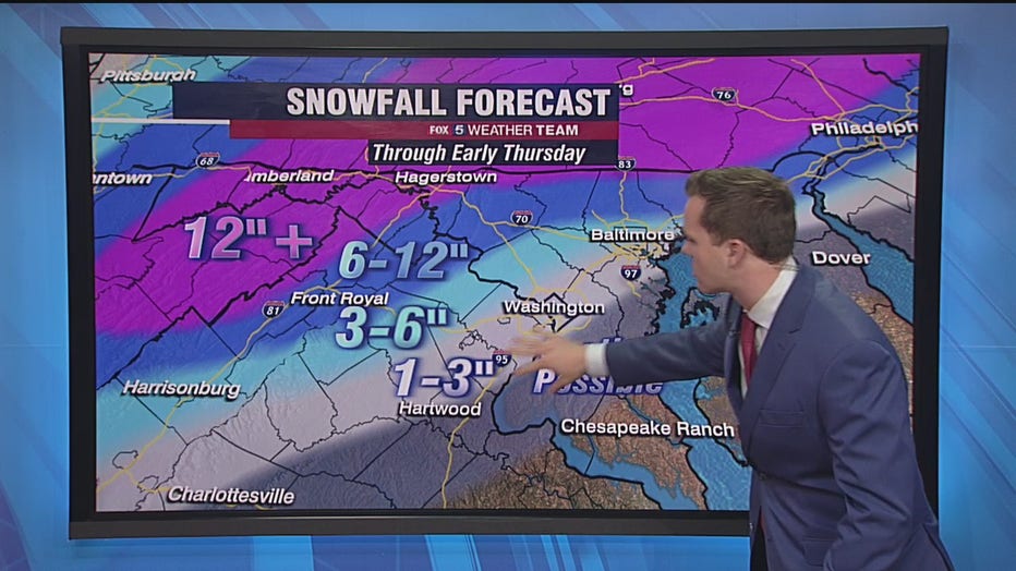
The snow jackpot will be along and west of Interstate 81 where no mixing is expected and snow accumulations could approach or exceed a foot making travel very hazardous.
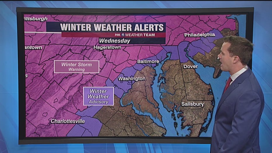
As the storm pulls north of us later at night we could see a change back to snow or even some freezing rain/sleet with some additional accumulations through the metro area. It will turn much colder as we drop into the 20s overnight which means Thursday morning could be treacherous for commuters.

Road preps underway in Leesburg
The town of Leesburg and local contractors are bracing for a snow emergency expected in the region.
Your FOX 5 Weather Team will keep you ahead of this changeable day online and on air!
Stay with FOX 5 on the app and online for weather updates:
Get the latest FOX 5 forecast here.
Check the latest Closings and Delays
Download the FOX 5 DC News App for Local Breaking News and Weather
Download the FOX 5 Weather App
Check the latest weather radars
Stay up to date with the FOX 5 Weather Team on Twitter: